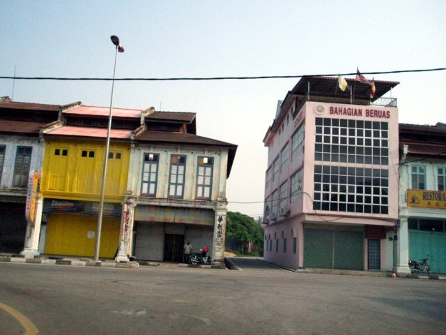
 Beruas, Perak
 https://commons.wikimedia.org/wiki/File:Beruas.JPG
 L joo
L joo
Beruas (GPS: 4.49941, 100.78256) is a small town on the western part of Perak. It is located within the district of Manjung. The town was named after beruas (Garcinia hombroniana) a fruit of the mangosteen family.
Although there is nothing much about Beruas today, it actually has existed as a settlement since ancient times, when it was the capital of the kingdom of Gangga Negara, a Hindu kingdom that flourished in the Manjung area from the 2nd to the 11th century, when an attack from the Chola kingdom of south India brought its demise. Visitors to the Beruas Museum can view some of the artefacts on display.
There are also some Acehnese gravestones in Beruas. These are said to belong to Acehnese royalty that moved to the area from Sumatra.
Map of Beruas, Perak
Sights in Beruas
- Beruas Market (GPS: 4.50171, 100.78068)

- Beruas Municipal Field (GPS: 4.50171, 100.78068)

- Beruas Museum (GPS: 4.49996, 100.78333)

- Masjid Beruas (GPS: 4.50051, 100.78417)

- Sekolah Jenis Kebangsaan (Cina) Pei Ching (GPS: 4.49982, 100.78156)

- Sri Subramaniar Temple (GPS: 4.49996, 100.78333)

Visiting Beruas
There is no simple way to go directly to Beruas. The most practical route is through Kuala Kangsar. From the Kuala Kangsar town roundabout, head south on Jalan Kangsar. When you reach the second roundabout, head south again, on Jalan Sultan Iskandar Shah (State Route A3). You will travel for about an hour on this road.Route A3 eventually ends at a T-junction. The road in front of you is Route 73 (also called Jalan Siputeh-Batu Hampar). Turn right and head west on Route 73 until the junction to Route 71 (jalan Beruas-Ayer Tawar). Look for the signage for Beruas. Turn left and head south on Rouote 71 until you arrive at Beruas.
Beruas on Google Maps Street View
Beruas is  on the Map of towns in Perak
Back to Perak mainpage; list of Towns in Perak and Towns in Malaysia
 Latest updates on Penang Travel Tips

Copyright © 2003-2025 Timothy Tye. All Rights Reserved.

 Go Back