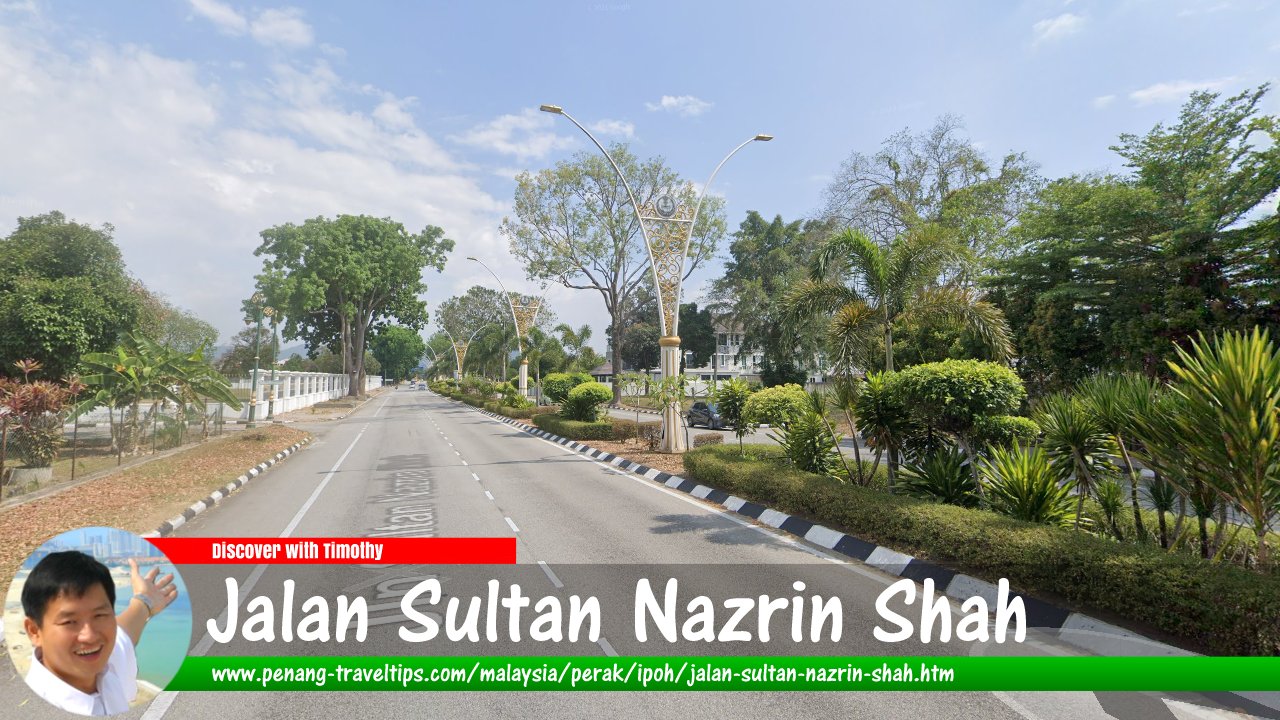
 Jalan Sultan Nazrin Shah, Ipoh
(Google Street View - Mar 2021)
Jalan Sultan Nazrin Shah is a major road in Ipoh, Perak. It starts at Bulatan Sultan Yussuf in the north, where it connects with Jalan Sultan Iskandar, Jalan Sultan Idris Shah and Jalan Raja Dihilir, and ends at the T-junction with State Route A181, from where it continues south as Jalan Gopeng.
Jalan Sultan Nazrin was originally called Jalan Raja Dr Nazrin Shah. It was named in honour of the crown prince of Perak, Naszrin Muizzuddin Shah. When His Royal Highness ascended the throne as the 35th Sultan of Perak, the road was correspondingly renamed. Jalan Raja Dr Nazrin Shah was created out of a stretch of Jalan Gopeng. The road passes through some of the major cave temples of Ipoh.
Jalan Sultan Nazrin Shah passes through some of the major cave temples of Ipoh. Being such a long road, it branches off on both sides to many more side roads. Among the roads that form junctions with Jalan Sultan Nazrin Shah include Jalan Seruan, Laluan Taman Kinta, Hala Taman Kinta, Jalan Windsor, Jalan Lumba Kuda, Hala Lawan Kuda, Solok Gopeng, Hala Gopeng, Jalan Raja Permaisuri, Jalan Tun Dr Ismail, Persiaran Kampar, Jalan Teh Hian Tat, Jalan Raja Permaisuri Bainun, Jalan Sultan Azlan Shah, Medan Gopeng, Lorong Gopeng, Jalan Rokam, Persiaran Indah Rokam 1, Persiaran Indah Rokam 4, Jalan Lapangan Terbang, Jalan Rapat Jaya, Jalan Raja Musa Mahadi, Jalan Harilela, Jalan Rapat Baru, Medan Legenda 1, Persiaran Lapangan Siber, Jalan Tuan Sheikh Jamil, Jalan Hj Buyong Bodeen, Persiaran Pulai Timur 8, Medan Pulai 7, Jalan PPSP2, Federal Route 3150, State Route A181, and Exit 137 (Simpang Pulai Interchange) on the North-South Expressway (E1).
Map of Jalan Sultan Nazrin Shah, Ipoh
Sights along Jalan Sultan Nazrin Shah
- Bulatan Sultan Yussuf (GPS: 4.59203, 101.09024)

- Dudjom New Treasure Buddhist Society (GPS: 4.56311, 101.11455)

- Gunung Rapat (GPS: 4.55685, 101.12175)

- Impiana Hotel Ipoh (GPS: 4.59008, 101.09444)

- Ling Sen Tong (GPS: 4.56642, 101.11404)

- Nam Thean Tong (GPS: 4.56589, 101.11442)

- Sam Poh Tong (GPS: 4.5643, 101.1151)

- Tasik Cermin (GPS: 4.55983, 101.11864)

Jalan Sultan Nazrin Shah on Google Street View
Jalan Sultan Nazrin Shah (May 2018)Back to Discover Ipoh, Perak; list of Streets of Ipoh, Streets of Perak and Streets of Malaysia
 Latest updates on Penang Travel Tips
 Ipoh Sight Index
 Streets of Ipoh
 Map of Ipoh, Perak
 Discover with Timothy Ipoh Videos
Where to go, what to see when in Ipoh? Here are some suggestions with my videos!
Copyright © 2003-2025 Timothy Tye. All Rights Reserved.

 Go Back