 Go Back
 Teluk Intan, Perak (17 September 2016)
Teluk Intan (GPS: 4.02215, 101.02409) is a town in the district of Hilir Perak in the southern part of the state. With a population of 110,000, it is the third largest town in Perak after Ipoh and Taiping.
About Teluk Intan
The Teluk Intan area is the site of a very old settlement. After the collapse of the Sultanate of Malacca to the Portuguese in 1511, Raja Muzaffar Shah, the eldest son of Sultan Mahmud, fled north where he established the Sultanate of Perak here, on the banks of the Perak River in 1528. The settlement, which comprised small villages such as Durian Sebatang, Pasir Bedamar and Batak Rabit, was the royal town of Perak from 1528 until 1877, when Kuala Kangsar was made the new royal town. (The other son of Sultan Mahmud fled south and established the Kingdom of Johor.There was a settlement here founded around the turn of the 19th century which was established by the Mandailing people of Sumatra. They were led by a widow named Mak Intan, hence the settlement was called Pekan Mak Intan. Soon traders from Rawa, Mandailing, Minangkabau, Kampar and even Mumbai, India, were converging on it. To facilitate trade movement, the Mandailing people dug a canal to form a loop in the Perak River, resulting in the land surrounding Pekan Mak Intan becoming an island. The canal links Durian Sebatang, a tributory of the Bidor River, to the Perak River.
In the late 19th century, Sir Archibald Anson, who was the Governor of the Straits Settlements in 1879-1880, founded a township in the area. The canal dug by the Mandailing was also filled up when the township was established. This township was named Teluk Anson in his honour in 1882. It became a port for the export of tin and agriculatural products from the southern part of Perak. To facilitate the movement of goods to the port, a railway line was built to connect Teluk Anson with Tapah. It was the fourth railway line in Malaya.
Teluk Anson became the administrative centre for Hilir Perak, and serve as the nerve centre for neighbouring towns such as Tapah, Bidor, Bagan Datoh and Hutan Melintang. The township was renamed Teluk Intan in 1982. By then it a town was in decline. The silting of the Perak River affected the role of Teluk Intan as a port for the export of tin and rubber, and as a petroleum distribution centre for Shell, as big ships and tankers were unable to reach its port. Eventually Shell moved its petroleum depot to Lumut.
The town received a much-needed boost with the construction of the coastal highway between Klang and Sabak Bernam. In 2004, it was upgraded to municipality level, the fourth after Ipoh, Taiping and Seri Manjung.
Updates on Teluk Intan
25 May 2014Groundbreaking ceremony for the West Coast Expressway (E32) was held in Teluk Intan.
Map of Teluk Intan
Main tourist attraction of Teluk Intan

Sights in Teluk Intan
- Gurdwara Sahib Teluk Intan (GPS: 4.02525, 101.0223)

- Pasar Besar Teluk Intan (GPS: 4.02522, 101.01935)

Categories of sights in Teluk Intan
Petrol Stations in Teluk Intan
- BHP Jalan Changkat Jong (GPS: 4.01928, 101.02585)
- Petronas Jalan Changkat Jong (GPS: 4.00402, 101.04193)
- Shell Jalan Changkat Jong (GPS: 4.01949, 101.02567)
Teluk Intan is  on the Map of towns in Perak
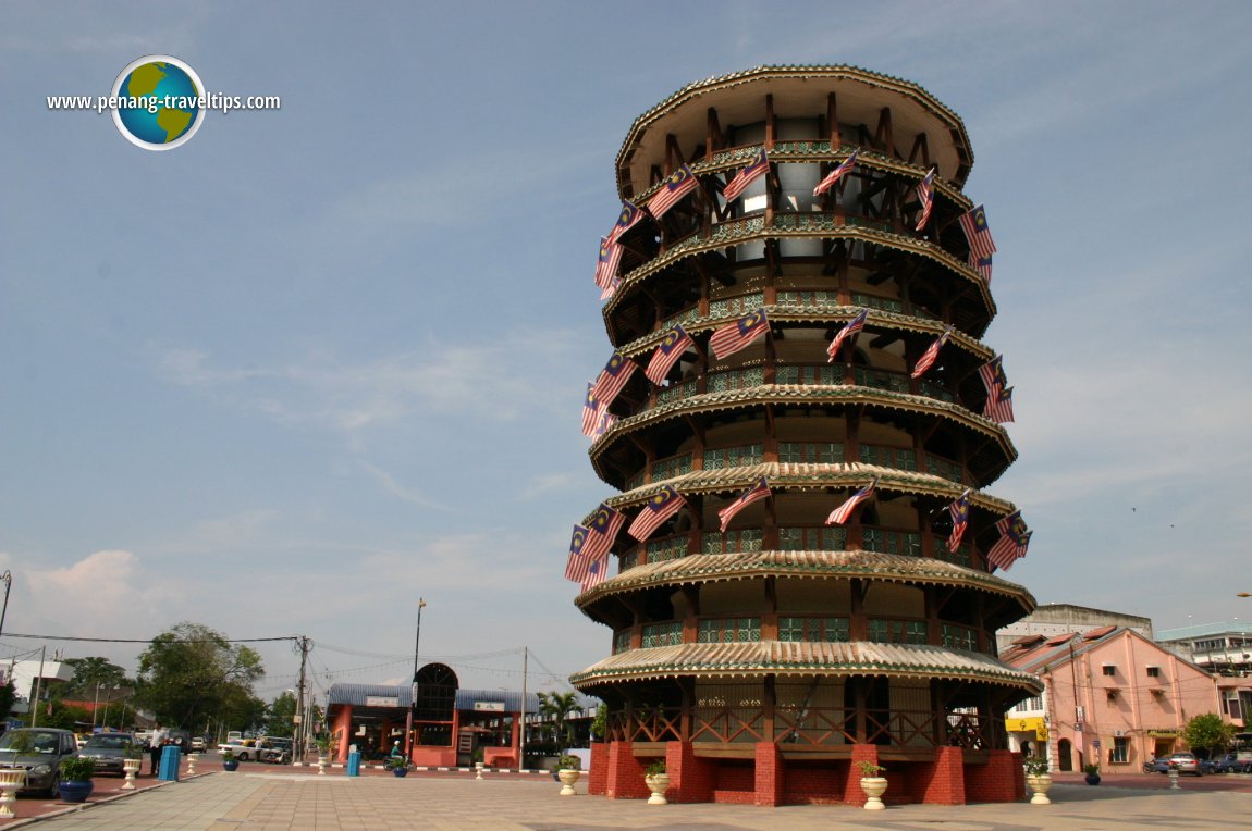
 Teluk Intan, with view of its famous leaning tower (21 September 2004)
Back to Perak mainpage; list of Towns in Perak and Towns in Malaysia
 Latest updates on Penang Travel Tips

Copyright © 2003-2025 Timothy Tye. All Rights Reserved.