 Discover Kangar (31 October, 2009)
B. Melayu
Kangar is my personal guide to help you visit, discover and enjoy Kangar, (GPS: 6.44222, 100.19736), the capital as well as the main town in Perlis, the northernmost state in Malaysia. Located by the banks of Sungai Perlis, Kangar has a population of approximately 50,000. I create this guide to provide information visitors can use when they plan their trip to Kangar.
Kangar is said to have been named after Kangkok, a species of hawk (Spizaetus limnaetu). Although small in size, the town has been around longer than most of the major cities of Malaysia such as Kuala Lumpur and Ipoh. It was established in 1653 by Tok Paduka, a nobleman in the court of Sultan Muhyiddin Mansur Shah (1651-1661)1. Located by the banks of Sungai Perlis, it served as an inland port. , having been established in the 18th century or earlier, even before the establishment of Perlis as a state. The Sultan of Kedah (Sultan Muhammad Jewa) sought refuge here following the attack on Kedah by the Bugis forces based in Selangor in 1771. At that time, Kangar was nothing more than a village with one narrow street by Sungai Perlis.
Map of sights in Kangar
Sights in Kangar
- Arulmigu Arumugaswamy Devasthanam (GPS: 6.435766, 100.190755)

- Arulmigu Kovil Sri Veera Mahakaliamman Alayam (GPS: 6.435766, 100.190755)

- Church of Our Lady of Fatima (GPS: 6.440609, 100.185546)

- Dewan 2020 (GPS: 6.41494, 100.19482)

- Gurdwara Sahib Kangar (GPS: 6.43838, 100.19671)

- Kangar Entrance Arch (GPS: 6.4393, 100.19687)

- Kangar Nine Emperor Gods Temple (GPS: 6.440609, 100.185546)

- Kangar State Museum (GPS: 6.43966, 100.1877)

- Kangar Town Hall Field
- Perlis Cultural Park (GPS: 6.41233, 100.19446)

- Perlis State Assembly Complex (GPS: 6.4141, 100.18786)

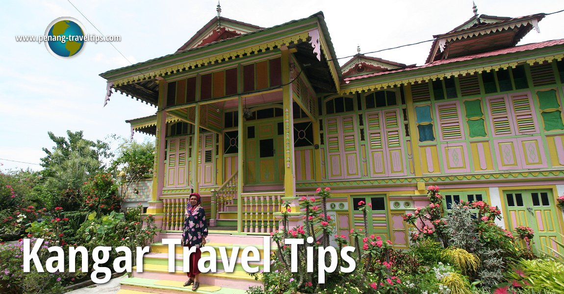
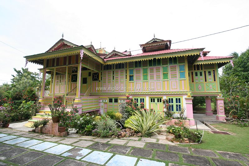
- Rumah Dato Wan Ahmad (GPS: 6.43725, 100.18608)

- Stadium Datuk Sheikh Ahmad
- State Mosque & Heritage Hall
- Taman Rekreasi Sungai Kechor (GPS: 6.438, 100.19028)

Hotels in Perlis
- Hotel Seri Malaysia (GPS: 6.41414, 100.19475)

Government Buildings in Perlis
- JKKN Complex (GPS: 6.41239, 100.19475)

- Perlis Youth & Sports Complex (GPS: 6.44028, 100.19244)

Eateries in Kangar
- Kedai Kopi dan Makanan CCS Embassi (GPS: 6.43612, 100.19104)

Category of sights in Kangar
Shopping Places in Kangar
- Gedung Ten Ten (GPS: 6.4361, 100.19136)

- Kompleks Kayangan Square
- Pasar Borong
- Pasaraya Aneka (GPS: 6.43692, 100.1941)

Streets in Kangar
Rivers in Kangar
Medical Attention in Kangar
- Hospital Tuanku Fauziah (GPS: 6.44106, 100.19135)

- Klinik Kesihatan Kangar (GPS: 6.43941, 100.19014)

- Pejabat Kesihatan Kangar (GPS: 6.44337, 100.19102)

Sights in Perlis in the vicinity of Kangar
- Arau
- Bukit Keteri
- Bukit Keteri Cement Factory
- Gua Kelam
- Bukit Cabang
- Kuala Perlis
- Museum Kota Kayang
- Sungai Batu Pahat Snake & Reptile Farm
- Padang Besar
- Perlis Grape Farm
- Perlis Craft Cultural Complex
- Tasik Melati
- Timah Tasoh Dam
- Taman Herba Negeri Perlis
- Universiti Malaysia Perlis
- Wang Kelian Border Market
- Wang Kelian State Park
- Wang Tangga Recreational Park
- Wat Machimaprasit
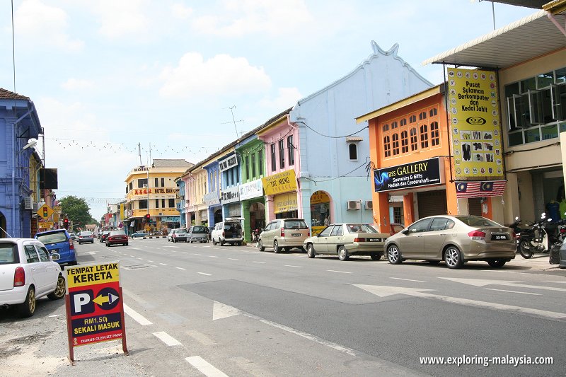
 Street in Kangar (31 October, 2009)
 Rumah Dato' Wan Ahmad, Kangar (31 October, 2009)
How to reach Kangar
Exit the North-South Expressway (E1) to the Changlun-Kuala Perlis Highway. The highway is Federal Route 194, unfortunately the highway number is missing at the access to the highway itself. It only appears much later (that's one of the issues I have with Malaysian highways). Instead routes to different towns are posted, namely to Arau (179), Kangar (7) and Kuala Perlis (81).Take the Changlun - Kuala Perlis Expressway (Federal Route 194) and then turn right into Jalan Raja Syed Alwi (Route R1) that goes straight into Kangar. Follow the directional signboards for Kangar.
Exiting the North-South Expressway for the Changlun-Kuala Perlis Expressway (194).
You will continue in Kedah for a while until you arrive at the border with Perlis, as marked by a big yellow arch.
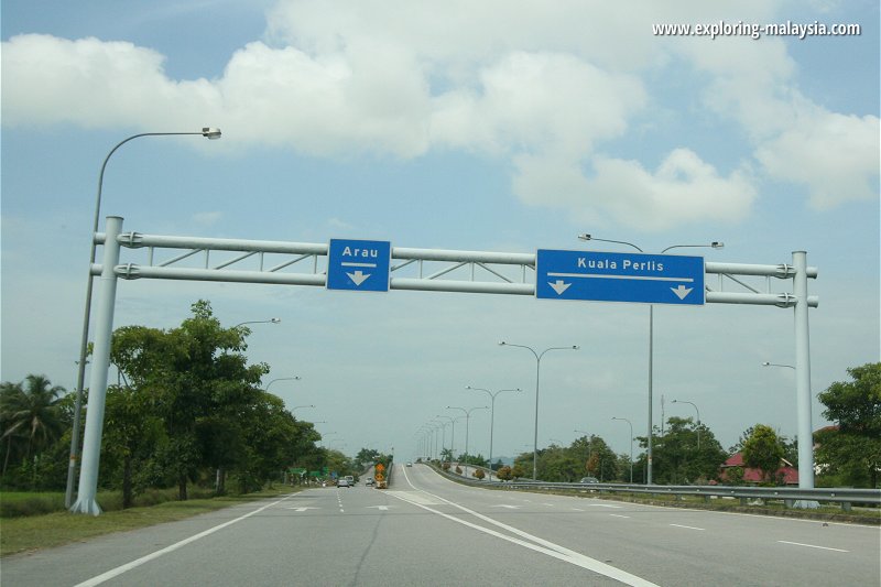
To reach Kangar, you need to exit Route 194 at the Arau Interchange. If you don't, you will end up in Kuala Perlis. This is the exit:
 Arau Interchange (31 October, 2009)
Just continue on this route (it's State Route R3) and it will take you pass Arau and then reach Kangar.
Getting Around Kangar
Kangar is a small two-main-road town. For your convenience, you can drive about and then park near the tourist attractions. Traffic is light compared to bigger towns in Malaysia.Kangar is  on the map of Towns in Perlis
References
1. Kunjungi Perlis blogList of Towns in Perlis and State Capitals of Malaysia
 Latest updates on Penang Travel Tips

Copyright © 2003-2025 Timothy Tye. All Rights Reserved.

 Go Back