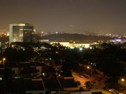
 Subang Jaya at night
 https://commons.wikimedia.org/wiki/File:Subang-night-view.jpg
 Wil12b4
Subang Jaya (GPS: 3.08121, 101.58441) is a residential township in the Petaling District of Selangor.
The original township of Subang Jaya was developed by Sime UEP and is located within the SS12 to SS19 sections. Today, however, Subang Jaya encompasses a bigger area, including Kampung Baru Subang and Subang town. It falls under the jurisdiction of the Subang Jaya Municipal Council (Majlis Perbandaran Subang Jaya), which administers the areas not under the Petaling Jaya and Shah Alam City Halls. Bandar Sunway, to the east of Subang Jaya proper, is also regarded as part of Subang Jaya.
As with most of the places in the Petaling district, Subang Jaya was developed out of former oil palm plantation land. The first phase of residential housing in Subang Jaya was initiated by Sime UEP in 1974 and the final phase in 1988.
The residential neighbourhood of USJ can be considered a continuation of Subang Jaya.
Location of sights in Subang Jaya on the map
How to reach Subang Jaya
Subang Jaya can be reached by taking the Federal Highway (Federal Route 2), exitting at Persiaran Kewajipan after the Subang Ria Recreational Park and from Persiaran Tujuan. You can also take the Shah Alam (also called the KESAS Highway) and the ELITE Highway.Subang Jaya is  on the Map of Towns in Selangor
Back to Discover Selangor; list of Towns in Selangor and Towns in Malaysia
 Latest updates on Penang Travel Tips

Copyright © 2003-2025 Timothy Tye. All Rights Reserved.

 Go Back