 Mandalay (22 November, 2003)
Mandalay is a guide to get to know and plan your visit to Mandalay, the second largest city in Myanmar. This city is the capital of Upper Burma. It is located 600 km north of Yangon, on the banks of the Ayeyarwady River. Mandalay has slightly over 800,000 inhabitants. It is the capital of Upper Burma that was immortalized in Rudyard Kipling's The Road to Mandalay, the 1887 poem that refers to the Ayeyarwady. In a country where the cities are a thousand years old or more, Mandalay is surprisingly young in comparison - "just" over 150 years old.
Sights in Mandalay
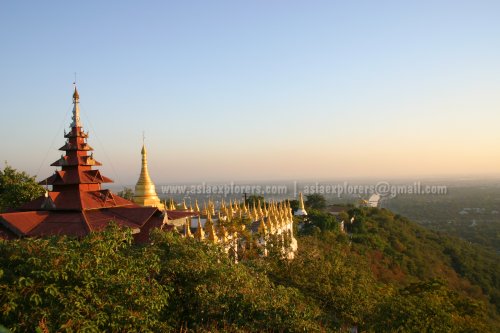 Mandalay Hill at sunset (22 November 2003)
History of Mandalay
Mandalay was founded by King Mindom in 1857. He did so to fulfill an ancient Buddhist prophecy (and as often happens with monarchs, to his own glory). There was a legend that Gautama Buddha visited Mandalay Hill with his disciple Ananda, and proclaimed that 2400 years after his death, a great city for Buddhist teaching will be founded at the foot of the hill.The ever pious Mindon thought he could achieve enlightenment by making true of that prophecy. So, in 1861, Mindon disposed of his half-brother Pagan Min as the Konbaung king. Taking over the throne, he moved his capital - literally uprooting most of his palace as well as 150,000 of his subjects - from Amarapura 20 km away, and move them to Mandalay. Here, he built his Royal Palace at the foot of Mandalay Hill and worked towards realising the "Golden City" of Buddhist teachings.
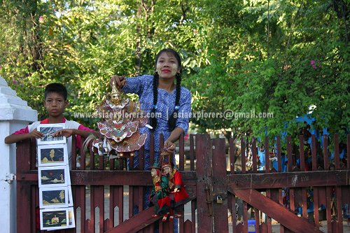 Souvenir sellers at Shwenandaw Kyaung Monastery, Mandalay (22 November 2003)
King Mindon's dream, unfortunately, came to a fast ending after he died in 1878. Taking over the reign was the tyrannic King Thibaw and his imperious wife Supyalat. During their terror reign, they liquidated many of their own friends and relatives to prevent any challenge to their rule. There was a smallpox epidemic. On the advise of astrologers, they had many of their own subjects and foreigners killed. Their excesses resulted in an invasion by the British, and they occupied Upper Burma in 1885. Mandalay, with all its beautiful palaces, became known by the now unknown name of Fort Dufferin.
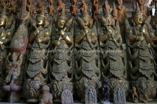 Mandalay handicrafts (22 November 2003)
Getting there
By PlaneThe Mandalay International Airport is located 45 km from the city center. You can reach Mandalay by taxi for approximately US$8.00, and pay US$6.00 for the return journey. There are mostly domestic flights as the airport has limited number of international flights, including twice weekly from Chiang Mai and three times a week from Kunming.
By Train
Most visitors from Yangon arrives in Mandalay by train. This is usually an overnight 15-hour journey that allows you to enjoy the beauty of the Myanmar countryside. The Dagon Mann Express overnight train costs US$50.00 and is the most comfortable option by train.
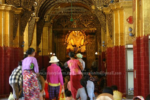 Pilgrims approaching the Mahamuni Buddha (22 November 2003)
Getting around
Taxis are relatively inexpensive in Mandalay. You might want to hire one to help you explore the many sights in and around the city. If you plan to explore only the sights within the city center, you can even hire a bicycle. Apart from the main roads, which are full of cyclists, the tourist places are often low in traffic. Young fan vendor at Atumashi Kyaung Monastery, Mandalay
Source: https://commons.wikimedia.org/wiki/File:Birmanie-0005a.jpg
Author: Yves Picq

Author: Yves Picq

 Latest updates on Penang Travel Tips
 Map of Roads in Penang
Looking for information on Penang? Use this Map of Roads in Penang to zoom in on information about Penang, brought to you road by road.
Copyright © 2003-2025 Timothy Tye. All Rights Reserved.

 Go Back