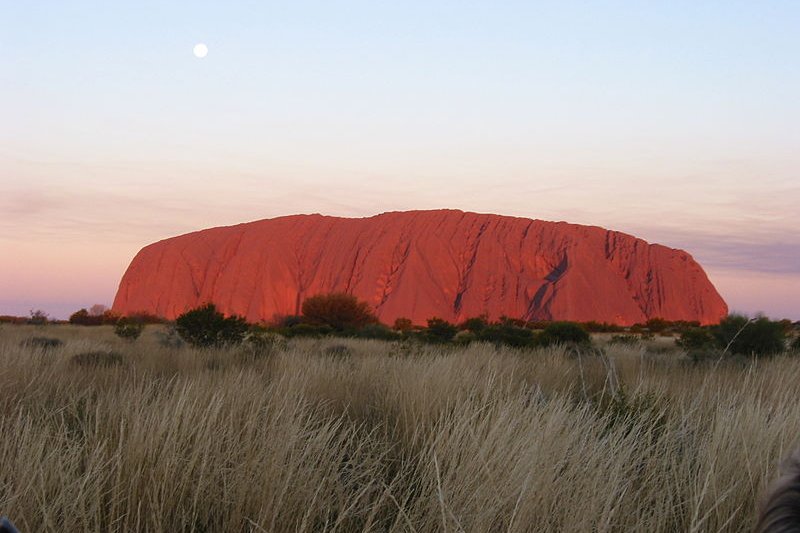
 View of Uluru/Ayers Rock with the moon in the sky
Source: https://commons.wikimedia.org/wiki/File:Paul_Mannix_-_Uluru_%28Ayers_Rock%29_at_sunset,_Uluru-Kata_Tjuta_National_Park,_Australia_%28by-sa%29.jpg
Author: Paul Mannix

The Uluru-Kata Tjuta National Park is a national park in Northern Territory, Australia. It covers an area of 1398 square kilometers and is most famous for two major attractions: Uluru, also known as Ayers Rock, and Kata Tjuta, also known as Mount Olga or The Olgas. Uluru-Kata Tjuta National Park was inscribed as a World Heritage Site during the 11th session of the World Heritage Committee which met at Headquarters in Paris, France, on 7-11 December, 1987.
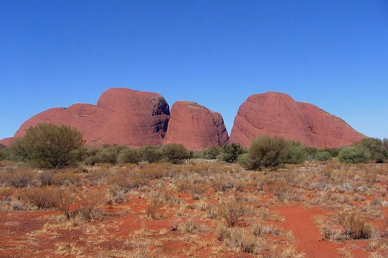 The formation known as Kata Tjuta/Mount Olga
Source: https://commons.wikimedia.org/wiki/File:Kata_Tjuta_Australia.jpg
Author: Barbara Stuparek-Püller

Uluru-Kata Tjuta National Park World Heritage Site Inscription Details
Location: S 25 19 60 E 131 0 0Inscription Year: 1987
Type of Site: Mixed
Inscription Criteria: V, VI, VII, VIII
What to See in Uluru-Kata Tjuta National Park
The highlight of Uluru-Kata Tjuta National Park is of course Uluru/Ayers Rock, a massive sandstone formation, often called the biggest rock on earth. Uluru stands at a height of 346 (1,140 ft) meters, although what is visible is metaphorically the "tip of the iceberg", as the rest of Uluru lies buried.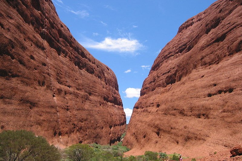 Walpa Gorge at Kata Tjuta
Source: https://commons.wikimedia.org/wiki/File:Kata_Tjuta_-_Walpa_Gorge_end.JPG
Author: Stefano

Ayers Rock was named after Sir Henry Ayers, the Chief Secretary of South Australia, by geologist-explorer William Gosse, who reached it on 19 July 1873. But before it became known as Ayers Rock, it was already known as Uluru by the Pitjantjatjara people, the local Aboriginal, or Anangu, group. In 1993, a dual naming of the rock was adopted, being Ayers Rock/Uluru. The order was reversed in 2002 to Uluru/Ayers Rock, by request of the regional tourism association, perhaps in recognition to which name was first given to the rock.
Uluru/Ayers Rock is often called a monolith, although geologists avoid that term, preferring to call it an inselberg or "island mountain". It appears to change colour at different times of the day. One of the popular views of Uluru is during sunset, when it often glows red.
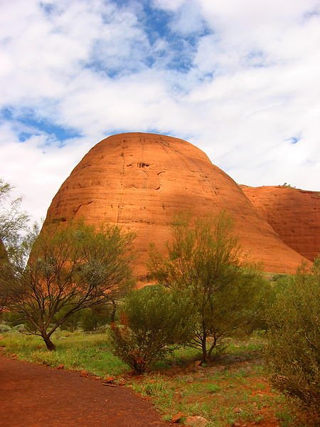 A dome rock formation at Kata Tjuta
Source: https://commons.wikimedia.org/wiki/File:Kata_Tjuta_dome_with_brush.jpg
Author: mapu

There are aboriginal cave paintings in the caves at the base of Uluru. Kata Tjuta/Mount Olga is a large rock formation to the west of Uluru. It comsists of 36 domes composed of different types of rock including granite and basalt held together by sandstone. The highest point on Kata Tjuta is Mount Olga, which is 1,066 meters high, or 546 meters above the surrounding plain.
Kata Tjuta means "many heads" in the language of the Pitjantjajara Aborigines. It was named The Olgas by explorer Ernst Giles, at the request of Baron Ferdinand von Mueller, who was made a baron by King Karl and Queen Olga of Württemberg the previous year, in conjunction with their 25th wedding anniversary.
Like Uluru, Kata Tjuta was given dual names of Mount Olga/Kata Tjuta in 15 December 1993, and the order reversed to Kata Tjuta/Mount Olga on 6 November, 2002.
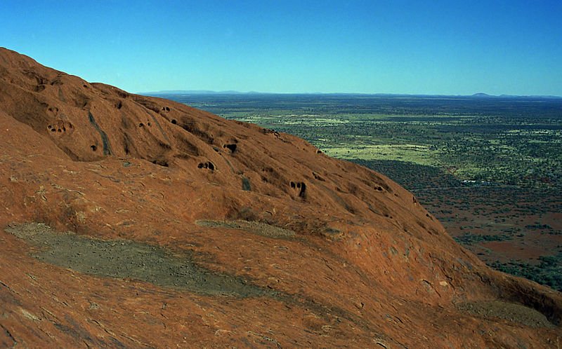 View of the surroundings from Uluru/Ayers Rock
Source: https://commons.wikimedia.org/wiki/File:Ayers_Rock_view.jpg
Author: Ikiwaner

Location of Uluru-Kata Tjuta National Park
Uluru-Kata Tjuta National Park is 1430 km south of Darwin. Within the park, Uluru is 335 km direct from Alice Springs or 450 km by road, while Kata Tjuta is located 40 km to the west of Uluru.Visiting Uluru-Kata Tjuta National Park
Most people choose Alice Springs as their base. From there, they visit Uluru-Kata Tjuta National Park by road.How to reach Uluru-Kata Tjuta National Park
The fastest and most expensive way to reach Uluru-Kata Tjuta National Park is by flight. The Connellan Airport is just 15 km to the north of Uluru. Qantas flies there from Alice Springs, Cairns, Sydney and Perth. Expect the airticket to be very expensive.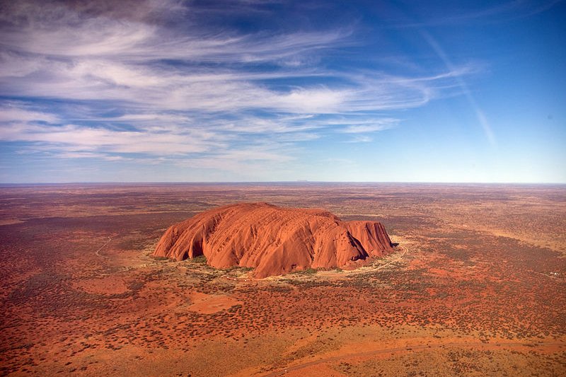 View of Uluru from helicopter
Source: https://commons.wikimedia.org/wiki/File:Uluru,_helicopter_view.jpg
Author: Corey Leopold

Taboos at Uluru-Kata Tjuta National Park
Uluru is a highly sacred site for the Pitjantjatjara, the local Aboriginal people. There is a sign posted by them requesting visitors not to climb the rock, and as a respect to them, I would encourage visitors to keep Uluru for their eyes only. However, as a national park, visitors are permitted to climb, and there are handholds to ease the climb. Still, 35 people had fallen to their deaths in attempting the climb.The Pitjantjatjara Anangu also requests that certain sections of Uluru not to be photographed. These are areas related to gender-linked rituals. Women are also not allowed to these places. The purpose of forbidding the photography is so that the Anangu do not themselves inadvertently view these.
List of World Heritage Sites in Australia and World Heritage Sites in the World
Back to Discover Australia
 Latest updates on Penang Travel Tips

Copyright © 2003-2025 Timothy Tye. All Rights Reserved.

 Go Back