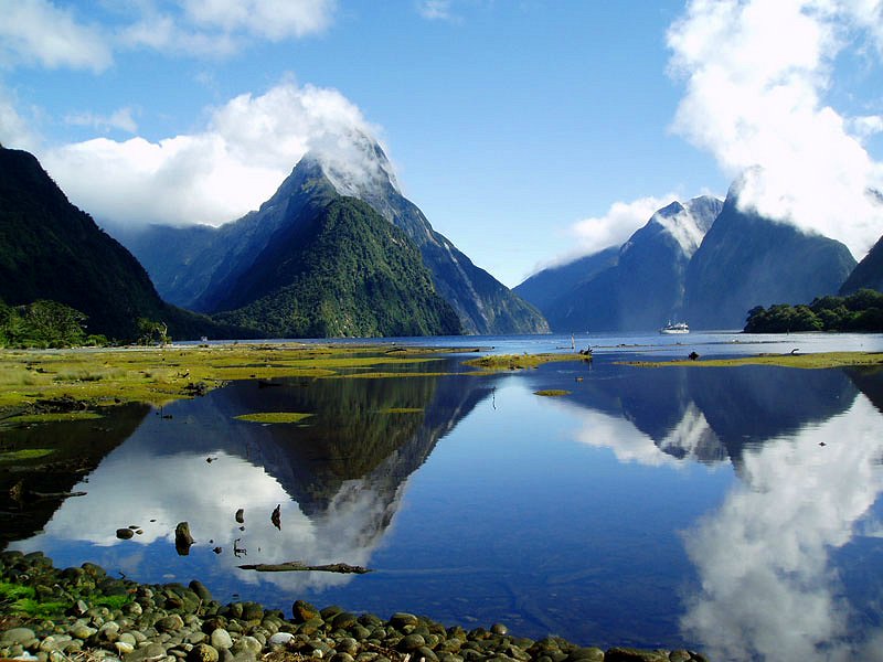
 Milford Sound
 https://commons.wikimedia.org/wiki/File:Milford_sound_Nouvelle_Z%C3%A9lande_03_mars_2005.jpg
Author: Olywyer

Milford Sound is a fjord in the South Island of New Zealand. It is also known as Piopiotahi in Maori. The fjord is located within the Fiordland National Park and is part of the Te Wahipounamu World Heritage Site. It is acclaimed as New Zealand's most famous tourist destination.
Milford Sound was named after Milford Haven in Wales, while the Cleddau River which flows into the sound is also named for its Welsh namesake. The Maoris called it Piopiotahi after the thrush-like piopio bird which is now extinct. Piopiotahi means "a single piopio", harking back to the legend of Maui trying to win immortality for mankind. When Maui died in the attempt, a piopio was said to have flown here in mourning.
360° View of Kodak on Google Maps Street View
Roadside view of Mitre Peak.View on Deepwater Basin Road, with Cleddau River to the left.
Tour bus stop for Mitre Peak cruises.
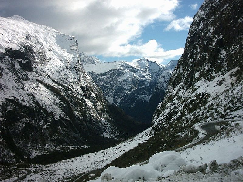 Homer Saddle looking west, leading into Milford Sound
 https://commons.wikimedia.org/wiki/File:Homer_Saddle_LookingWest.jpg
 Ingolfson
Milford Sound runs 15 kilometres inland from the Tasman Sea and is surrounded by sheer rock faces that rise 1,200 metres (3,900 ft) or more on either side. Among the peaks are The Elephant at 1,517 metres (4,980 ft), said to resemble an elephant's head, and Lion Mountain, 1,302 metres (4,270 ft), in the shape of a crouching lion.
Lush rain forests cling precariously to these cliffs, while seals, penguins, and dolphins frequent the waters. It was initially overlooked by European explorers, because its narrow entry did not appear to lead into such large interior bays.
Sailing ship captains such as James Cook, who bypassed Milford Sound on his journeys for just this reason, also feared venturing too close to the steep mountainsides, afraid that wind conditions would prevent escape.
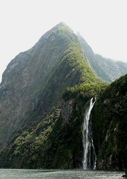 Waterfall at Milford Fjords
 https://commons.wikimedia.org/wiki/File:Milford_Fjords.jpg
 Eric Bréchemier
While Fiordland as such remained one of the least-explored areas of New Zealand up to the 20th century, Milford Sound's natural beauty soon attracted national and international renown, and led to the discovery of the McKinnon Pass in 1888, soon to become a part of the new Milford Track, an early walking tourism trail. In the same year, the low watershed saddle between the Hollyford River and the Cleddau River was discovered, where the Homer Tunnel was to be developed about sixty years later to provide road access.
The beauty of this landscape draws thousands of visitors each day, with over 550,000 in total per year. This makes the sound one of New Zealand's most-visited tourist spots, and also the most famous New Zealand tourist destination, even with its remote location and the long journey from the nearest population centres.
Almost all tourists going to the sound also take one of the boat tours which usually last between 1-2 hours. They are offered by several companies, departing from the Milford Sound Visitors' Centre. There is also the option of extended overnight cruises on Milford Sound.
Unesco Inscription
Milford Sound is part of the Fiordland National Park, which is inscribed as a World Heritage Site under Te Wahipounamu - South West New Zealand since 1990 under criteria vii, viii, ix and x.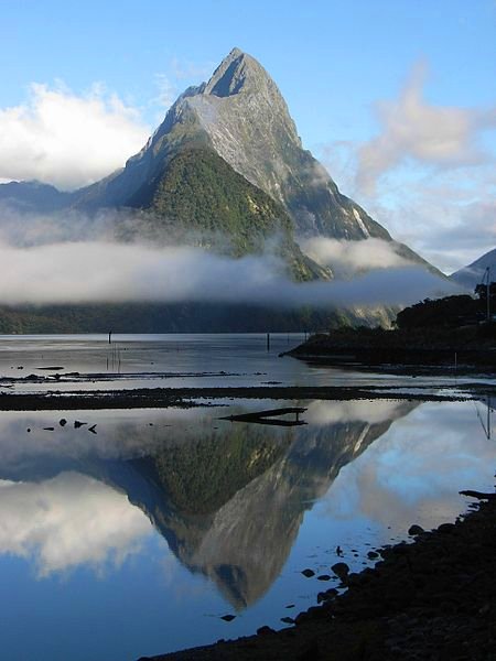 Mist shrouding Mitre Peak, Milford Sound
 https://commons.wikimedia.org/wiki/File:Mitre_Peak_sunny.JPG
 RCLH
RCLH
Getting there
By planeThe most spectacular way to see and experience every thing about Milford Sound is to fly in on a beautiful day. The flight to Milford Sound from Queenstown, Te Anau or Wanaka is undoubtedly one of the world's greatest scenic flights. You are greeted with unsurpassed views of the mountains and glaciers on route. There are a number of flightseeing operators that fly light aircraft and helicopters into Milford Sound from Queenstown,Wanaka or Te Anau.
By bus
There are sightseeing tour by bus from Queenstown or Te Anau to Milford Sound.
By car
Milford Sound is 120 km from Te Anau on State Highway 94. Allow plenty of time (and fuel), to make the 2-3 hours journey from Te Anau. The road winds through some of the most spectacular scenery in New Zealand as it climbs up to the Homer Tunnel. The Homer Tunnel is a single lane tunnel. Although it has been fitted with traffic lights in 2004, you may still experience a wait while opposing traffic clears the tunnel. You may also want to break your journey along the road to take photographs or investigate scenic spots - including Mirror Lakes, and views of the Hollyford and The Chasm.
State Highway 94 is a high pass and regularly has icy conditions between June and November. It is also subject to avalanches. All cars must carry chains in winter and the Transit New Zealand information kiosk 8km north of Te Anau will check that you are carrying them and can fit them. High risk sections of the road are marked with a red cross on a blue background and with 'no stopping' signs, do not stop your car on these sections of road. Review the state of the road at Transit New Zealand before departing; if the risk of an avalanche is high, the road will be closed and if it is moderate it may close at short notice. Drivers not experienced at driving on ice and snow might prefer a bus tour.
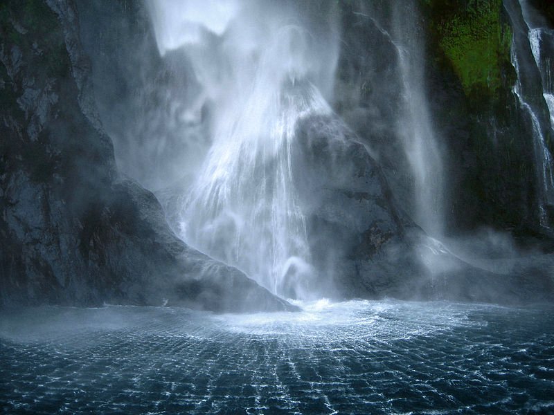 Stirling Falls, Milford Sound
 https://commons.wikimedia.org/wiki/File:MilfordSoundStirlingFalls_gobeirne_EDIT.jpg
 Gobeirne
Climate of Milford Sound
With a mean annual rainfall of 6,813 mm on 182 days a year, a high level even for the West Coast, Milford Sound is known as the wettest inhabited place in New Zealand and one of the wettest in the world. Rainfall can reach 250 mm during a span of 24 hours. The rainfall creates dozens of temporary waterfalls (as well as a number of major, more permanent ones) cascading down the cliff faces, some reaching a thousand metres in length. Smaller falls from such heights may never reach the bottom of the sound, drifting away in the wind. Accumulated rainwater can at times cause portions of the rain forest to lose their grip on the sheer cliff faces, resulting in tree avalanches into the sound. The regrowth of the rain forest after these avalanches can be seen in several locations along the sound.List of World Heritage Sites in New Zealand and World Heritage Sites in the World
 Latest updates on Penang Travel Tips

Copyright © 2003-2025 Timothy Tye. All Rights Reserved.

 Go Back