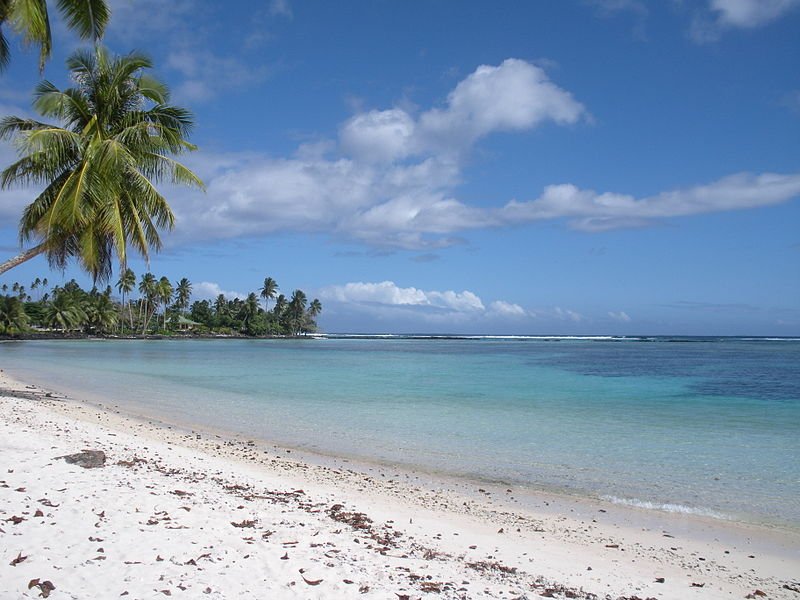
 Beach on Upolu Island, Samoa
Source: https://commons.wikimedia.org/wiki/File:Beach_on_Upolu_Island,_Samoa,_2009.jpg
Author: Stephen Glauser

Samoa is a small island nation in the South Pacific Ocean. Its official name today is the Independent State of Samoa. Formerly it was known as Western Samoa and Germany Samoa. Covering 2,831 sq km (1,093 sq mi), Samoa is part of the island group that includes the American Samoa.
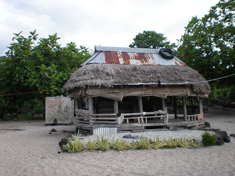 A Samoan fakei'o (thatched home)
Source: https://commons.wikimedia.org/wiki/File:Samoan_faleo%27o_%28thatched_home%29,_Falealupo_village,_Savai%27i,_Samoa.JPG
Author: Teinesavaii

Samoa has a population of 183,000. It comprises a cluster of islands, the two main ones being Upolu and Savai'i. Although Savai'i is the bigger of the two - it is the biggest island in the Pacific outside Hawaii and New Zealand - it has only 24% of Samoa's population. The capital of Samoa as well as its biggest city is Apia, located on Upolu.
Samoa is eleven hours behind Coordinated Universal Time (UTC-11). Its currency is called the Tala (WST). Traffic is driven on the left here, just as in Britain. The phone IDD code is +685.
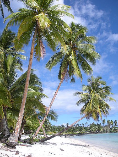 Lefaga village on Upolu Island, Samoa
Source: https://commons.wikimedia.org/wiki/File:Lefaga,_Return_to_Paradise_beach,_south_coast_Upolu_Island,_Samoa,_2009.jpg
Author: Stephen Glauser

The economy of Samoa is based largely on agriculture and fishing. Cash crops include coconut and its derivatives, noni, taro, cocoa and bananas. In 2009, Samoa had an estimated nominal GDP of $558 million, equivalent to a per capita nominal GDP of $3,077. Its per capita GDP at purchasing power parity stood at $5,782.
The islands of Samoa were the product of volcanic eruptions. Today only Savai'i remains volcanically active. The only road through the island passes through the lava fields. There are a number of volcanoes on Savai'i including Mount Matavanu, Mata o le Afi and Mauga Afi. The highest mountain in Samoa is Mount Silisili, which is 1,858 m (6,096 ft). It is located near the center of Savai'i.
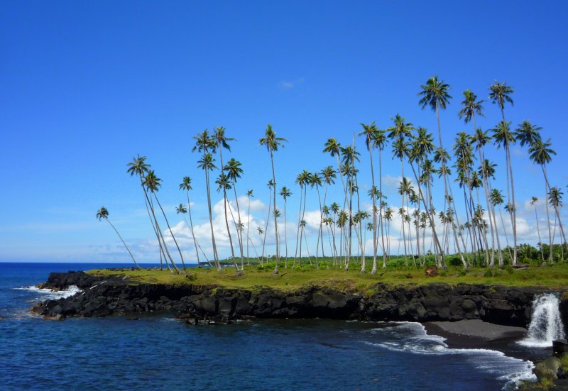 Savai'i island, Samoa
Source: https://commons.wikimedia.org/wiki/File:Mu_Pagoa_Waterfall_-_Savai%27i_-_Samoa.jpg
Author: Sarah Kelemen

Samoa experiences an equatorial climate with temperatures that are quite uniform throughout the year. Temperature ranges from 23°C to 30°C (73°F-86°F). January and December are the wettest months.
Samoa has been inhabited for the past three thousand years. The first contact with Europeans was established in the early 18th century when Dutchman Jacob Roggeveen sighted it in 1722. This was followed by French explorer Louis-Antoine de Bougainville in 1768. He named them the Navigator Islands.
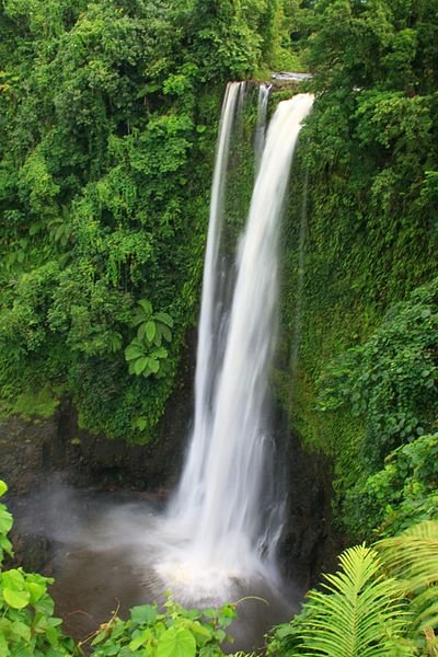 Fuipisia Waterfall, Upolu Island, Samoa
Source: https://commons.wikimedia.org/wiki/File:Fuipisia_waterfall_-_Samoa.jpg
Author: Neil

Missionaries and traders only began showing an interest in Samoa from the 1830's onwards. Missionary work was established by John Williams of the London Missionary Society. By the late 19th century, Samoa was frequented by cargo and whaling ships as a refueling station. The Germans, Americans and British began laying claims to different islands of Samoa. At the turn of the 20th century, the islands were divided between the Americans and Germans, creating the American Samoa and German Samoa.
German Samoa came under the control of New Zealand at the end of World War I. Under New Zealand administration, two major incidences occured in Samoa. On 7 November, 1918, the ship SS Talune arrive from Auckland, and was allowed to berth by the New Zealand administration, in breach of quarantine. Within seven days of its arrival, the population of Samoa was hit by an influenza epidemic which killed one fifth of its population.
The second major incident under New Zealand administration was the firing at peaceful demonstrators on 28 December, 1929. It killed the leader, High Chief Tupua Tamasese Lealofi, as well as ten others, and injured 50. The day was remembered as Black Saturday. Samoa eventually gained independence from New Zealand on 1 January, 1962. In 2002, New Zealand prime minister Helen Clark formally apologised for New Zealand's role in those two incidences during her visit to Samoa.
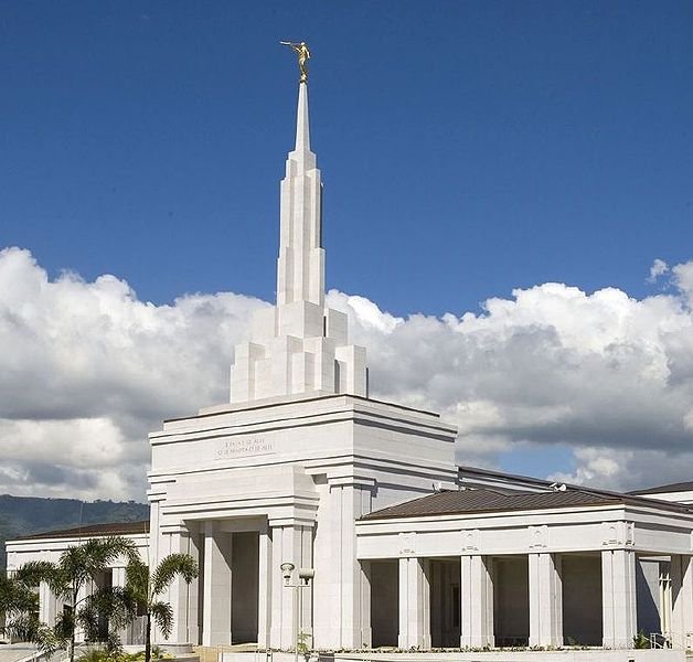 Apia Samoa Temple
Source: https://commons.wikimedia.org/wiki/File:Apia_Samoa_Temple-new.jpg
Author: Antipus

When Western Samoa changed its name to Samoa, it caused American Samoa to protest that the move diminished its own identity. On 7 September, 2009, Samoa changed from driving on the right to driving on the left. In doing so, it is aligned with other countries in the region, and particularly with New Zealand, which it shares close affiliation.
Planning your visit to Samoa
Fagalii Airport (FGI), located to the east of Apia, is the gateway to Samoa. It is served by Polynesian Airlines, Air New Zealand, Polynesian Blue and Air Pacific. There are flights connecting Apia with Auckland, Brisbane, Melbourne, Sydney and Townsville, among others.Major Towns in Samoa
- Apia - capital
 Latest updates on Penang Travel Tips

Copyright © 2003-2025 Timothy Tye. All Rights Reserved.

 Go Back