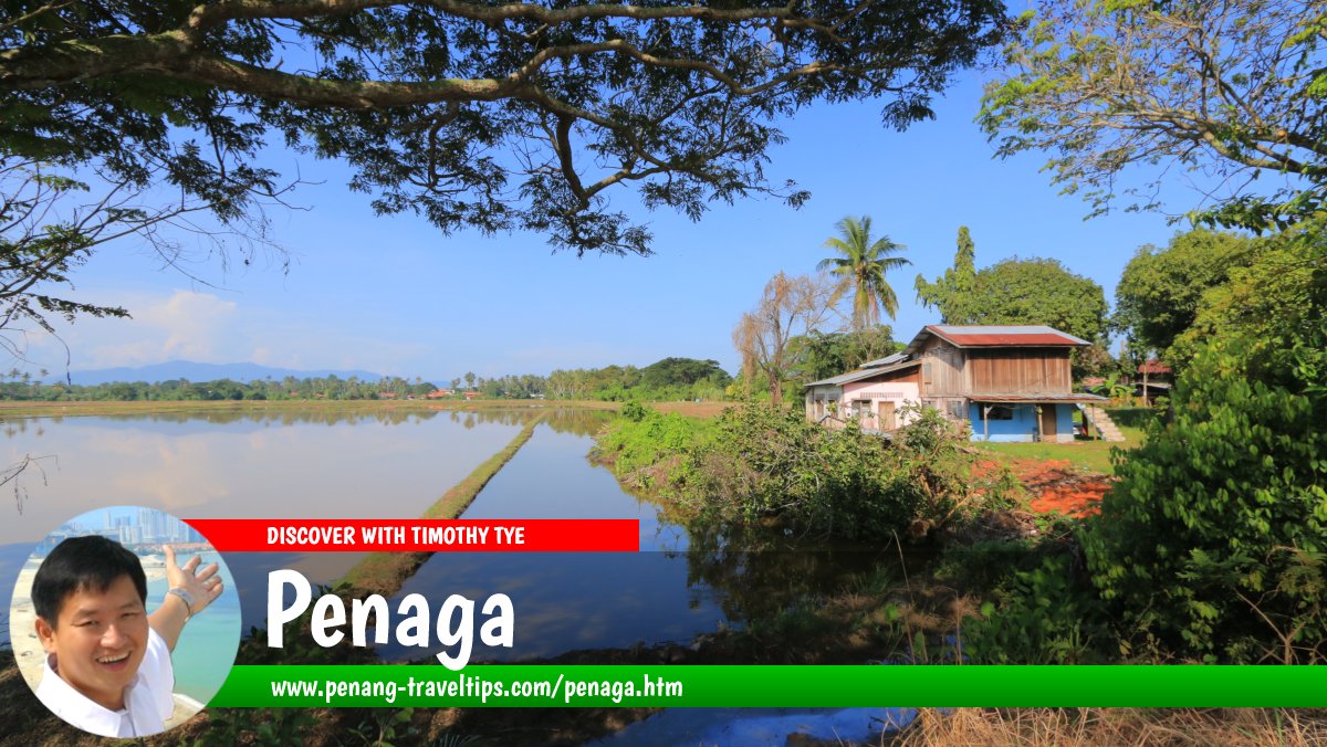
 Penaga, Seberang Perai Utara (16 November 2019)
Penaga (GPS: 5.527686, 100.381479) is a small town in Seberang Perai Utara on the Penang Mainland. It is located to the north of Teluk Air Tawar. The pekan, or town centre, is similar to most small towns in Malaysia, comprising semi-wooden shophouses, with a few brick ones, lining both sides of Jalan Penaga.
Measured from the junction between Jalan Penaga and the entrance to the Penaga Market (GPS: 5.527151, 100.380947), Penaga is 16.2 km to Penang Sentral, 23.3 km to the Penang Bridge, 43.8 km to the Second Penang Bridge and 41.1 km to the Penang International Airport.
 Map of Penaga
Attractions in Penaga
- Kampung Agong (GPS: 5.54023, 100.37974)

Wet markets and night markets in Penaga
- Pasar Awam Penaga (local wet market) (GPS: 5.52831, 100.38011)

- Pasar Ikan Penaga (GPS: 5.53147, 100.37949)

 Petrol Stations in Penaga
- Caltex Penaga (GPS: 5.53646, 100.38036)

- Shell Penaga (GPS: 5.5304, 100.38214)

 Schools in Penaga
- Aik Keow Primary School (GPS: 5.52531, 100.38102)

- Sekolah Kebangsaan Penaga (GPS: 5.5369, 100.37871)

- Sekolah Kebangsaan Permatang Janggus (GPS: 5.5547, 100.38983)

- Sekolah Menengah Kebangsaan Dato Haji Hassan Noh (GPS: 5.55099, 100.37828)

Hospitals and public clinics in Penaga
- Klinik Kesihatan Penaga (GPS: 5.53543, 100.38082)

 Eateries in Penaga
- Medan Selera PERDA Lahar Endin (GPS: 5.53236, 100.38032)

 Chinese Temples in Penaga
- Penaga Tua Pek Kong Temple (GPS: 5.52561, 100.38098)

 Mosques in Penaga
- Masjid Jamek Al Hidayah (GPS: 5.57416, 100.33952)

- Masjid Jamek Nurussaadah (GPS: 5.51639, 100.383)

- Masjid Penaga (GPS: 5.52796, 100.38189)

- Masjid Permatang Bendahari (GPS: 5.57873, 100.37496)

Villages in Penaga
- Kampung Kuala Muda (GPS: 5.57435, 100.33932)

- Lahar Tabut (GPS: 5.51732, 100.38264)

- Permatang Berah (GPS: 5.50678, 100.38369)

- Permatang Binjai (GPS: 5.49978, 100.39574)

- Permatang Kuala (GPS: 5.50546, 100.3919)

- Permatang Pak Elong (GPS: 5.50668, 100.40248)

- Permatang Rambai (GPS: 5.5269, 100.39495)

- Permatang Sintok (GPS: 5.51551, 100.40244)

- Pulau Mertajam (GPS: 5.57186, 100.36208)

Roads in Penaga
360° View of Penaga
So far, Penaga appears slightly out of the way, as far as development is concerned. The place is still rural, and the pace here is slower than in the central and southern part of Seberang Perai. The two main roads in the area are Jalan Penaga and Jalan Permatang Bendahari, which goes all the way to the bank of the Muda River, across from Kota Kuala Muda.
The village of Kampung Baru Penaga is located on the coast overlooking Penang Island. Other villages in the area includes Kampung Kuala Muda, Kampung Bakar Kapor, Kampung Penaga Dua, Kampung Lahar Endin and Kampung Tembusu.
Getting there
Exit the North-South Expressway at Exit 166 (Bertam Interchange). Head west to reach Penaga.Penaga is  on the Map of Seberang Perai
List of Towns in Penang and Towns in Malaysia

Copyright © 2003-2025 Timothy Tye. All Rights Reserved.

 Go Back