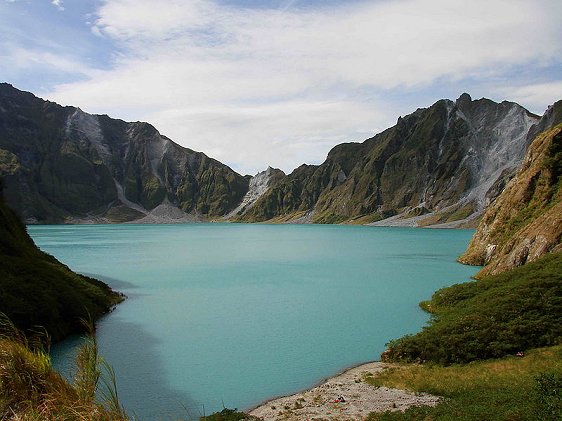
 Caldera of Mount Pinatubo, Luzon
 http://commons.wikimedia.org/wiki/File:Mount_Pinatubo_20081229_02.jpg
 Chris Tomnong
Luzon is the biggest, most populous and most developed of the islands in the Philippines. It is also the location of the capital of the country, Manila. Luzon is the main island in the Luzon Group of islands, which includes the Batanes and Babuyan group of islands to the north, and the Cantanduanes, Marinduque, Masbate, Romblon and Mindoro islands to the south.
Luzon covers an area of 104,688 sq km (40,420 sq mi). 8 of the 17 administrative regions of the Philippines are located on it. The highest point on Luzon is Mount Pulag, standing at 2,922m (9,587 ft). It is the third highest mountain in the Philippines. Other major mountains in Luzon includes Mount Pinatubo, Mount Mayon and Taal Volcano.
The Cagayan River, at 505km (314mi) is both longest river in Luzon is also the longest in the country. Central Luzon (Region III) has the largest plain in the country, and is also the main producer of rice in the Philippines.
Places of Interest in Luzon
- Banaue Rice Terraces
Ancient rice terraces on the mountains of Ifugao. - Coconut Palace
Mansion in Pasag City, Metro Manila, that was built using different parts of the coconut palm. - Corregidor Island
Island guarding the entrance of Manila Bay. - Mount Mayon
A beautiful, active stratovolcano in the Bicol Region of southern Luzon. - Mount Pinatubo
Active stratovolcano in central Luzon. - Pagsanjan Falls
One of the most famous waterfalls in the Philippines. - Taal Volcano
Volcano that created the scenic Lake Taal.
 Latest updates on Penang Travel Tips
 Map of Roads in Penang
Looking for information on Penang? Use this Map of Roads in Penang to zoom in on information about Penang, brought to you road by road.
Copyright © 2003-2025 Timothy Tye. All Rights Reserved.

 Go Back