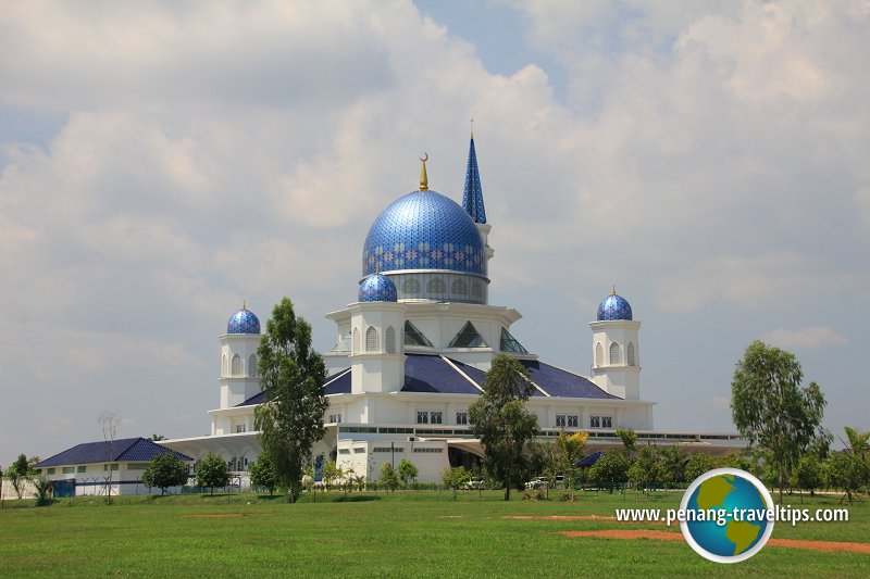
 Masjid Abdullah Fahim (22 July 2015)
Seberang Perai Utara is one of the three administrative districts of Seberang Perai. It covers 269 square kilometers and have a population of a little less than 300,000 (as of 2010).
The main towns in Seberang Perai Utara are Butterworth, Kepala Batas, Penaga and Tasek Gelugor. There are many villages and small towns in Seberang Perai Utara, among them Bagan Ajam and Teluk Air Tawar.
The present border of Seberang Perai Utara came about around 1826 following the Siamese invasion of Kedah in 1821 and the subsequent Burney Treaty1 between the Siamese and the British over the new boundary, which is then marked with three British-Siamese boundary stones. The treaty put in writing an earlier agreement between the Siamese and the British made in 1822 when British Resident of Singapore John Crawfurd visited Bangkok to determine the border of Siamese territory, which was acknowledged as including the four Malay states of Kedah, Kelantan, Perlis and Terengganu.
Location of places in Seberang Perai Utara on map
Townships in Seberang Perai Utara
- Butterworth (GPS: 5.42564, 100.38722)

- Kepala Batas (GPS: 5.51757, 100.43048)

- Penaga (GPS: 5.52953, 100.38276)

- Tasek Gelugor (GPS: 5.47912, 100.49142)

Villages in Seberang Perai Utara
- Bagan Ajam (GPS: 5.55601, 100.4416)

- Bumbung Lima (GPS: 5.55601, 100.4416)

- Ekor Kuching (GPS: 5.54358, 100.52584)

- Kampung Kuala Muda (GPS: 5.57435, 100.33932)

- Kampung Nyior Sebatang (GPS: 5.57435, 100.33932)

- Kubang Menerong (GPS: 5.51766, 100.50629)

- Lahar Tiang (GPS: 5.5483, 100.48027)

- Lahar Yooi (GPS: 5.46949, 100.45736)

- Pajak Song (GPS: 5.424423, 100.392713)

- Pajak Song (GPS: 5.500556, 100.426105)

- Permatang Binjai (GPS: 5.49978, 100.39574)

- Permatang Buluh (GPS: 5.48549, 100.42613)

- Permatang Kuala (GPS: 5.50546, 100.3919)

- Permatang Pak Elong (GPS: 5.50668, 100.40248)

- Permatang Rambai (GPS: 5.5269, 100.39495)

- Permatang Sintok (GPS: 5.51551, 100.40244)

- Permatang Tok Gelam (GPS: 5.4895, 100.39785)

- Permatang Tok Jaya (GPS: 5.45764, 100.40123)

- Pulau Mertajam (GPS: 5.57186, 100.36208)

- Sungai Dua (GPS: 5.44528, 100.42965)

- Sungai Puyu (GPS: 5.44791, 100.39505)

- Tanjung Rambai (GPS: 5.56394, 100.44068)

- Teluk Air Tawar (GPS: 5.47822, 100.38339)

References
List of Towns in Penang and Towns in Malaysia

Copyright © 2003-2025 Timothy Tye. All Rights Reserved.

 Go Back