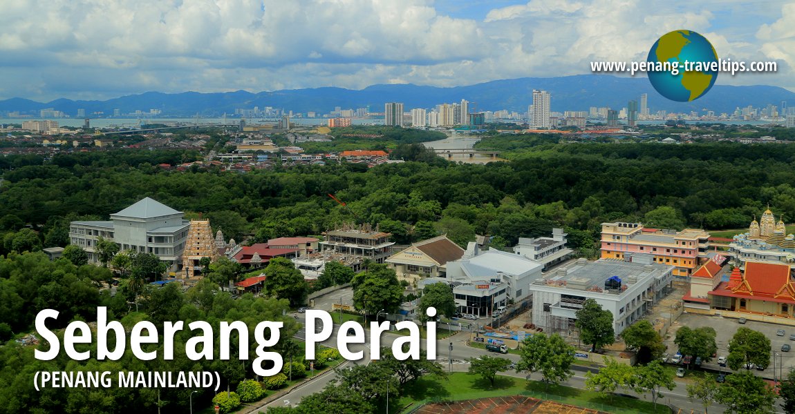
 Seberang Perai (Penang Mainland) (7 October 2017)
Penang Mainland (Malay: Seberang Perai/Seberang Prai; Traditional/Simplified Chinese: 威省; Pinyin: Wēi Shěng; Tamil: செபாராங் பிறை) is the mainland component of Penang State. It is also known in Malay as Seberang Prai, which is also written Seberang Perai. Penang Mainland occupies the strip of land that was known under the British as Province Wellesley. Today Penang Mainland comprises three administrative districts namely Seberang Perai Utara, Seberang Perai Tengah and Seberang Perai Selatan. This Seberang Perai Travel Tips provides you a comprehensive guide to all the towns on Penang Mainland.
Districts of Penang Mainland (Seberang Perai)
Seberang Perai was a municipality of Penang State until May 2019, when it was granted city status. For administrative purposes, the area is split into three districts namely Seberang Perai Utara , Seberang Perai Tengah
  and Seberang Perai Selatan
  . Each district has a district seat, which is Kepala Batas for Seberang Perai Utara, Bukit Mertajam for Seberang Perai Tengah, and Sungai Jawi for Seberang Perai Selatan.
Map of Towns in Seberang Perai
 Places in Seberang Perai
- Alma (GPS: 5.32987, 100.4781)

- Ara Kuda (GPS: 5.43802, 100.51307)

- Bagan Ajam (GPS: 5.43747, 100.38071)

- Bagan Dalam (GPS: 5.39264, 100.36991)

- Bagan Lalang (GPS: 5.43118, 100.39702)

- Bagan Luar (GPS: 5.41051, 100.37083)

- Bagan Nyior (GPS: 5.32621, 100.41877)

- Bandar Cassia (GPS: 5.25601, 100.43386)

- Bandar Perai Jaya (GPS: 5.37769, 100.39776)

- Bandar Perda (GPS: 5.36576, 100.43519)

- Bandar Tasek Mutiara (GPS: 5.2778, 100.49243)

- Batu Kawan (GPS: 5.26481, 100.43598)

- Berapit (GPS: 5.39774, 100.49416)

- Bukit Berangan (GPS: 5.43565, 100.47185)

- Bukit Mertajam (GPS: 5.36552, 100.46056)

- Bukit Minyak (GPS: 5.32874, 100.44836)

- Bukit Tambun (GPS: 5.2762, 100.46545)

- Bukit Tengah (GPS: 5.33839, 100.43057)

- Bukit Tok Alang (GPS: 5.44309, 100.47732)

- Bumbung Lima (GPS: 5.5568, 100.4356)

- Butterworth (GPS: 5.39552, 100.36688)

- Cherok Tokun (GPS: 5.34683, 100.48665)

- Ekor Kuching (GPS: 5.54358, 100.52584)

- Jarak Atas (GPS: 5.45038, 100.48001)

- Jarak Tengah (GPS: 5.45403, 100.47679)

- Jawi (GPS: 5.19761, 100.49503)

- Juru (GPS: 5.31634, 100.44396)

- Kepala Batas (GPS: 5.51666, 100.42552)

- Kuala Juru (GPS: 5.34031, 100.40897)

- Kubang Menderung (GPS: )

- Kubang Semang (GPS: )

- Lima Kongsi (GPS: 5.24045, 100.50648)

- Machang Bubok (GPS: 5.33941, 100.51043)

- Mak Mandin (GPS: 5.424423, 100.392713)

- Mengkuang (GPS: 5.40338, 100.49388)

- Mengkuang Titi (GPS: 5.41405, 100.49175)

- Nibong Tebal (GPS: 5.17009, 100.47861)

- Padang Lalang (GPS: 5.365168, 100.448287)

- Padang Menora (GPS: 5.45688, 100.47332)

- Pajak Song (GPS: 5.500556, 100.426105)

- Pekan Darat (GPS: 5.47358, 100.40118)

- Penaga (GPS: 5.52768, 100.38147)

- Penanti (GPS: 5.40504, 100.46543)

- Perai (GPS: 5.38778, 100.38162)

- Permatang Batu (GPS: 5.36435, 100.43229)

- Permatang Binjai (GPS: 5.49978, 100.39573)

- Permatang Buluh (GPS: 5.48549, 100.42613)

- Permatang Haji Hassan (GPS: 5.48606, 100.43283)

- Permatang Keriang (GPS:5.56457, 100.36759)

- Permatang Kuala (GPS: 5.50546, 100.3919)

- Permatang Nibong (GPS: 5.38995, 100.43706)

- Permatang Pak Elong (GPS: 5.50668, 100.40248)

- Permatang Pasir (GPS: 5.42, 100.43671)

- Permatang Pauh (GPS: 5.41058, 100.41329)

- Permatang Rambai (GPS: 5.5269, 100.39495)

- Permatang Rawa (GPS: 5.36868, 100.44984)

- Permatang Sintok (GPS: 5.51551, 100.40244)

- Permatang Sungai Dua (GPS: 5.46439, 100.42969)

- Permatang Tinggi, Simpang Ampat, SPS (GPS: 5.30101, 100.47704)

- Permatang Tinggi, Kepala Batas, SPU (GPS: 5.54395, 100.43475)

- Permatang Tok Gelam (GPS: 5.4895, 100.39785)

- Permatang Tok Jaya (GPS: 5.45764, 100.40123)

- Permatang Tok Mahat (GPS: 5.13211, 100.48058)

- Pulau Mertajam (GPS: 5.57152, 100.36244)

- Seberang Jaya (GPS: 5.39522, 100.39924)

- Simpang Ampat (GPS: 5.26481, 100.43598)

- Sungai Bakap (GPS: 5.26481, 100.43598)

- Sungai Dua (GPS: 5.44528, 100.42965)

- Sungai Lembu (GPS: 5.35636, 100.52061)

- Sungai Puyu (GPS: 5.44791, 100.39505)

- Sungai Setar (GPS: 5.14685, 100.44619)

- Sungai Udang (GPS: 5.16545, 100.42779)

- Tanah Liat (GPS: 5.38369, 100.46329)

- Tasek Gelugor (GPS: 5.5.48267, 100.49279)

- Teluk Air Tawar (GPS: 5.44505, 100.38219)

- Valdor (GPS: 5.24002, 100.49331)

Map of Roads in Seberang Perai
Nature Sites on Penang Mainland
Shopping Malls in Penang Mainland
Country Clubs in Penang Mainland
Places in Penang Mainland
- Alma
- Bagan Ajam
- Bagan Dalam
- Bagan Jermal
- Bagan Luar
- Bandar Perda
- Batu Kawan
- Berapit
- Bukit Mertajam
- Bukit Minyak
- Bukit Panchor
- Bukit Tambun
- Bukit Tengah
- Butterworth
- Jawi
- Juru
- Kepala Batas
- Kubang Semang
- Mak Mandin
- Mengkuang
- Mengkuang Titi
- Nibong Tebal
- Pantai Bersih
- Penaga
- Penanti
- Perai
- Permatang Pauh
- Permatang Rawa
- Permatang Tinggi
- Pulau Aman
- Pulau Gedung
- Seberang Jaya
- Simpang Ampat
- Sungai Bakap
- Sungai Puyu
- Sungai Udang
- Tasik Gelugor
- Teluk Air Tawar
- Valdor
Villages on Penang Mainland
About Seberang Perai
The name Province Wellesley was given in honour of Richard Wellesley, the Governor-General of Bengal, when it was taken from the Sultan of Kedah in 1798. The sultan in question, Sultan Abdullah, had no choice but to cede the strip of land to the British, as he had just lost a war with the British, in an unsuccessful bid to wrestle Penang Island back from Francis Light.By the time Province Wellesley was ceded, Francis Light had passed away (in 1794), and the negotiation was carried out by Sir George Leith, the then Lieutenant-Governor of Penang. The British wanted this strip of land to create a buffer zone to protect Penang. As you look at the map, you will see that mainland Penang does separate Penang state from Kedah in its entirely. Even when you drive south, you will re-enter Kedah at Bandar Baharu before entering Perak.
The ceding of Province Wellesley was mentioned in the 10 November, 1831 issue of Singapore Chronicle and Commercial Register. It reads:
Upwards of thirty years ago, Province Wellesley was not only ceded by the king of Kedah to the Company, but the extent of its boundaries defined by treaty as follows: "His Majesty agrees to give to the English Comapny for ever, all that part of teh sea coast that is between Kwala Krian and the river side of Kwala Mooda, and measuring inland from the seaside sixty o'longs, the whole length above mentioned to be measured by people appointed by His Majesty and the Company's people. The English Company are to protect this coast from all enemies, robbers and pirates that may attack it by sea from north or south."1
Updates on Seberang Perai
10 October, 2018The Star report that Seberang Perai's undisturbed natural areas will be included in Penang'sw tourism masterplan.
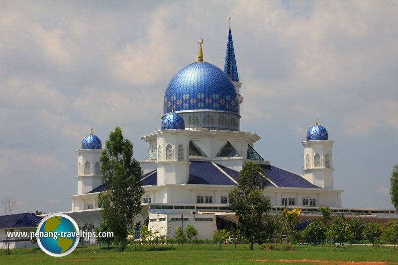
 Masjid Abdullah Fahim, Kepala Batas (22 July 2015)
Why is Province Wellesley called Seberang Perai?
The name Seberang Perai comes from the township of Perai which was already a Malay settlement in the 18th century. In early British maps, it was spelled Prye. Although Perai is older than even George Town, it has always played a subordinate role.The topography of Province Wellesley was defined in this 29 June, 1861, article in The Straits Times, page 2, as follows:
Province Wellesley is a narrow strip on the main-land of the Malay Peninsula directly opposite to Pinang, 32 miles long, and varying in width from 13 miles to somewheat less than 4 miles, the narrowest being nearly opposite to the town of Pinang. It was originally ceded by the Rajah of Kedah in the year 1801 (fifteen years after the occupation of Pinang) and was then a mere strip of coast, little more than three miles in width, extending from the Mudah to the Krian River. It was increased to its present limits in the year 1831. The Mudah and Krian rivers still continue to form the northern and southern boundaries of the Province.
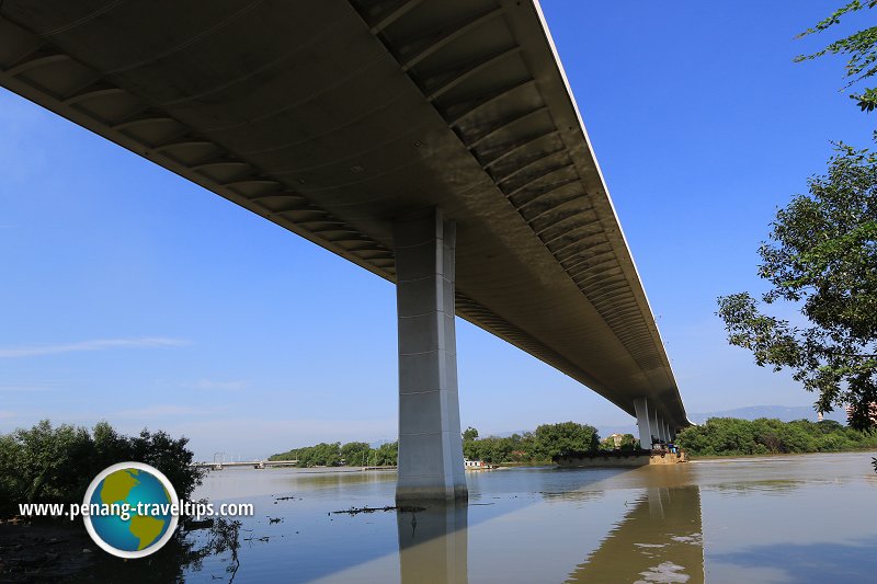
 Prai River Bridge (11 September 2015)
The inland frontier, commencing to the north, consists of an imaginary line from a pillar erected on the south bank of the Mudah, 13 miles in a direct line inland from its mouth, to a similar pillar on an island in the Pry River, distant somewhat less than 4 miles in a direct line ialand from the coast. From this point to the Frontier Pillar on the Krian River, 8 miles inland from the sea, the boundary line is distinctly defined by geographical features of a permanent character.
It (the boundary line) crosses the summit of Mount Mertajam, the highest hill in the Province, and thence runs along the crest of the Berator Range to the banks of the Krian. The Kra Islands, two steep-sided thickly wooded hummocks, lying near the coast, also form part of the Province. The entire area consists of 286 square miles, about half of which is under cultivation.
Province Wellesley may have been called Seberang Perai because the land ceded to the British was across from Pantai Prai in Kedah. It is just across the river from Ekor Kuching, where the British-Siamese Boundary Stone is located. This piece of land, when reference from the Kedah perspective, is "across the Prai", hence "Seberang Perai". Similarly, even prior to the founding of Penang, the Hokkiens had already settled in Kedah, and to them, Province Wellesley is also "across the Prai", hence "Koay1 Kang4"
 , which means "across the river".
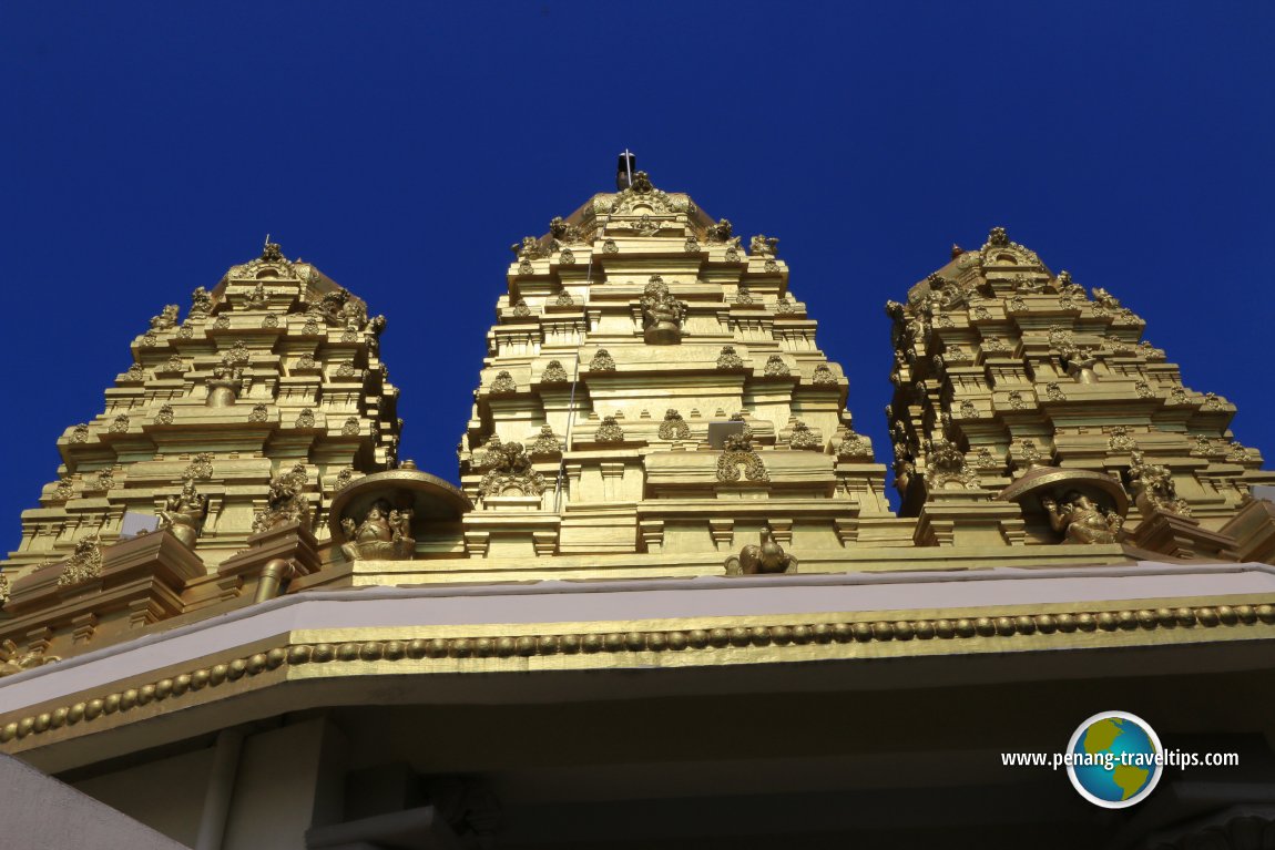
 Golden gopurams of Sri Selva Vinayagar Temple (11 September 2015)
Comparing Penang Mainland to Penang Island
For much of Penang's history, the land called Province Wellesley or Seberang Prai was where vegetable farms were located. Rubber and palm oil estates are located here, and as Penang becomes industrialized, heavy industries are located in Prai.Even today, one can see the difference between the types of industries located on Penang Island and those on Penang Mainland. Although three times the size of Penang Island, Penang Mainland has about the same number of people living there, so its population density is just one third that of the island. In recent years, the price of property on Penang Mainland has increased higher, making it one of the most expensive place to live in northern Malaysia, outside of Penang Island itself.
On this page I list the localities - encompassing townships, districts, areas, or places in general - located on Mainland Penang. It is pitiful to note that many Penangites who live on Penang Island often forgot that the state comprises two sections. The localities on the mainland is often ignored. In a case of not knowing hence not loving, most islanders are not familiar with the places in Seberang Perai.
References
- Singapore Chronicle and Commercial Register (10 November, 1831, page 19): Penang Affairs
- The Straits Times (29 June, 1861): Topography of Province Wellesley
More on Penang Mainland; List of Towns in Penang and Towns in Malaysia
Private Guided Tours of Penang
If you are seeking private guided tours of Penang, message Penang Tour Guides at penangtourguides@gmail.com and enquire with them. Buy, rent or sell properties in Penang
Do you have a property for sale or to rent out? Are you looking to buy or rent a property? Get in touch with me. WhatsApp me (Timothy Tye) at 012 429 9844, and I will assign one of my property agents to serve you. I will choose the agent for you, according to your property needs. So when you message me, provide me some details of what you need, whether to sell, to buy, to rent or to rent out, and what type of property, is it condo, apartment, house, shop, office or land. Latest updates on Penang Travel Tips
 Map of Roads in Penang
Looking for information on Penang? Use this Map of Roads in Penang to zoom in on information about Penang, brought to you road by road.About this website

Dear visitor, thank you so much for reading this page. My name is Timothy Tye and my hobby is to find out about places, write about them and share the information with you on this website. I have been writing this site since 5 January 2003. Originally (from 2003 until 2009, the site was called AsiaExplorers. I changed the name to Penang Travel Tips in 2009, even though I describe more than just Penang but everywhere I go (I often need to tell people that "Penang Travel Tips" is not just information about Penang, but information written in Penang), especially places in Malaysia and Singapore, and in all the years since 2003, I have described over 20,000 places.
While I try my best to provide you information as accurate as I can get it to be, I do apologize for any errors and for outdated information which I am unaware. Nevertheless, I hope that what I have described here will be useful to you.
To get to know me better, do follow me on Facebook!
Copyright © 2003-2025 Timothy Tye. All Rights Reserved.

 Go Back