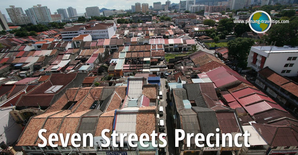
 Seven Streets Precinct (25 November 2010)
The Seven Streets Precinct (Penang Hokkien: Chit1 Tiau3 Lor33) is an area in George Town immediately south of the Prangin Canal. This triangular piece of land is anchored by Magazine Circus to the northwest, the junction of Anson Bridge to the northeast, and Sungai Pinang Bridge to the south.
For much of the 19th century, the area was a collection of Chinese villages, with Koay Kangnga ("Across the River") being the settlement closest to the Prangin Canal. Beach Street continues south in the form of a country path that meandered along the coast towards the plantations in Gelugor and Batu Lanchang (by the way, "Batu Lanchang" in the 19th century refers to much of what is Green Lane today).
 Map of the Seven Streets Precinct, Penang
Sights in the Seven Streets Precinct
- Citadines Connect Georgetown Penang (GPS: 5.41268, 100.32868)

- Noordin One (GPS: 5.41268, 100.32868)

- Pak Thean Keong Temple (GPS: 5.40649, 100.3291)

- Phu Thor Yen Temple (GPS: 5.40869, 100.32794)

- Sandilands (GPS: 5.40513, 100.32852)

- Seng Hong Beow Temple (GPS: 5.40633, 100.3289)

- SJKC Eng Chuan (GPS: 5.40858, 100.32881)

- The Granite Luxury Hotel (GPS: 5.41343, 100.32957)

- The Wembley Penang (GPS: 5.413321, 100.329928)

What to eat in the Seven Streets Precinct
- Char Koay Kak at Cecil Street Market Hawker Centre in the Seven Streets Precinct of George Town, Penang, was recommended by Eddy Tong on 5 October, 2019
- Pasembur at the Cecil Street Market Hawker Centre in the Seven Streets Precinct was recommended by Deric Ong on 21 September, 2019
 Eateries within the Seven Streets Precinct
 Businesses in the Seven Streets Precinct
- 66 Unisex Hair Saloon
- Aik Soon Heng Enterprise
- BL Boon Lee Auto Parts
- Chin Heng Design
- Chan Hoe Hardware Trading
- Chin Huat & Sons Motor
- Chop Boon Sin Foundry
- Cinkoon Hardware
- Gogain Industry (metal works)
- Hi Style Hair Saloon
- Hoe Shen Trading
- Hok Hing Leong Sdn Bhd (motorcycle accessories)
- Huat Motor (motorcycle repair shop)
- Hup Seng Engineering
- K.E. Chong Air Conditioning
- Kedai Runcit Sin Guan Soon (sundry shop)
- Kedai Ubat Peh Cheong Tong (Chinese medical hall)
- Khian Huat Steel Works (metal works)
- Kim Lye Construction
- Klinik Soon
- Kwong Wah Yit Poh Newspaper
- Laison Supplies
- Lam Hin Motors
- Lye Advertising Enterprise
- Ms Cake House
- New Silk Unisex Hair & Beauty
- Ninety Nine Furniture Design
- Oh Eng Huat Cake Shop
- Pasar Mini Bu Zhi Dao
- Pidta Zillionaire Enterprise
- Pusat Bateri dan Tayar Lean Yi
- Recycle (Saro Metal Scrap Enterprise)
- Soon Way Hardware (PG) Sdn Bhd
- SS Hardware & Electrical Trading
- Tanjung Air-Cond Sales & Service
Living in the Seven Streets Precinct area (it wasn't called that yet) were Hokkiens who worshipped at temples such as the Seng Ong Beow Temple, at that time surrounded by mangrove, somewhere between land and sea. The kampung houses within that area were not arranged in any particular order - it is similar to the kampungs we see today, with clusters of houses interrupted by vegetable plots. The settlers, mostly farmers, sent their produce to the Prangin Canal, where they are loaded to boats and distributed elsewhere in town. Similarly, fish and imported goods come in through the canal and are sent to godowns and sundry shops.
Penang actually became more prosperous from the 4th quarter of the 19th century, when tin mining in Perak propelled an economic boom which even the repeated clan warfares could not derail. There was an influx of immigrants from China, the poor to work in the tin mines and the harbour - where much workforce was needed to load and unload tin and later rubber, the middle class setting up provision shops and retail businesses, while the upper class owning tin mines and were the main benefactors of the clan associations and builders of ornate clan temples.
The houses within the Seven Streets Precinct that we see today were built around the late 19th century. The burgeoning population induced the development of George Town to spill south across the Prangin Canal. The vegetable farms had to make way for roads. These were quickly laid out as seven parallel streets framed by two main roads, to be named Bridge Street (now Jalan C.Y. Choy) and Brick Kiln Road (now Jalan Gurdwara), and the Prangin Canal at the northern end. The houses that were put up were of bricks, certainly more durable than the attap and wood sheds that they replaced. The seven parallel streets were Magazine Road, Noordin Street, Presgrave Street, Tye Sin Street, Macallum Street, Katz Street and Cecil Street. To these were added Presgrave Street, Nanking Road, Herriot Street and Sandilands Streets. Running right through the Seven Streets Precinct, like a fishbone, is McNair Street.
The Seven Streets Precinct has all along been a working class neighbourhood. Even before the brickhouses were built, it was a no-man's land to the gentrified Baba Nyonyas, a place where clan warfares and triad activities were rampant. So it was until as late as the 1970's and early 80's.
The Seven Streets Precinct was originally earmarked to be included within George Town UNESCO World Heritage Site. However, the size of the core and buffer zones were subsequently reduced in area to what it is eventually inscribed.
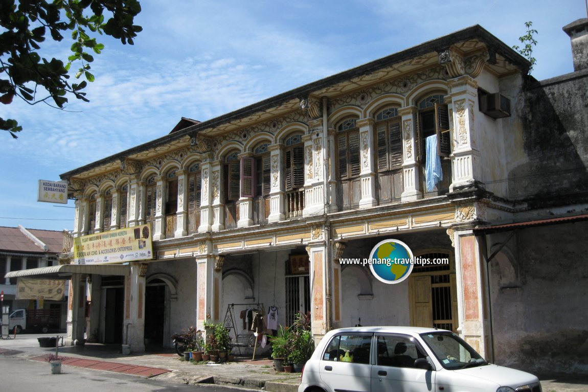 Pre-war houses in the Seven Streets Precinct (2 December 2008)
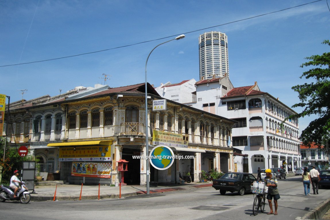 McNair Street, the main thoroughfare in the Seven Streets Precinct (2 December 2008)
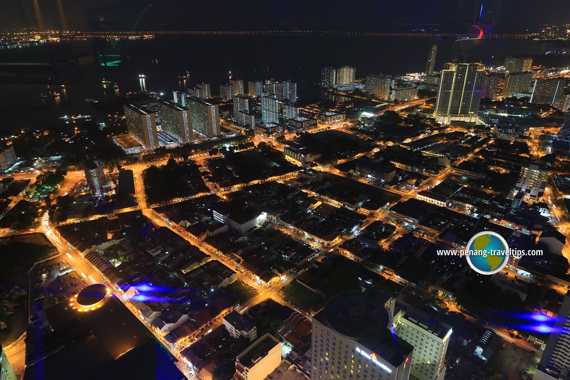 Seven Streets Precinct at night (26 May 2017)
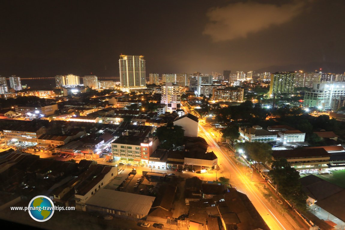 Seven Streets Precinct at night (26 May 2017)

Copyright © 2003-2025 Timothy Tye. All Rights Reserved.

 Go Back