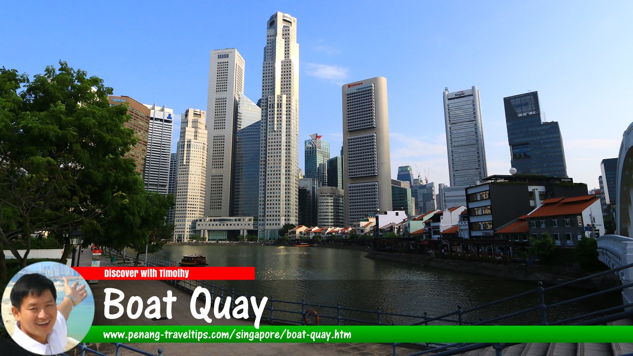
 Boat Quay, Singapore (28 July 2017)
Boat Quay (GPS: 1.28771, 103.84935) is a historical quay along the south bank of the Singapore River. Today, the area is also a subzone or neighbourhood within the Singapore River Planning Area, in Postal District 01. As the curve of the river here resembles the belly of a carp, it is considered an auspicious spot among the Chinese to trade. Hence many built their shophouses here. This same belief is carried on to this day in the form of towering bank headquarters that line the side of Boat Quay forming the financial district of Singapore.
In keeping with the times, Boat Quay shophouses have today been restored for use as restaurants, pubs and al fresco eateries catering to tourists and the expatriate community, and Boat Quay itself is now converted into a pedestrian mall.
The history of Boat Quay goes back to the earliest days of Singapore, for it is here that most of the commerce took place. In the 1820's, the place was a mangrove swamp over which were piers built on stilts that led into the river. In Stamford Raffles's 1822 Plan for Singapore (often also called the Jackson Plan), the area on the south bank of the river was already earmarked for Chinese settlement. By 1842 the quay was completed, and indeed most of the traders there were Chinese.
In 1852, a new harbour was built at Tanjong Pagar, but the trading in Boat Quay continued. Early-day entrepreneurs like Tan Tock Seng and Tan Kim Seng operated trading offices here. From Boat Quay, barge lighters transport goods upsteam to the godowns at Clarke Quay. With the opening of the Suez Canal in 1869, steamships started arriving in Singapore. Although it was a messy, squalid place, the trade at Boat Quay rapidly exceeded that of the European Town, on the north bank of the river.
By the turn of the 20th Century, Boat Quay was a buzzling place with bumboats fighting for the limited berthing place, coolies scurrying about with loads on their backs, merchants trading rubber, tin, steel, rice and coffee.
The importance of Boat Quay was only affected in the 1960s, as the modern shipping industry, with its efficient, highly mechanised container ports, usurping the labourious and hazourdous system of Boat Quay. By the mid 1980s, all the trading companies have moved out, and Boat Quay, for the first time in over a century, was quiet.
The Urban Redevelopment Authority stepped in with plans to convert Boat Quay. The area encompassing South Bridge Road, Circular Road, Lorong Telok and North Canal Road were gazetted, meaning none of the shophouses can be torn down or altered without approval. Boat Quay was given a new breath of life, this time as an entertainment haven.
Map of Boat Quay Singapore
Roads in the Boat Quay subzone
Boat Quay Singapore on Google Street View
Boat Quay Singapore (Oct 2021)List of Quays in Singapore; Discover Singapore
 Copyright © 2003-2025 Timothy Tye. All Rights Reserved.
Copyright © 2003-2025 Timothy Tye. All Rights Reserved.

 Go Back