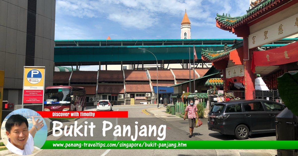
 Bukit Panjang, Singapore
Wzhkevin, CC BY-SA 4.0, via Wikimedia Commons
Bukit Panjang
 (GPS: 1.37741, 103.77194) is a suburban housing area (called "planning area" in local nomenclature) in the central north-western part of Singapore. It includes the Bukit Panjang New Town and Bukit Timah Nature Reserve. The area is served by the Bukit Panjang LRT Line, which feeds to the Choa Chu Kang MRT Station of the North-South Line.
The planning area of Bukit Panjang can be divided into 7 neighbourhoods (called "subzones"). They are Bangkit, Dairy Farm, Fajar, Jelebu, Nature Reserve, Saujana and Senja.
The main road through Bukit Panjang is Bukit Panjang Road. A community nature area is the Bukit Panjang Park. There are a few places of worship in the area including the Al Iman Mosque, Bak Sua Siah Boo Temple, Bukit Panjang Gospel Chapel, Chi Hock Keng Temple and Covenant Evangelical Free Church.
Shopping malls in Bukit Panjang includes Ten Mile Junction, Bukit Panjang Plaza (BPP), Fajar Shopping Centre and Greenridge Shopping Centre.
Among the schools within the Bukit Panjang area includes Beacon Primary School, Bukit Panjang Primary School, Greenridge Primary School, West View Primary School, Zhenghua Primary School, Assumption English School, Chestnut Drive Secondary School, Fajar Secondary School, Greenridge Secondary School, West Spring Secondary School and Zhenghua Secondary School.
Map of Bukit Panjang, Singapore
MRT and LRT stations in Bukit Panjang
- Bangkit LRT Station (GPS: 1.38038, 103.77267)

- Bukit Panjang MRT Station (GPS: 1.37813, 103.7635)

- Cashew MRT Station (GPS: 1.36882, 103.76471)

- Fajar MRT Station (GPS: 1.36882, 103.76471)

- Jelapang MRT Station (GPS: 1.38682, 103.76464)

- Pending LRT Station (GPS: 1.37627, 103.77133)

- Petir LRT Station (GPS: 1.37778, 103.76662)

- Segar MRT Station (GPS: 1.38748, 103.77018)

- Senja MRT Station (GPS: 1.38322, 103.76217)

Sights in Bukit Panjang
- Bukit Timah Nature Reserve (GPS: 1.34839, 103.77746)

- Hindhede Nature Park (GPS: 1.34602, 103.77518)

Getting there
Take the Singapore MRT North-South Line to the Choa Chu Kang MRT Station (NS4). From there, transit to the Bukit Panjang LRT Line. Among the stations serving the Bukit Panjang area includes Phoenix, Bukit Panjang, Petir, Pending, Bangkit Fajar, Segar, Jelapang and Senja.List of Planning Areas in Singapore and Places in Singapore; Discover Singapore
 Copyright © 2003-2025 Timothy Tye. All Rights Reserved.
Copyright © 2003-2025 Timothy Tye. All Rights Reserved.

 Go Back