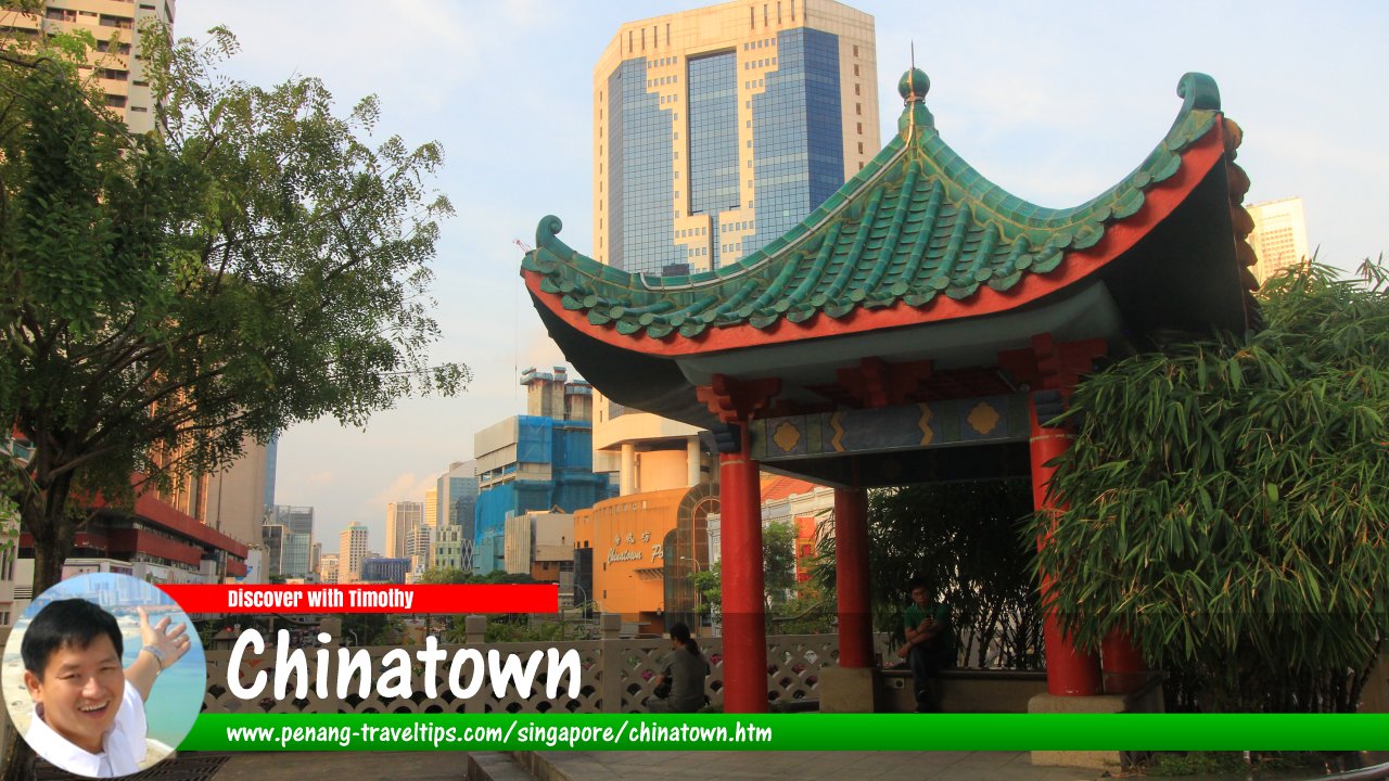
 Chinatown, Singapore (8 July 2011)
Chinatown (GPS: 1.28389, 103.84346) is the earliest Chinese settlement in Singapore. This came about because the British parcelled the population according to ethnic lines. It may seem strange today that a nation that is predominantly Chinese should also have a Chinatown. Today, Chinatown is a neighbourhood (or "subzone" in the local nomenclature) of Outram district (or "planning area". Chinatown covers an area that includes Postal Districts 01 and 02.
When you visit Singapore's Chinatown, you will realise that it is not entirely Chinese. In between the Chinese shophouses, you will come across mosques and Hindu temples, along with the occasional church.
The area designated as Chinatown is located south of the Singapore River, next to the Financial District. In present-day administrative nomenclature, it is a subzone or neighbourhood within the Outram planning area. As it happens to be within the downtown area of Singapore, Chinatown has also evolved to embrace urbanization. The skyscrapers of the Financial District are all within sight of the temples of Chinatown.
Map of Chinatown, Singapore
MRT stations in Chinatown, Singapore
- Chinatown MRT Station DT19/NE4 (GPS: 1.28453, 103.84353)

- Maxwell MRT Station DT18 (GPS: 1.28068, 103.84408)

- Telok Ayer MRT Station DT18 (GPS: 1.28194, 103.84871)

Sights in Chinatown, Singapore
- Airview Building (GPS: 1.27902, 103.84504)

- Buddhist Tooth Relic Temple (GPS: 1.28149, 103.84422)

- Chinatown Complex (GPS: 1.28249, 103.84319)

- Dorsett Singapore (GPS: 1.27987, 103.84023)

- Jamae Mosque (GPS: 1.28318, 103.84536)

- Maxwell House (GPS: 1.279, 103.84584)

- Murray Terrace (GPS: 1.279, 103.84584)

- Sri Layan Sithi Vinayagar Temple (GPS: 1.28143, 103.84168)

- Sri Mariamman Temple (GPS: 1.28269, 103.84513)

- The Scarlet (GPS: 1.28071, 103.84538)

- Yue Hwa Building (GPS: 1.28497, 103.84342)

Streets in Chinatown, Singapore
- Amoy Street
- Ann Siang Hill
- Ann Siang Road
- Boon Tat Street
- Bukit Pasoh Road
- Club Street
- Cook Street
- Craig Road
- Cross Street
- Duxton Hill
- Duxton Road
- Erskine Road
- Eu Tong Sen Street
- Keong Saik Road
- Kreta Ayer Road
- Maxwell Road
- Mosque Street
- Neil Road
- New Bridge Road
- Pagoda Street
- Peck Seah Street
- Sago Lane
- Sago Street
- Smith Street
- South Bridge Road
- Tanjong Pagar Road
- Telok Ayer Street
- Tras Street
- Wallich Street
- Yan Kit Road
Getting there
The easiest way to reach Chinatown is by MRT. The MRT stations serving the Chinatown district are the Chinatown MRT Station (NE4) on the North East Line; the Tanjong Pagar MRT Station (EW15) on the East-West Line, the Outram Park MRT Station (EW16/NE3) on the East-West Line and North East Line; and the Raffles Place MRT Station (EW14/NS26) within the Financial District, on the East West and North-South Line.Chinatown in Google Street View
View of Smith Street in Chinatown (Oct 2021)List of Places in Singapore; Discover Singapore
 Copyright © 2003-2025 Timothy Tye. All Rights Reserved.
Copyright © 2003-2025 Timothy Tye. All Rights Reserved.

 Go Back