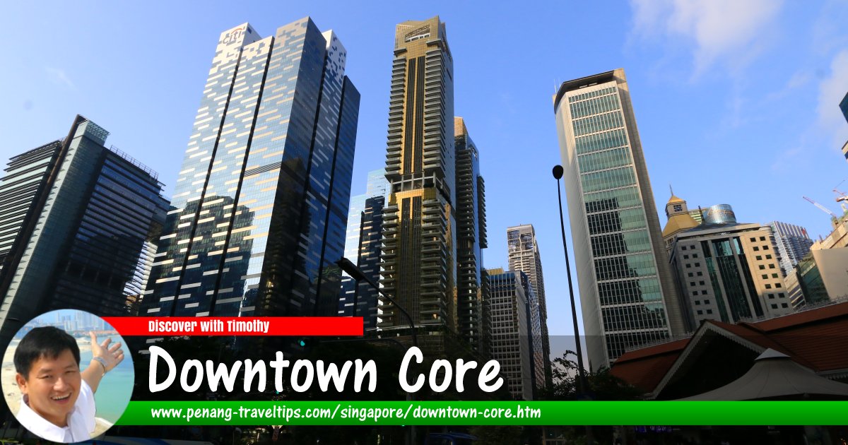
 Skyscrapers of the Downtown Core, Singapore (27 July 2017)
Downtown Core (GPS: 1.28669, 103.8535) is one of the 55 planning areas in Singapore. It is located within the Central Area, a sub-region of the Central Region. The Downtown Core encompasses the Central Business District of Singapore, covering an area of 266 hectares.
The planning area of Downtown Core is divided into 12 neighbourhoods called subzones. They are Anson, Bayfront, Bugis, Cecil, Central, City Hall, Clifford Pier, Marina Centre, Maxwell, Phillip, Raffles Place and Tanjong Pagar.
Much of the Downtown Core was built on reclaimed land. Land reclamation in the area began as early as the 19th century, when the coastline was extended out from Telok Ayer Street. As a result, the sea-facing Thian Hock Keng Temple was no longer facing the sea. Successive land reclamation created the Financial District within Shenton Way and Robinson Road as the main arteries.
Newer areas within the Downtown Core include Downtown Central and Bayfront. These reclaimed lands are being set apart to become full-fledged planning areas over time.
To fuel further economic growth in the post-independent decades, the coastline was extended out from Queen Elizabeth Walk, creating the man-made Marina Bay, which is surrounded by the reclaimed planning areas of Marina East, Marina South and Straits View. These are presently undergoing rapid urban development.
Map of Downtown Core, Singapore
Apartments, Condominiums and HDB Flats in the Downtown Core, Singapore
- Marina View Residences (GPS: 1.28421, 103.8526) Under Development

Commercial Properties in the Downtown Core, Singapore
- 16 Collyer Quay (GPS: 1.28421, 103.8526)

- AIA Tower (GPS: 1.28189, 103.85112)

- Bank of China Building (GPS: 1.28561, 103.85197)

- CapitaGreen (GPS: 1.28181, 103.85009)

- Chevron House (GPS: 1.28408, 103.85211)

- CHIJMES (GPS: 1.29505, 103.85215)

- Hong Leong Building (GPS: 1.28134, 103.85096)

- Grace Global Raffles (GPS: 1.28226, 103.85046)

- IOB Building (GPS: 1.28202, 103.84945)

- Maybank Tower (GPS: 1.28586, 103.85238)

- Ocean Financial Centre (GPS: 1.28312, 103.85199)

- One Raffles Place (GPS: 1.28437, 103.85098)

- Queen Elizabeth Walk (GPS: 1.2883, 103.85322)

- Republic Plaza (GPS: 1.2831, 103.85097)

- Singapore Land Tower (GPS: 1.28472, 103.85209)

- St Andrew's Cathedral (GPS: 1.29245, 103.8523)

- Telok Ayer Chinese Methodist Church (GPS: 1.27845, 103.84696)

- The Capitol Kempinski Hotel Singapore (GPS: 1.29404, 103.8508)

- The Quadrant At Cecil (GPS: 1.28241, 103.85049)

- UOB Plaza 1 (GPS: 1.28241, 103.85049)

- UOB Plaza 2 (GPS: 1.28546, 103.8507)

MRT Stations in the Downtown Core, Singapore
- Bayfront MRT Station (GPS: 1.28134, 103.85882)

- Bugis MRT Station (GPS: 1.30106, 103.85596)

- City Hall MRT Station (GPS: 1.29329, 103.85266)

- Esplanade MRT Station (GPS: 1.29359, 103.85541)

- Marina Bay MRT Station (GPS: 1.27613, 103.85461)

- Prince Edward Road MRT Station (GPS: 1.27431, 103.84835)

- Promenade MRT Station (GPS: 1.29389, 103.86)

- Raffles Place MRT Station (GPS: 1.28389, 103.85142)

- Tanjong Pagar MRT Station (GPS: 1.27664, 103.84665)

Streets in the Downtown Core of Singapore
- Anson Road
- Battery Road
- Bayfront Avenue
- Beach Road
- Bras Basah Road
- Cecil Street
- Coleman Street
- Central Boulevard
- Chulia Street
- Collyer Quay
- Connaught Drive
- Cross Street
- East Coast Parkway
- Enggor Street
- Esplanade Drive
- Finlayson Green
- Fraser Street
- Fullerton Road
- Marina Boulevard
- Maxwell Road
- Mccallum Street
- Middle Road
- Nicoll Highway
- North Boat Quay
- North Bridge Road
- Palmer Road
- Park Street
- Prince Edward Road
- Raffles Avenue
- Raffles Boulevard
- Raffles Quay
- Republic Boulevard
- Robinson Road
- Rochor Road
- Shenton Way
- St Andrew's Road
- Stamford Road
- Straits Boulevard
- Tanjong Pagar Road
- Telok Ayer Street
- Temasek Avenue
- Union Street
Subzones of Downtown Core
- Bayfront
- Cecil
- Central
- City Hall
- Cecil
- Clifford Pier
- Marina Centre
- Maxwell
- Phillip
- Raffles Place
- Tanjong Pagar
List of Planning Areas in Singapore and Places in Singapore; Discover Singapore
 Copyright © 2003-2025 Timothy Tye. All Rights Reserved.
Copyright © 2003-2025 Timothy Tye. All Rights Reserved.

 Go Back