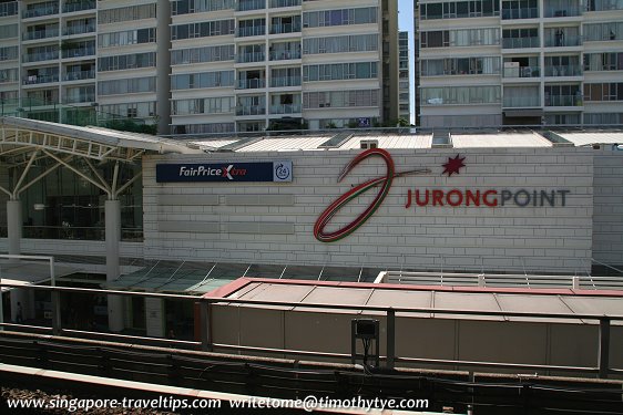
 Jurong Point Shopping Mall (11 September, 2010)
Jurong (GPS: 1.32545, 103.72621) is a constituency as well as township in the western part of Singapore. Historians speculate that the name comes from the Malay word "jerong" meaning "shark", though there is no clear explanation as to how the name was given.
Jurong is located in Singapore Postal District 22.
The main road through the area, Jurong Road, was laid out in the mid 19th century, during the term of John Thomson as Chief Surveyor (1852-53). Apart from that, the area was largely undeveloped until 1959, when Jurong was picked as the site for development. The Jurong Industrial Estate was developed in the 1960's and 70's. Among the earliest industries here was the National Iron and Steel Mills, opened in 1962. The following year, 24 more factories opened in Jurong. Jurong Port became operational in 1965.
Jurong Town Corporation was created in 1968 to manage the area's development. At that time, there were 153 factories in Jurong, and another 46 being constructed. Recreational facilites were developed in Jurong, including the Jurong Bird Park, Chinese Garden, Japanese Garden, and Science Centre.
Amenities in Jurong
Retail premises in Jurong include the Gek Poh Shopping Centre, Jurong Point Shopping Mall, Jurong Entertainment Centre, NTUC FairPrice Jurong West, NTUC FairPrice Yung Kuang and Taman Jurong Shopping Centre.Schools in Jurong include Boon Lay Secondary School, Commonwealth Secondary School, Corporation Primary School, Fuhua Primary School, Fuhua Secondary School, Hong Kah Secondary School, Hua Yi Secondary School, Jurong Primary School, Jurong Junior College, Jurong West Primary School, Jurongville Secondary School, Juying Primary School, Juying Secondary School, Lakeside Primary School, Nanyang Technological University, Pioneer Primary School, Pioneer Secondary School, Rulang Primary School, Shuqun Primary School, Shuqun Secondary School, West Grove Primary School, Xingnan Primary School, Yuan Ching Secondary School and Yuhua Primary School.
Places of worship in Jurong include Assyakirin Mosque, Calvary Bible Presbyterian Church, Church of St Francis of Assisi, City Harvest Church, Jin Fu Gong Temple, Sisters of the Infants of Jesus Church, Tong Whye Temple, Tui San Temple, and Yu Huan Tian Combined Temple. City Harvest Church is a Charismatic/Pentecostal church with over 27,000 regular members and a monthly average attendee of 33,000, making it the largest independent church in Singapore.
Jurong West
Jurong West is a neighborhood covering an area of about 10 square kilometers. Until the 1950's, Jurong West was swampy ground punctuated by low hills and forest land. These were cleared and used for residential development in the form of HDB housing. It is served by the Boon Lay MRT Station (EW27).Jurong East
Jurong East covers 3.8 sq kilometers. It is served by the Jurong East MRT Station (EW24/NS1) on the East-West Line and the North-South Line; and Jurong East Bus Interchange.Beginning in the 1990's, seven small islets were merged through land reclamation to create Jurong Island, the site for oil, petrochemical and chemical industries. Reclamation of Jurong Island is still on going and is expected to complete in 2010. The island is linked to Singapore mainland by a causeway, but the public is restricted from access.
List of Places in Singapore; Discover Singapore
 Copyright © 2003-2025 Timothy Tye. All Rights Reserved.
Copyright © 2003-2025 Timothy Tye. All Rights Reserved.

 Go Back