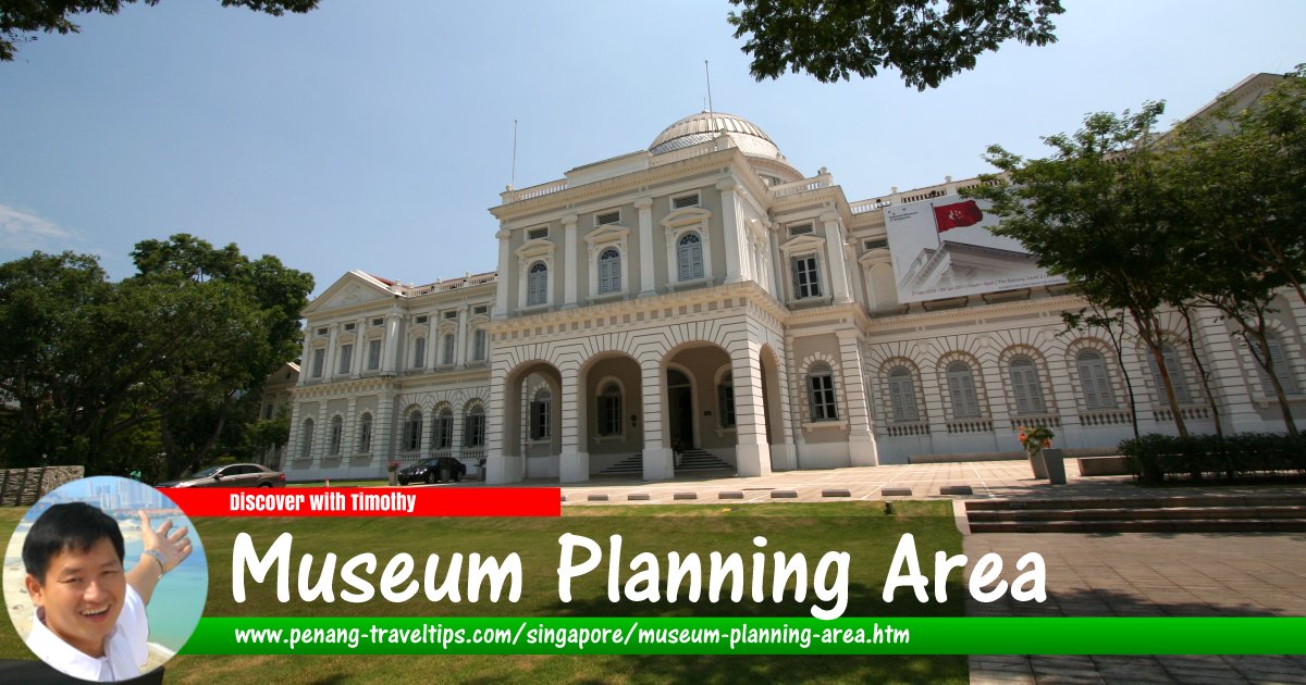
 Museum Planning Area, Singapore (13 September 2010)
Museum Planning Area is a planning area within the Civic District, in the Central Business District of Singapore. It took its name from the National Museum of Singapore, as well as the plan to make the area a cultural precinct within the Central Area.
Within the Museum Planning Area are three neighbourhoods, or subzones, namely Bras Basah, Dhoby Ghaut and Fort Canning. The main roads in this area include Orchard Road, Penang Road and Clemenceau Avenue.
The Museum Planning Area is rich in historic monuments, which include the Armenian Church, the Cathedral of the Good Shepherd, Cathay Building, Central Fire Station, the House of Tan Yeok Nee, MacDonald House, Old Tao Nan School (today the Peranakan Museum), the National Museum of Singapore, the Old Hill Street Police Station (today the MICA Building), the former Saint Joseph's Institution (today the Singapore Art Museum). Other buildings of historical significance in the area included the YMCA, the National Theatre and the United Chinese Library.
Map of the Museum Planning Area, Singapore
MRT Stations in the Museum Planning Area, Singapore
- Bras Basah MRT Station (GPS: 1.29757, 103.8505)

- Dhoby Ghaut MRT Station (GPS: 1.29859, 103.84599)

Sights in the Museum Planning Area, Singapore
- Armenian Church (GPS: 1.29314, 103.84933)

- Cathedral of the Good Shepherd (GPS: 1.2961, 103.8511)

- Central Fire Station (GPS: 1.2923, 103.84904)

- Church of the Sacred Heart (GPS: 1.296, 103.84361)

- Dhoby Ghaut Green (GPS: 1.29826, 103.84601)

- Istana Park (GPS: 1.29928, 103.84387)

- Lazada One (GPS: 1.29787, 103.85013)

- Orchard Road Presbyterian Church (GPS: 1.29789, 103.84753)

- Red Cross House (GPS: 1.29728, 103.84449)

- Rendezvous Hotel Singapore (GPS: 1.29851, 103.84931)

- School of the Arts Singapore - SOTA (GPS: 1.29936, 103.84862)

- The Cathay Cineplex (GPS: 1.29944, 103.84771)

- Singapore Shopping Centre (GPS: 1.29816, 103.84413)

- Sri Thendayuthapani Temple (GPS: 1.29431, 103.84305)

- Teochew Building (GPS: 1.29543, 103.84343)

- The MacDonald House (GPS: 1.29914, 103.84617)

- VisionCrest Commercial (GPS: 1.29902, 103.84262)

Streets in the Museum Planning Area, Singapore
How to go to the Museum Planning Area
The Bras Basah MRT Station (CC2) is located on the eastern end of the Museum Planning Area while the Dhoby Ghaut MRT Station is on the western end.List of Planning Areas in Singapore and Places in Singapore; Discover Singapore
 Copyright © 2003-2025 Timothy Tye. All Rights Reserved.
Copyright © 2003-2025 Timothy Tye. All Rights Reserved.

 Go Back