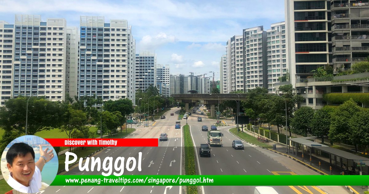
 Punggol, Singapore
Wzhkevin, CC BY-SA 4.0, via Wikimedia Commons
Punggol
 (GPS: 1.39844, 103.9072; Pronounced: pɔŋ-gol), also written Ponggol, is a township in northeastern Singapore. A new township, the Punggol New Town, is taking shape here. The Punggol planning area is bordered by Pasir Ris to the east, Sengkang located to the south, Seletar to the west and the Straits of Johor to the north. Among the institutions in Punggol include Greendale Secondary School, Central Christian Church, Edgefield Primary School and Mee Toh School.
Punggol is located in Singapore Postal District 19.
The planning area of Punggol can be divided into 7 neighbourhoods or subzones. These are Coney Island, Matilda, Northshore, Punggol Canal, Punggol Field, Punggol Town Centre and Waterway East.
Punggol got its name from a Malay word, punggal, which means "to hurt stick at the branches of fruit trees to bring the fruits down to ground", or simply, "to break a twig". It used to be a very rural part of Singapore. The area was traditionally farmland. Chinese villagers live here are involved in farming, rearing poultry, pigs and fish farming. The last pig farm in Punggol closed in 1990. The land has since been developed into high rise Housing Development Board flats. The northern tip, called Punggol Point or Tanjong Punggol, was notorious because it was the site the Japanese massacred 400 Chinese civilians during the Second World War, in what was to be known as the Punggol Beach Massacre. The site is today marked as a National Heritage Site.
Today, the coastline of Punggol is well known among Singaporeans for its seafood restaurants as well as water sports such as water skiing, skin diving and boating.
Map of Punggol, Singapore
MRT and LRT Stations in Punggol
- Coral Edge LRT Station (GPS: 1.39386, 103.91273)

- Cove LRT Station (GPS: 1.39921, 103.90629)

- Damai LRT Station (GPS: 1.40567, 103.908)

- Kadaloor LRT Station (GPS: 1.3996, 103.91662)

- Meridian LRT Station (GPS: 1.39679, 103.90916)

- Nibong LRT Station (GPS: 1.41186, 103.90035)

- Oasis LRT Station (GPS: 1.40163, 103.9137)

- Punggol MRT Station (GPS: 1.4052, 103.90225)

- Punggol Point LRT Station (GPS: 1.41687, 103.90669)

- Riviera LRT Station/Riviera MRT Station (GPS: 1.39541, 103.91673)

- Sam Kee LRT Station (GPS: 1.40976, 103.90489)

- Samudera LRT Station (GPS: 1.41587, 103.90216)

- Soo Teck LRT Station (GPS: 1.40534, 103.89728)

- Sumang LRT Station (GPS: 1.40851, 103.89853)

- Teck Lee LRT Station (GPS: 1.41275, 103.90656)

Getting there
The nearest MRT station is Punggol MRT Station (NE17) on the North East Line. The township is also served by the Punggol LRT Line, a 10.3 km line with 15 stations.List of Planning Areas in Singapore and Places in Singapore; Discover Singapore
 Copyright © 2003-2025 Timothy Tye. All Rights Reserved.
Copyright © 2003-2025 Timothy Tye. All Rights Reserved.

 Go Back