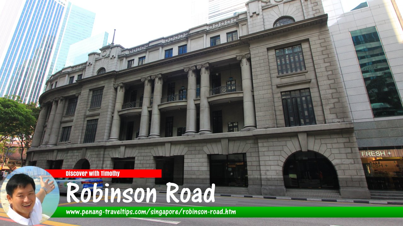
 Robinson Road, Singapore (8 July 2011)
Robinson Road is a major thoroughfare in Singapore's Central Business District, which is in Downtown Core, Singapore. It is a one-way street with traffic flowing from south to north. It starts at Anson Road, at the intersection with Maxwell Road, and ends at Collyer Quay, at the junction with Finlayson Green. In between it forms intersections and junctions with Robinson Road dates back to the 19th century following the 1879 reclamation that filled up Telok Ayer. At the time it was built, Robinson Road was the new waterfront in place of the old shoreline at Telok Ayer Street. Robinson Road would lose its waterfont when the subsequent reclamation of 1932 created Shenton Way.
Robinson Road was named after Sir William C.F. Robinson, the Governor of the Straits Settlements from 1877 to 1879. Since the mid 20th century, Robinson Road has become a prime real estate for skyscrapers. Robinson Road is also known in Hokkien as Heng Long Kay, after a well-known Chinese tycoon, Chop Heng Leong, who had his business operating there.
Map of Robinson Road, Singapore
Sights along Robinson Road
- 71 Robinson Road (GPS: 1.27857, 103.84885)

- 80 Robinson Road (GPS: 1.28035, 103.8494)

- 110 Robinson Road (GPS: 1.27941, 103.84892)

- ASO Building (GPS: 1.28234, 103.8514)

Afro-Asia Building(GPS: 1.27902, 103.84911)
- AIA Tower (GPS: )

- BEA Building (GPS: 1.2807, 103.84969)

- Capital Tower (GPS: 1.2778, 103.84771)

Chow House(GPS: 1.27861, 103.84834)
- City House (GPS: 1.28117, 103.85)

- CPF Building (GPS: 1.27733, 103.84812)

- Finexis Building (GPS: 1.27949, 103.84896)

- Hong Leong Building (GPS: 1.28143, 103.85092)

- One Finlayson Green (GPS: 1.28205, 103.85121)

- Overseas Union Trust Building (GPS: 1.27838, 103.84819)

- Oxley Tower (GPS: 1.27874, 103.84842)

- Robinson 77 (formerly SIA Building) (GPS: 1.27822, 103.84861)

- Robinson 112 (GPS: 1.27921, 103.8488)

- Robinson Centre (GPS: 1.27929, 103.84924)

- Robinson Point (GPS: 1.27965, 103.84948)

- Robinson Suites (GPS: 1.28096, 103.84984)

- Robinson Square (GPS: 1.27857, 103.84885)

- Robinson Tower (GPS: 1.28188, 103.85055)

- SBF Center (GPS: 1.27828, 103.8481)

- SIF Building (GPS: 1.27985, 103.84917)

- SO Sofitel Singapore (GPS: 1.2807, 103.84969)

- Telok Ayer Market (Lau Pa Sat) (GPS: 1.2805, 103.85044)

- The Corporate Building (GPS: 1.27853, 103.84883)

The Corporate Office(GPS: 1.27874, 103.84842)
Taking the MRT to Robinson Road
Depending on the part of Robinson Road you are heading to, the MRT stations nearby include Raffles Place MRT Station, Downtown MRT Station and Tanjong Pagar MRT Station.Robinson Road Singapore on Google Street View
Robinson Road, Singapore (Mar 2022)List of the Streets in Singapore; Discover Singapore
 Copyright © 2003-2025 Timothy Tye. All Rights Reserved.
Copyright © 2003-2025 Timothy Tye. All Rights Reserved.

 Go Back