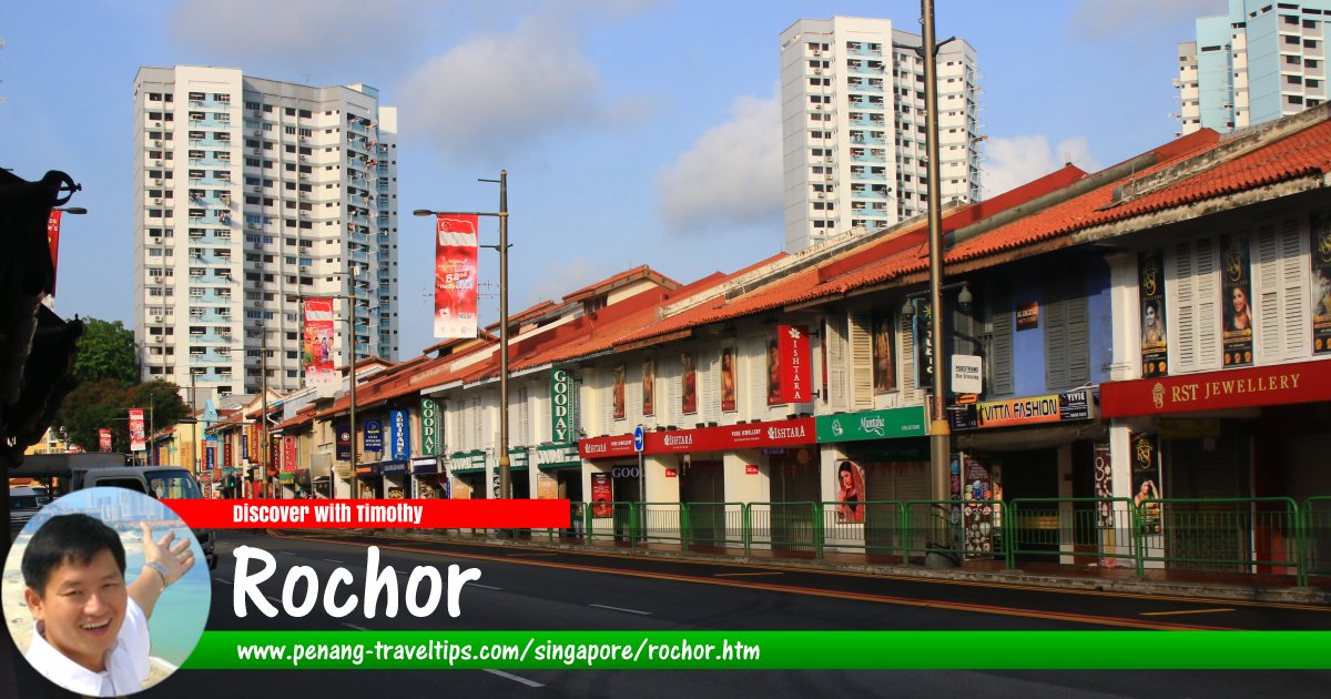
 Rochor, Singapore (30 July 2017)
Rochor
 (Pronounce: ro-tso; Simplified/Traditional Chinese: 梧槽, Pinyin: Wúcáo; Tamil: ரோச்சர்) is an planning area in Singapore. Located in the Central Region, it covers 1.62 square kilometers. Rochor is bordered by Kallang, which wraps around it in the north and east, Downtown Core in the southeast, Museum in the southwest, and Newton in the west.
Rochor is located in Singapore Postal District 07.
The district of Rochor can be divided into a few neighbourhoods (called subzone in local nomenclature). These include Bencoolen, Farrer Park, Kampong Glam, Little India, Mackenzie, Mount Emily, Rochor Canal, Selegie, Sungei Road and Victoria.
Map of Rochor, Singapore
MRT Stations in Rochor, Singapore
- Bencoolen MRT Station (GPS: 1.29963, 103.85105)

- Farrer Park MRT Station (GPS: 1.31725, 103.80749)

- Jalan Besar MRT Station (GPS: 1.30525, 103.85556)

- Little India MRT Station (GPS: 1.30642, 103.84945)

- Rochor MRT Station (GPS: 1.30399, 103.85281)

Hotels in Rochor, Singapore
- Mercure Singapore Bugis (GPS: 1.29968, 103.85299)

Sights in Rochor, Singapore
- Chinese Calligraphy Society of Singapore (GPS: 1.2986, 103.85106)

- Church of Saints Peter and Paul (GPS: 1.29762, 103.85155)

- Church of the True Light (GPS: 1.30724, 103.854)

- Covenant House Presbyterian Church (GPS: 1.30933, 103.85184)

- Dance Ensemble Singapore (GPS: 1.29884, 103.85116)

- Foochow Methodist Church (GPS: 1.30905, 103.85151)

- Fortune Centre (GPS: 1.30049, 103.85215)

- Gayatri Restaurant (GPS: 1.30956, 103.85205)

- Hilton Garden Inn Singapore Serangoon (GPS: 1.30838, 103.85204)

- ibis budget Singapore Selegie (GPS: 1.3037, 103.84999)

- Kampong Kapor Methodist Church (GPS: 1.30724, 103.854)

- Objectifs - Centre for Photography & Film (GPS: 1.29977, 103.85212)

- Parklane Shopping Mall (GPS: 1.30068, 103.84933)

- Peace Centre (GPS: 1.30129, 103.84952)

- Prinsep Street Presbyterian Church (GPS: 1.30724, 103.854)

- Selegie Court (GPS: 1.30306, 103.8498)

- Selegie House (GPS: 1.3032, 103.85037)

- Singapore Council of Women's Organisations (GPS: 1.29946, 103.85173)

- St Joseph's Church (GPS: 1.29834, 103.85315)

- Strand Hotel Singapore (GPS: 1.29865, 103.84981)

- Tamil Methodist Church (GPS: 1.30204, 103.85067)

- Tekka Centre (GPS: 1.30633, 103.85032)

- Waterloo Centre (GPS: 1.29897, 103.85206)

- Wilkie Edge (GPS: 1.30214, 103.8496)

Map of Rochor subzones, Singapore
Neighbourhoods (subzones) of Rochor
- Bencoolen
- Farrer Park
- Kampong Glam
- Little India
- Mackenzie
- Mount Emily
- Rochor Canal
- Selegie
- Sungei Road
- Victoria
Streets in Rochor
- Adis Road
- Albert Street
- Aliwal Street
- Arab Street
- Baboo Lane
- Baghdad Street
- Beach Road
- Belilios Lane
- Belilios Road
- Bencoolen Street
- Birch Road
- Bukit Timah Road
- Buffalo Road
- Burmah Road
- Bussorah Street
- Campbell Lane
- Chander Road
- Cheng Yan Place
- Clive Street
- Cuff Road
- Dalhousie Lane
- Desker Road
- Dickson Road
- Dunlop Street
- Farrer Park Station Road
- Haji Lane
- Hastings Road
- Hindoo Road
- Jalan Berseh
- Jalan Besar
- Jalan Klapa
- Jalan Kledek
- Jalan Kubor
- Jalan Pinang
- Jalan Sultan
- Kampong Kapor Road
- Kandahar Street
- Kelantan Lane
- Kerbau Road
- Kinta Road
- Kirk Terrace
- Kitchener Road
- Lembu Road
- Mackenzie Road
- Madras Street
- Middle Road
- Muscat Street
- Norris Road
- North Bridge Road
- Ophir Road
- Owen Road
- Pahang Street
- Pasar Lane
- Perak Road
- Prinsep Link
- Prinsep Street
- Queen Street
- Race Course Lane
- Race Course Road
- Roberts Lane
- Rochor Canal Road
- Rowell Road
- Selegie Road
- Serangoon Road
- Short Street
- Sophia Road
- Sultan Gate
- Sungei Road
- Syed Alwi Road
- Upper Weld Road
- Veerasamy Road
- Victoria Street
- Waterloo Street
- Weld Road
- Wilkie Road
List of Planning Areas in Singapore and Places in Singapore; Discover Singapore
 Copyright © 2003-2025 Timothy Tye. All Rights Reserved.
Copyright © 2003-2025 Timothy Tye. All Rights Reserved.

 Go Back