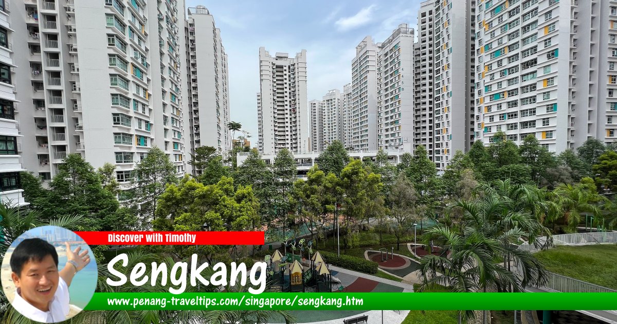
 Sengkang, Singapore
Wzhkevin, CC BY-SA 4.0, via Wikimedia Commons
Sengkang
 (GPS: 1.38681, 103.89144; pronounce: seŋ-kaŋ; Chinese: 盛港; Pinyin: Shènggǎng; Hokkien POJ: Sêng-káng; Hokkien Taiji: Seng3kang4
  ) is a township (or "planning area", in local administrative nomenclature) to the northeast part of Singapore. It is located between Hougang and Punggol. The name Sengkang means "prosperous harbour", an ideal place for seafarers. It is the name of a fishing village that used to be located at Sungei Serangoon. In the old days, the people in Sengkang lived on fishing and planting of rubber and pepper. There were vegetable and pig farms as well as the jungle here. The two rivers flowing through the area are Sungei Serangoon and Sungei Punggol.
Sengkang is located in Singapore Postal District 19.
Sengkang New Town is a new township that was developed by the Housing and Development Board of Singapore, to create a "21st century township" out of what was a rural part of Singapore. The town is fed by the Tampines Expressway to the north. The new township was first conceptualised in 1994.
The planning area of Sengkang is divided into 7 neighbourhoods, or subzones, namely Anchorvale, Compassvale, Fernvale, Lorong Halus North, Rivervale, Sengkang Town Centre and Sengkang West.
Map of Sengkang, Singapore
Mass Rapid Transit Stations in Sengkang, Singapore
- Bakau LRT Station (GPS: 1.38784, 103.90527)

- Cheng Lim LRT Station (GPS: 1.39633, 103.89381)

- Compassvale LRT Station (GPS: 1.39461, 103.90015)

- Farmway LRT Station (GPS: 1.39725, 103.88895)

- Fernvale LRT Station (GPS: 1.39205, 103.87626)

- Kangkar LRT Station (GPS: 1.38784, 103.90527)

- Kupang LRT Station (GPS: 1.39818, 103.8813)

- Layar LRT Station (GPS: 1.39215, 103.87991)

- Ranggung LRT Station (GPS: 1.38784, 103.90527)

- Renjong LRT Station (GPS: 1.38676, 103.89053)

- Rumbia LRT Station (GPS: 1.39111, 103.90628)

- Sengkang MRT/LRT Station (GPS: 1.39128, 103.89521)

- Tongkang LRT Station (GPS: 1.38926, 103.88611)

- Thanggam LRT Station (GPS: 1.39745, 103.8756)

Getting there
Nearest MRT station is the Sengkang MRT Station (NE16) on the North East Line which is integrated with the Sengkang LRT and Sengkang Bus Interchange. The Sengkang Light Rail Transit is a 10.7 km line comprising an East Loop with five stations and West Loop with 8 stations.List of Planning Areas in Singapore and Places in Singapore; Discover Singapore
 Copyright © 2003-2025 Timothy Tye. All Rights Reserved.
Copyright © 2003-2025 Timothy Tye. All Rights Reserved.

 Go Back