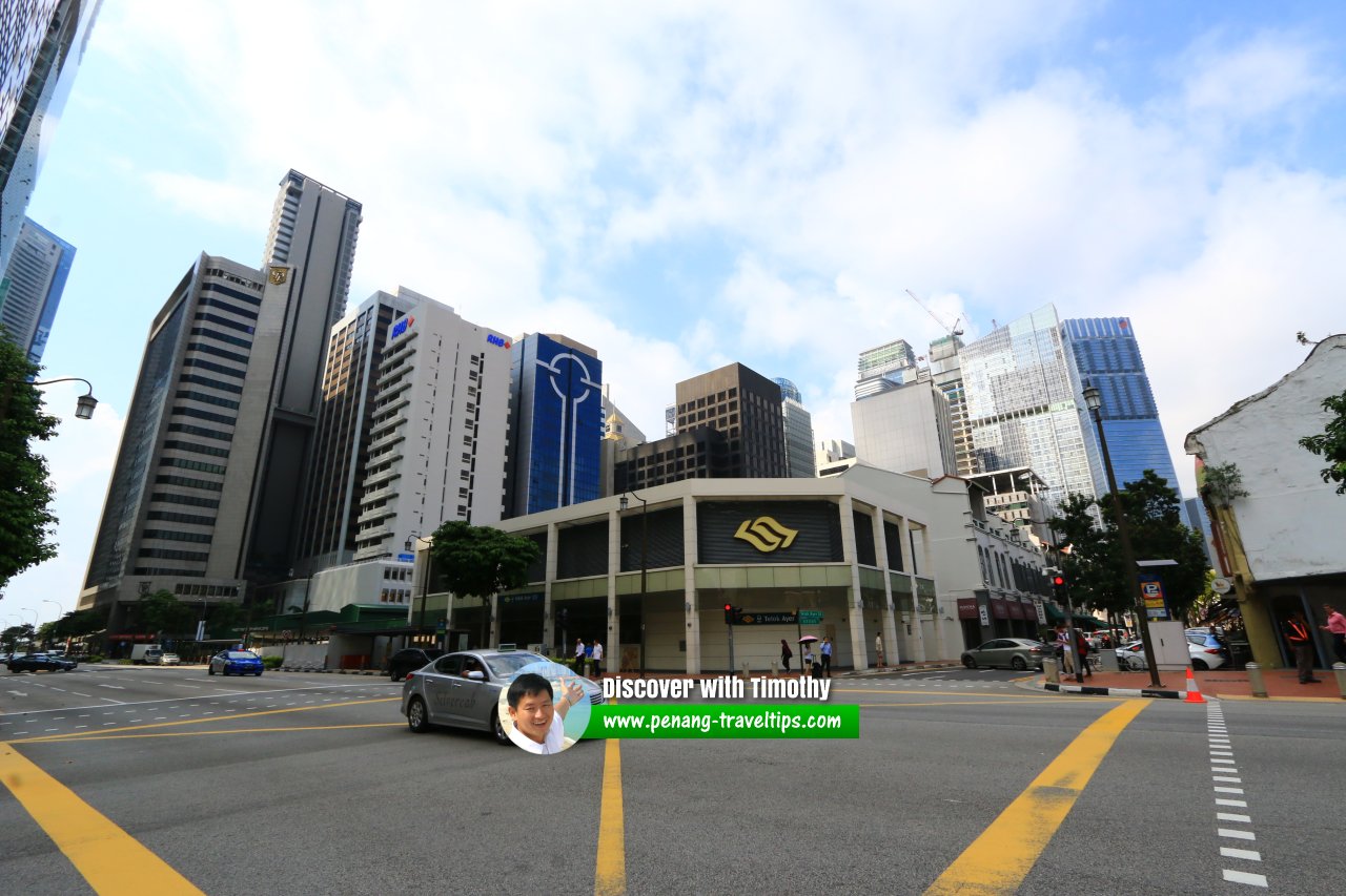
 Telok Ayer MRT Station (28 July 2017)
Telok Ayer MRT Station
 (GPS: 1.28216, 103.84852; DT18) is an underground station of the Singapore MRT. Located in the Telok Ayer area in Outram, Singapore, it went into service on 22 December 2013.
Telok Ayer MRT Station is served by the Downtown Line between the Downtown MRT Station (DT17) and Chinatown MRT Station (DT18/NE4).
The Telok Ayer MRT Station is located at the junction of Cross Street and Amoy Street, below the new Cross Street Viaduct and beside the Lau Pa Sat.
Telok Ayer MRT Station is  on the Map of Outram, Singapore
Walking distance to surrounding buildings
- CapitaGreen (GPS: 1.28181, 103.85009; 230m away)
- City House (GPS: 1.28408, 103.85211; 160m away)
- Fuk Tak Chi Museum (GPS: 1.28291, 103.84873; 140m away)
- IOB Building (GPS: 1.28202, 103.84945; 90m away)
- Manulife Tower (GPS: 1.28219, 103.84902; direct access)
- Prudential Tower (GPS: 1.28281, 103.84977; 130m away)
- RHB Bank Building (GPS: 1.28143, 103.84913; 110m away)
- The Quadrant At Cecil (GPS: 1.28245, 103.85052; 230m away)
- Fuk Tak Chi Museum (GPS: 1.28093, 103.84763; 240m away)
Telok Ayer MRT Station is  on the Map of Singapore MRT
 Telok Ayer MRT Station at junction of Cross Street and Telok Ayer Street. (1 August 2017)
 Entrance to Telok Ayer MRT Station beside Manulife Tower at Telok Ayer Street. (1 August 2017)
Telok Ayer MRT Station on Google Street View
(Sept 2021)List of Singapore MRT Stations; Singapore MRT Lines; Singapore MRT; Discover Singapore
 Explaining Singapore YouTube Channel
 Streets of Singapore and Map of Singapore Streets
 Postal Districts of Singapore and Map of Singapore Postal Districts
 Planning Areas of Singapore and Map of Singapore Planning Areas

Copyright © 2003-2025 Timothy Tye. All Rights Reserved.

 Go Back