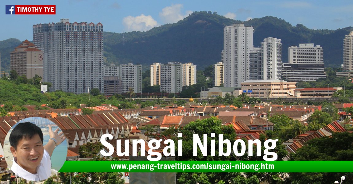
 Sungai Nibong, as seen from Queensbay Mall (22 May 2013)
Sungai Nibong (GPS: 5.33669, 100.29793) is a neighbourhood on the east central side of Penang Island. Also written Sungai Nibung, it is best known as the Pesta Site as well as the location for the Sungai Nibong Express Bus Terminal.
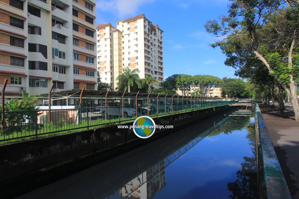
Sungai Nibong was named after the river (sungai) that flowed through the area where in the old days, nibung palms grew. Nibung palms (Oncosperma tigillarium) produce wood suitable as building material. The district called Sungai Nibong comprises Sungai Nibong Besar and Sungai Nibong Kecil. Both are named after the rivers flowing through the area.
Until the late 1970's, Sungai Nibong was an outskirt of George Town. It has since been absorbed as one of the residential suburbs. The housing estates here include Century Garden, Pantai Jerejak and Taman Sri Nibong. Much of the traditional Malay and Chinese villages in Sungai Nibong have been erased, except for the Malay kampung of Bukit Kecil.
Measured from the intersection between Jalan Sultan Azlan Shah with Jalan Sungai Dua and Jalan Aziz Ibrahim (GPS: 5.342094, 100.300457), Sungai Nibong is 9.7 km to Komtar, 3.3 km to the Penang Bridge, 8.4 km to the Second Penang Bridge and 6.6 km to the Penang International Airport.
 Map of Sungai Nibong, Penang
Sights in Sungai Nibong in alphabetical order
Apartments & Condominiums in Sungai Nibong
- 98 Nibong Residence (GPS: 5.33911, 100.30275)

- Casa Anggun Apartment (GPS: 5.33866, 100.30097)

- Celesta Residency (GPS: 5.33505, 100.29777)

- Iconic Regency (GPS: 5.34012, 100.30003)

- Krystal Court (GPS: 5.33173, 100.29763)

- Krystal Villa (GPS: 5.33254, 100.29639)

- Lavinia Apartment (GPS: 5.33527, 100.30493)

- Lucky Gardens (GPS: 5.33842, 100.29699)

- Mawar Apartment (GPS: 5.33653, 100.30048)

- Medan Mutiara Apartment (GPS: 5.33863, 100.29553)

- Melati Apartment (GPS: 5.33129, 100.30015)

- Montage (GPS: 5.33256, 100.29686)

- Nibong Indah Apartment (GPS: 5.34038, 100.30247)

- Novus (GPS: 5.33254, 100.29841)

- Pangsapuri Seri Melor (GPS: 5.33607, 100.29931)

- Taman Bukit Kecil (GPS: 5.33619, 100.29892)

- The Sun (GPS: 5.3357, 100.29765)

 Businesses in Sungai Nibong
- Agensi Pekerjaan Strategi Setia
- Bamboo Catering
- Cellini (furniture)
- Classic Studio Hair Salon & Photo
- Diang Exhaust Pipe Service
- Duaria (car dealer)
- Hong Keong Hardware
- Hong Leong Bank
- Hot Print Design & Advertising
- Jion Pharmacy
- Kedai Gunting Rambut KST Global
- Kedai Teh Bamboo (tea shop)
- Medix Lab (medical lab)
- Northern Image (furniture)
- Sweet Forest Pastries
- Today Mini Market
- VG-I Hair Salon
Clinics in Sungai Nibong
- Happy Life TCM Clinic (GPS: 5.33649, 100.29237)
- Poliklinik I-Care
Commercial Complexes in Sungai Nibong
- Bayan Point (GPS: 5.33268, 100.29461)

- Ideal Avenue (GPS: 5.33295, 100.29332)

- Krystal Point (GPS: 5.33181, 100.29657)

- Krystal Point Corporate Park (GPS: 5.33116, 100.29809)

- Lot 28 Sungai Nibong
Eateries in Sungai Nibong
- 5 Loaves 2 Fish (GPS: 5.33181, 100.29657)

- Daorae Korean BBQ Restaurant (GPS: 5.33268, 100.29461)

- Golden Bay Food Court (GPS: 5.34084, 100.3022)

- Golden Cafe (GPS: 5.33268, 100.29461)

- Kompleks Lebuh Nipah (GPS: 5.33614, 100.29313)

- Kompleks Medan Suri (GPS: 5.34081, 100.29914)

- Maa Roy Thai Seafood Restaurant
- Siriwan Thai Seafood Restaurant
- Xiang Yun Vegetarian House (GPS: 5.33313, 100.2942)

 Hotels in Sungai Nibong
- Iconic Marjorie Hotel (GPS: 5.3378, 100.29882)

 Housing Estates in Sungai Nibong
- Bukit Kecil (GPS: 5.33341, 100.29761)

- Jubilee Residences (GPS: 5.33965, 100.29768)

- Palms Pavilion (GPS: 5.33916, 100.29856)

- Pantai Jerejak
- Seri Anggun (GPS: 5.33877, 100.29937)

- Taman Jerejak Villa (GPS: 5.34038, 100.30247)

- Taman Sri Nibong (GPS: 5.34038, 100.30247)

Parks in Sungai Nibong
- Gerbang Bukit Kecil 2 Park (GPS: 5.33292, 100.29873)

- Persiaran Pantai Jerjak 10 Neighbourhood Park (GPS: 5.33677, 100.30399)

- Taman Sri Nibong Linear Park (GPS: 5.33054, 100.30017)

- Taman Sri Nibong Park (GPS: 5.33237, 100.30079)

- Tanah Lapang Lebuh Nipah 2 (GPS: 5.33645, 100.29488)

- Tanah Lapang Lebuh Pantai Jerjak 1 (GPS: 5.33957, 100.30068)

 Petrol Stations in Sungai Nibong
- Caltex Sungai Nibong (GPS: 5.33516, 100.29701)

- Petron Sungai Nibong (GPS: 5.34601, 100.30292)

- Shell Sungai Nibong 1 (GPS: 5.34601, 100.30292)

- Shell Sungai Nibong 2 (GPS: 5.334, 100.29576)

Places of Worship in Sungai Nibong
- Masjid Jamek Sungai Nibong Besar (GPS: 5.33982, 100.29903)

- Sungai Nibong Gospel Hall (GPS: 5.34542, 100.30316)

- Sungai Nibong Tan Kongsi (GPS: 5.33763, 100.29881)

- Surau An-Nur (GPS: 5.33503, 100.29412)

Public Amenities in Sungai Nibong
- Balai Polis Sungai Nibong (GPS: 5.33647, 100.29744)

- Sungai Nibong Express Bus Terminal (GPS: 5.34312, 100.30065)

- Pesta Site (GPS: 5.34489, 100.30083)

The nearest school in Sungai Nibong includes Kwang Hwa Primary School, Shih Chung (Primary) Branch School and Sekolah Menengah Kebangsaan Sungai Nibong. Nearby schools include Sekolah Menengah Jenis Kebangsaan (Cina) Phor Tay and Sekolah Rendah Jenis Kebangsaan (Cina) Keong Hoe in Sungai Dua. The nearest market in Sungai Nibong is the Lip Sin Market and Super Tanker Market. The nearest shopping mall is Queensbay Mall. Petrol stations in Sungai Nibung includes the Mobil at Pantai Jerejak, the Caltex and the two Shell stations near the Bayan Baru Roundabout. The nearest hospital is Pantai Hospital in Bayan Baru.
 Schools in Sungai Nibong
- SJK(C) Kwang Hwa (GPS: 5.33589, 100.29658)

- SJKC Shih Chung Cawangan (GPS: 5.33551, 100.29589)

- SK Sungai Nibong (GPS: 5.33829, 100.29908)

- SMK Sungai Nibong (GPS: 5.33504, 100.29515)

 Streets in Sungai Nibong
- Jalan Aziz Ibrahim
- Gerbang Bukit Kecil 1
- Gerbang Bukit Kecil 2
- Jalan Bukit Kecil 2
- Jalan Pantai Aziz Ibrahim
- Jalan Pantai Pantai Jerjak
- Jalan Pantai Pantai Jerjak 1
- Jalan Pantai Pantai Jerjak 2
- Jalan Pantai Pantai Jerjak 3
- Jalan Pantai Pantai Jerjak 4
- Jalan Pantai Pantai Jerjak 5
- Jalan Pantai Pantai Jerjak 6
- Jalan Pantai Pantai Jerjak 8
- Jalan Pantai Pantai Jerjak 9
- Jalan Pantai Pantai Jerjak 10
- Jalan Pantai Pantai Jerjak 13
- Jalan Pantai Pantai Jerjak 14
- Jalan Pantai Pantai Jerjak 15
- Jalan Pantai Pantai Jerjak 18
- Lebuh Bukit Kecil 1
- Lebuh Bukit Kecil 1A
- Lebuh Bukit Kecil 2
- Lebuh Bukit Kecil 3
- Lebuh Bukit Kecil 4
- Lebuh Bukit Kecil 5
- Lebuh Nipah 2
- Lebuh Nipah 3
- Lebuh Nipah 4
- Lebuh Pantai Jerjak 1
- Lebuh Pantai Jerjak 2
- Lintang Bukit Kecil 1
- Lintang Bukit Kecil 2
- Lintang Bukit Kecil 3
- Lintang Bukit Kecil 4
- Lintang Bukit Kecil 5
- Lintang Bukit Kecil 6
- Lintang Pantai Jerjak
- Lintang Pantai Jerjak 2
- Lintang Pantai Jerjak 3
- Lintang Pantai Jerjak 4
- Lintang Pantai Jerjak 5
- Lintang Pantai Jerjak 6
- Lorong Pantai Jerjak
- Medan Pantai Jerjak
- Persiaran Bukit Kecil 1
- Persiaran Bukit Kecil 2
- Persiaran Bukit Kecil 3
- Persiaran Bukit Kecil 4
- Persiaran Bukit Kecil 5
- Persiaran Bukit Kecil 6
- Persiaran Pantai Jerjak
- Persiaran Pantai Jerjak 1
- Persiaran Pantai Jerjak 2
- Persiaran Pantai Jerjak 3
- Persiaran Pantai Jerjak 5
- Persiaran Pantai Jerjak 6
- Persiaran Pantai Jerjak 7
- Persiaran Pantai Jerjak 8
- Persiaran Pantai Jerjak 9
- Persiaran Pantai Jerjak 10
- Pintasan Bukit Kecil
- Solok Pantai Jerjak
- Tingkat Bukit Kecil
- Tingkat Bukit Kecil 1
- Tingkat Bukit Kecil 2
- Tingkat Bukit Kecil 3
- Tingkat Bukit Kecil 4
- Tingkat Bukit Kecil 5
- Tingkat Pantai Jerjak
Public Transport in Sungai Nibong
Sungai Nibong is centrally located. Located 10.9 km from Magazine Circus, it is half way between the city and the Bayan Lepas Free Industrial Zone. The many buses that pass by it include Rapid Penang Bus 303, 304, 305, 306, 308 and 401Traffic in Sungai Nibong
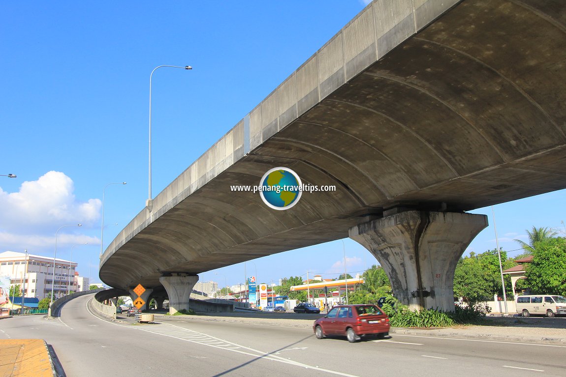
Traffic is usually smooth along Jalan Sultan Azlan Shah, the main thoroughfare through Sungai Nibung. The Bayan Lepas Elevated Highway further helps to reduce the congestion. Having said that, one exception to the rule is on Friday evenings, when the traffic slows to a crawl due to commuters heading towards the Penang Bridge north of Sungai Nibung, and the traffic lights at Jalan Sungai Dua, near USM. The junction at Jalan Aziz Ibrahim also experiences slow traffic on Wednesday nights where the Pasar Malam at Pantai Jerejak is in session.Map of Sungai Nibong river
 Aerial view of Sungai Nibong (3 April 2017)
 The Bayan Lepas Elevated Highway in Sungai Nibong (17 January 2012)
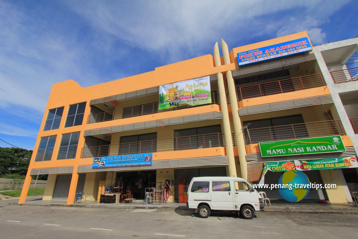
 Commercial development in Sungai Nibong (19 October 2014)
 Sungai Nibong Besar, the now canalised river that gave the area its name (22 October 2012)
List of Towns in Penang and Towns in Malaysia

Copyright © 2003-2025 Timothy Tye. All Rights Reserved.

 Go Back