 Charoen Krung Road (Thai: Thanon Charoen Krung ถนนเจริญกรุง
  ) is a major road in Bangkok Thailand. Its name means New Road, but far from that, it is in fact one of the oldest roads in the city. Following the curve of the Chao Phraya River, it starts from the t-junction with Sanam Chai Road in Rattanakosin, and ends at Rama III Road.
Charoen Krung Road was built in 1861 by King Rama V (King Mongkut). Although it is one of the oldest road in Bangkok, its name "Charoen Krung" actually means "new" road. It starts at the Sanam Chai roundabout at Rattanakosin, near Wat Phra Chetuphon (Temple of the Reclining Buddha), and makes a curve southwards, passing through Pahurat and Chinatown for a distance of over 8 kilometers. At the Mittraphan Road intersection, Charoen Krung Road makes a bend towards the south where Rama IV Road begins. Charoen Krung Road continues on south to end at Rama III Road.
Charoen Krung Road started as an elephant trail, and later became the first paved highway in the Bangkok. There was a tramline that followed Charoen Krung Road and was in use from 1892 until 1965.
Today, numerous roads form junctions with it, including Rachini Alley, Atsadang Road, Fuang Nakhon Road, Ti Thong Road, Tri Phet Road, Unakan Road, Burapha Road, Soi Sam Yot, Maha Chai Road, Boriphat Road, Worachak Road, Maha Chak Road, Ratchawong Road, Phlap Phla Chai Road, Mittraphan Road, Rama IV Road, Lamphun Chai, Kalan Tan Alley, Tri Mit Road, Chinatown Gate, Khao Lam Road, Song Wat Road, Nakhon Kasem Road Soi 5, Yotha Road, Rong Nam Khaeng Road Soi 1, Mahaphuruttharam Road, Si Phraya Road, Surawong Road, Silom Road, Si Wiang, Charoen Wiang Road, N. Sathon Road, Sathon Tai Road, and Tok Road, not to mention over a hundred Charoen Krung Road "soi" or alleys.
Map of Charoen Krung Road
Charoen Krung Road on Google Street View
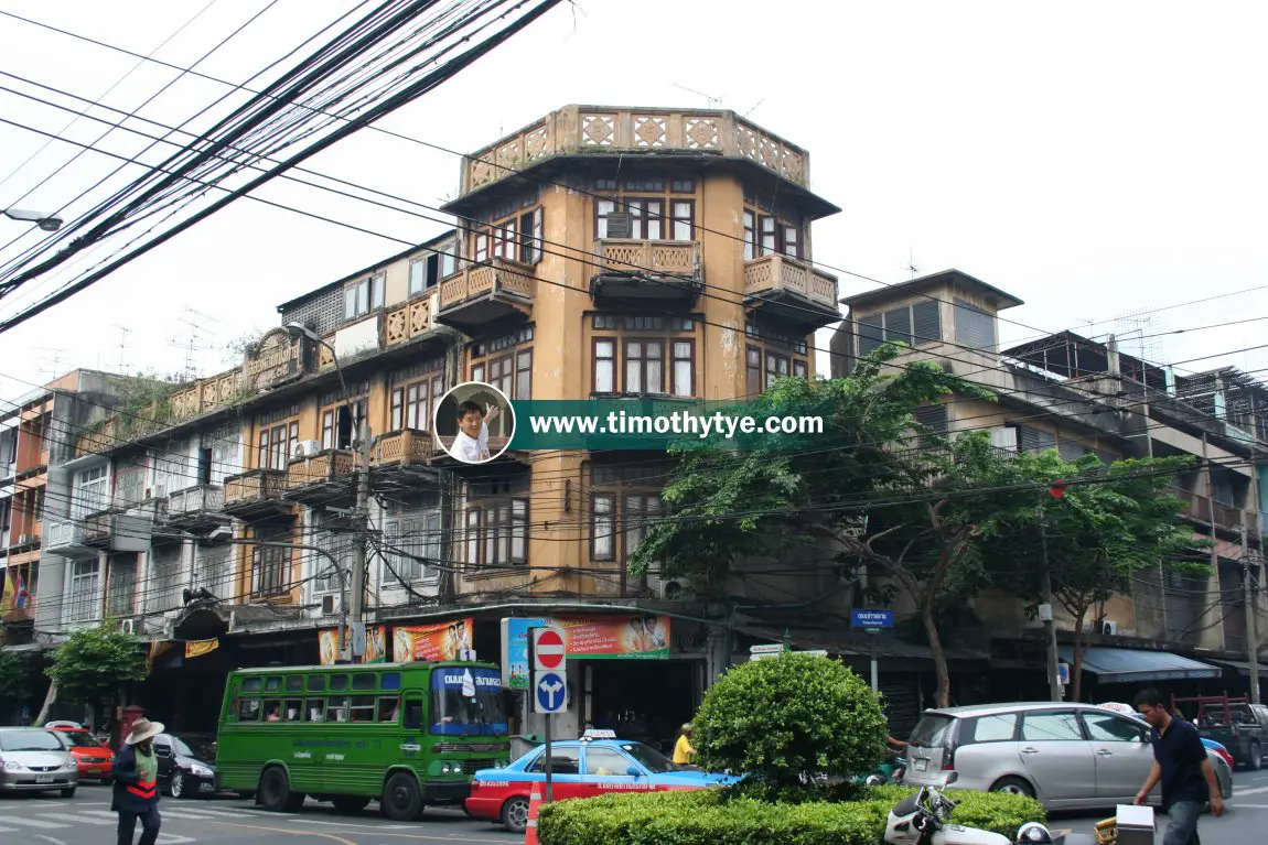
(Jun 2018) Old building at the junction of Charoen Krung Road and Khao Lam Road in the Bangkok Chinatown. (29 August, 2006)
List of Streets in Bangkok; list of Districts of Bangkok
 Latest updates on Penang Travel Tips
 Map of Roads in Penang
Looking for information on Penang? Use this Map of Roads in Penang to zoom in on information about Penang, brought to you road by road.About this website

Dear visitor, thank you so much for reading this page. My name is Timothy Tye and my hobby is to find out about places, write about them and share the information with you on this website. I have been writing this site since 5 January 2003. Originally (from 2003 until 2009, the site was called AsiaExplorers. I changed the name to Penang Travel Tips in 2009, even though I describe more than just Penang but everywhere I go (I often need to tell people that "Penang Travel Tips" is not just information about Penang, but information written in Penang), especially places in Malaysia and Singapore, and in all the years since 2003, I have described over 20,000 places.
While I try my best to provide you information as accurate as I can get it to be, I do apologize for any errors and for outdated information which I am unaware. Nevertheless, I hope that what I have described here will be useful to you.
To get to know me better, do follow me on Facebook!
Copyright © 2003-2025 Timothy Tye. All Rights Reserved.

 , Bangkok
 Go Back