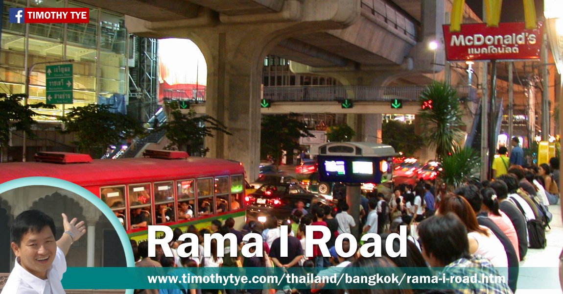
 Rama I Road, Bangkok (30 December, 2002)
Rama I Road (Thai: ถนนพระรามที่ 1
 ) is a major shopping boulevard in downtown Bangkok, Thailand. It connects Bamrung Muang Road in the west with Phloen Chit Road in the east. The road is intersected by Krung Kasem Road, Rama VI Road, Banthat Thong Road, Soi Shulalongkorn 5, Kasem San Alley 3, Kasem San Alley 2, Kasem San Alley 1, Phayathai Road and ends at Ratchadamri Road.
Rama I Road was named after King Phutthayotfa Chulalok, the founder of the Rattanakosin Kingdom of the Chakri Dynasty. The road was originally known as Pathum Wan Road. It is in presently Pathum Wan District of Bangkok. The road was renamed Rama I Road during the reign of Rama VI (King Vajiravudh).
Map of Rama I Road, Bangkok, Thailand
Sights along Rama I Road, Bangkok, Thailand
- Bangkok Art and Culture Centre (GPS: 13.74677, 100.53036)

- CentralWorld (GPS: 13.74659, 100.53154)

- Charoen Phon Intersection (GPS: 13.74745, 100.52376)

- Department of Alternative Energy Development and Efficiency (GPS: 13.74904, 100.51689)

- Department of Tourism (GPS: 13.74664, 100.52699)

- Gaysorn (GPS: 13.74486, 100.54065)

- Holiday Inn Express (GPS: 13.74704, 100.52767)

- Khlong Ong Ang (GPS: 13.74904, 100.51689)

- Mazda Pathumwan (GPS: 13.74663, 100.52963)

- MBK Center (GPS: 13.74555, 100.53001)

- Mercure Ibis Bangkok Siam (GPS: 13.74684, 100.5288)

- Metalion Tower 1 (GPS: 13.74765, 100.52128)

- National Stadium (GPS: 13.74674, 100.52595)

- National Stadium BTS Station (GPS: 13.74765, 100.52128)

- Nimibutr Stadium (GPS: 13.74567, 100.52889)

- Pathumwan Institute of Technology (GPS: 13.74727, 100.52578)

- Phong Phraram Intersection (GPS: 13.74797, 100.52075)

- Royal Thai Police Headquarters (GPS: 13.74489, 100.53376)

- Shell Rama I Road (GPS: 13.74754, 100.52207)

- Siam@Siam Design Hotel Bangkok (GPS: 13.74778, 100.523)

- Siam BTS Station (GPS: 13.74559, 100.53405)

- Siam Center (GPS: 13.74628, 100.5328)

- Siam Discovery Center (GPS: 13.74659, 100.53154)

- Siam Motors Yamaha (GPS: 13.74702, 100.52799)

- Siam Paragon (GPS: 13.7461, 100.53411)

- Siam Square One (GPS: 13.74489, 100.53376)

- Srijulsup Building (GPS: 13.74768, 100.5202)

- Suksapanpanit (GPS: 13.7465, 100.52785)

- Tesco Lotus Rama I Road (GPS: 13.74821, 100.52452)

- Wat Chai Mongkol (GPS: 13.74778, 100.523)

- Wat Chamni Hatthakan @ Wat Sam Ngam (GPS: 13.7484, 100.5194)

- Wat Pathum Wanaram (GPS: 13.7459, 100.53674)

- Wat Sa Bua (GPS: 13.74804, 100.51851)

Google Street View of sights along Rama I Road, Bangkok, Thailand
Road sign showing start of Rama I Road in Bangkok, Thailand (Feb 2018)Wat Sa Bua, Rama I Road, Bangkok Thailand. (Feb 2018)
Wat Chamni Hatthakan (Wat Sam Ngam), Rama I Road, Bangkok Thailand. (Feb 2018)
Wat Chai Mongkol, Rama I Road, Bangkok Thailand. (Feb 2018)
National Stadium, Rama I Road, Bangkok Thailand. (Feb 2018)
Department of Tourism, Bangkok Thailand. (Feb 2018)
Bangkok Art and Culture Centre. (Nov 2017)
Rama I Road (Feb 2018)
List of Streets in Bangkok and Streets in Thailand; list of Districts of Bangkok
 Latest updates on Penang Travel Tips
 Map of Roads in Penang
Looking for information on Penang? Use this Map of Roads in Penang to zoom in on information about Penang, brought to you road by road.
Copyright © 2003-2025 Timothy Tye. All Rights Reserved.

 , Bangkok
 Go Back