 Chiang Mai Province จังหวัดเชียงใหม่
[an error occurred while processing this directive]
Chiang Mai Province จังหวัดเชียงใหม่  is the second largest of the 75 provinces of Thailand. It covers an area of 20,107 sq km (7,763 sq mi) in North Thailand. It has a population of 1.7 million people (2011 estimate). The provincial capital is the city of Chiang Mai.
Chiang Mai Province is bordered by Chiang Rai Province to the northeast, Lampang Province to the east, Lamphun Province to the southeast, Tak Province to the south, Mae Hong Son Province to the west, and the international border with Myanmar to the north.
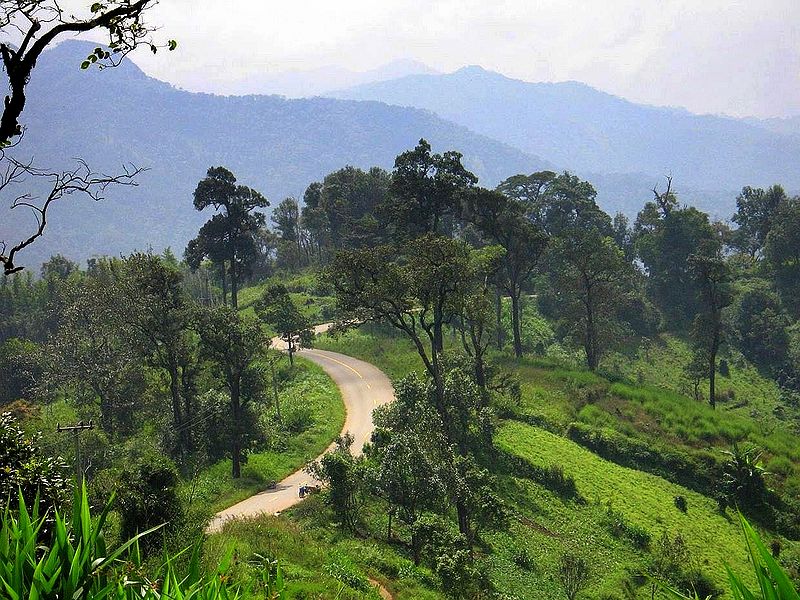
 Hill road in Chiang Mai Province
 https://commons.wikimedia.org/wiki/File:Chiang_Mai_province_road_1099_Omkoi.jpg
 Takeaway
Located some 700 km from Bangkok on the northwestern part of Thailand, Chiang Mai Province is at an average elevation of 300 m above sea level. The province is mountainous. The highest mountain in Thailand, the 2,565-m Doi Inthanon, is located within this province.
Chiang Mai Province comprises 25 districts (Amphoe) namely Mueang Chiang Mai, Chom Thong, Mae Chaem, Chiang Dao, Doi Saket, Mae Taeng, Mae Rim, Samoeng, Fang, Mae Ai, Phrao, San Pa Tong, San Kamphaeng, San Sai, Hang Dong, Hot, Doi Tao, Omkoi, Saraphi, Wiang Haeng, Chai Prakan, Mae Wang, Mae On, Doi Lo and Galyani Vadhana.
There are seven national parks within Chiang Mai Province namely Chiang Dao National Park, Doi Inthanon National Park, Doi Suthep-Pui National Park, Huay Nam Dang National Park, Mae Ping National Park, Ob Luang National Park and Sri Lanna National Park. [an error occurred while processing this directive]
About this website

Dear visitor, thank you so much for reading this page. My name is Timothy Tye and my hobby is to find out about places, write about them and share the information with you on this website. I have been writing this site since 5 January 2003. Originally (from 2003 until 2009, the site was called AsiaExplorers. I changed the name to Penang Travel Tips in 2009, even though I describe more than just Penang but everywhere I go (I often need to tell people that "Penang Travel Tips" is not just information about Penang, but information written in Penang), especially places in Malaysia and Singapore, and in all the years since 2003, I have described over 20,000 places.
While I try my best to provide you information as accurate as I can get it to be, I do apologize for any errors and for outdated information which I am unaware. Nevertheless, I hope that what I have described here will be useful to you.
To get to know me better, do follow me on Facebook!
Copyright © 2003-2025 Timothy Tye. All Rights Reserved.