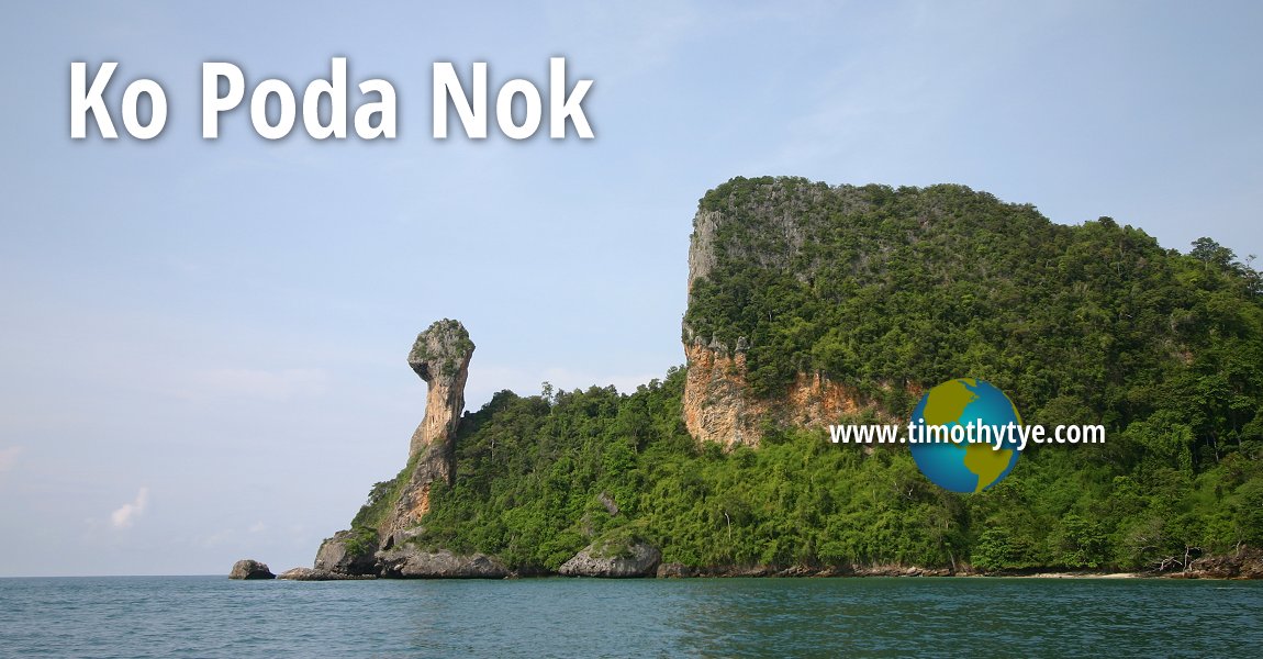
 Ko Poda Nok, Krabi (4 November, 2005)
Ko Poda Nok (GPS: 7.9539, 98.80686) is an island in the sea in Krabi Province, Thailand. It is often nicknamed Ko Kai, which means Chicken Island, and is variously spelled as Koh Gai and Koh Khai. The island is also called Koh Hua Khawan. It was given this nickname because of the rock formation at one side of the island, which has the appearance of a chicken. Ko Poda Nok consists of steep cliffs on one end, and beautiful beaches along a peninsula on the other. At high tide, this peninsula gets flooded, creating a small island. There is no accommodation on Ko Poda Nok. However it offers excellent snorkeling opportunities in its warm and clear water which is rich in coral. As it is not affected by the monsoon, it can be visited all year round.
Ko Poda Nok is south of Ko Poda, and is the largest in a cluster of islets. Surrounding it include Ko Tap in the north, Ko Khom in the southeast, Ko Ya Wa Bon in the southwest, Ko Ya Wa Bong Ko and Ko Urai in the west.
Ko Poda Nok is  on the map of Krabi Province
 Latest updates on Penang Travel Tips
 Map of Roads in Penang
Looking for information on Penang? Use this Map of Roads in Penang to zoom in on information about Penang, brought to you road by road.Disclaimer
Please use the information on this page as guidance only. The author endeavours to update the information on this page from time to time, but regrets any inaccuracies if there be any.
Copyright © 2003-2025 Timothy Tye. All Rights Reserved.

 Go Back