Nakhon Si Thammarat Province จังหวัดนครศรีธรรมราช
 is a province in southern Thailand facing the coast of the Gulf of Thailand. It is bordered by Surat Thani Province to the northwest, Krabi Province to the west, Trang Province to the southwest, Phatthalung Province to the south, and Songkhla Province to the southeast.
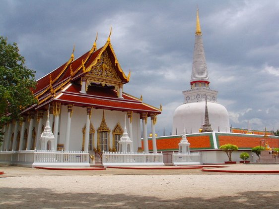
 Wat Phra Mahathat Woramahawihan, Nakhon Si Thammarat
 https://commons.wikimedia.org/wiki/File:WatPraTaat.jpg
 Meditube
Nakhon Si Thammarat Province covers 9,945 km (3,838.8 sq mi), making it the 18th largest province of Thailand. It has a population of 1.5 million people (2011 estimate). The provincial capital is Nakhon Si Thammarat Town.
Nakhon Si Thammarat Province is subdivided into 23 districts or amphoe. They include Mueang Nakhon Si Thammarat (provincial capital), Bang Khan, Cha-uat, Chaloem Phra Kiat, Chang Klang, Chawang, Chian Yai, Chulabhorn, Hua Sai, Khanom, Lan Saka, Na Bon, Nopphitam, Pak Phanang, Phipun, Phra Phrom, Phrom Khiri, Ron Phibun, Sichon, Tha Sala, Tham Phannara, Thung Song and Thung Yai.
Sights in Nakhon Si Thammarat Province
 Latest updates on Penang Travel Tips
 Map of Roads in Penang
Looking for information on Penang? Use this Map of Roads in Penang to zoom in on information about Penang, brought to you road by road.
Copyright © 2003-2025 Timothy Tye. All Rights Reserved.


 Go Back