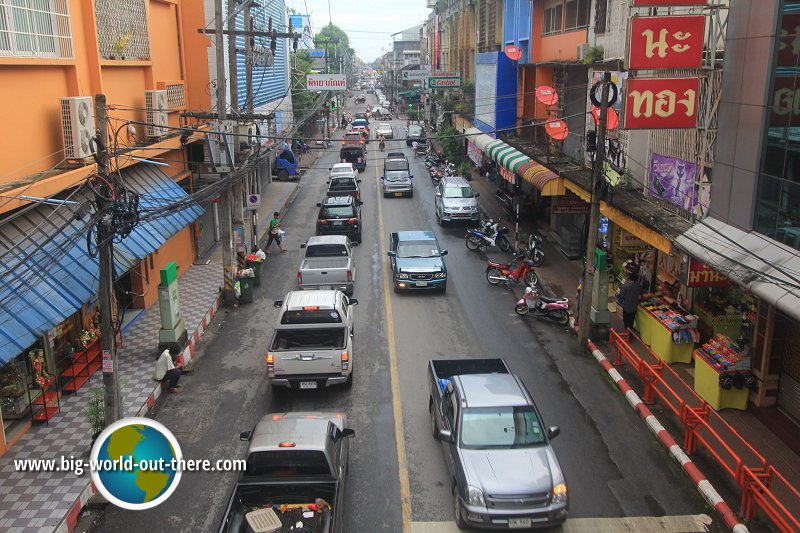
 Downtown Nakhon Si Thammarat, Thailand (12 January, 2013)
Nakhon Si Thammarat นครศรีธรรมราช
 is a major city in southern Thailand. Located about 610 km (380 mi) south of Bangkok, it has a population of around 110,000 people (2013 estimate). Tourists often pass through it without stopping on their way between Ko Samui and Hat Yai. As it is still not a popular tourist destination, not many foreign visitors come here. For that reason I am writing this guide so that it can become better known.
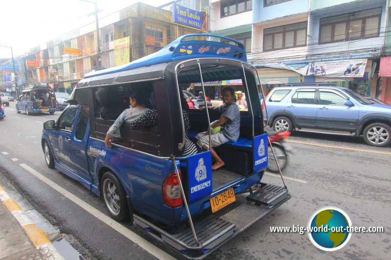
 A songthaew, or pick-up truck, picking up passengers in Nakhon Si Thammarat (12 January, 2013)
Nakhon Si Thammarat is the capital of a Thai province of the same name. This lengthy name comes from the Pali-Sanskrit name, which reads "Nagara Sri Dhammaraja", which means "City of the Sacred Righteous King". (It is formed from the following Sanskrit words: नगरी, nagarI, "city"; श्री, zri, loveliness, splendid, glorious; धम, dhamma; श्रेष्ठ, zreSTha, king) The name becomes Nakhon Si Thammarat in Thai. Incidentally, the same word "nagara" becomes "Angkor" in Khmer. Historically, European merchants however recognized the city by its Malay name Ligor (also written Ligur).
Scholars believe that Nakhon Si Thammarat was the centre of the Srivijaya kingdom, an ancient kingdom that flourished in southern Thailand since the 3rd century AD. According to the Ramkamhaeng stele in Sukhothai, it fell under the realm of the Sukhothai kingdom, and later was absorbed as a tributary kingdom to Ayutthaya.
According to the chronicles of Nakhon Si Thammarat, the city itself was in the receiving end of tributes from twelve cities on the Malay peninsula, represented by twelve animals of the zodiac. The twelve cities are Saiburi (represented by the mouse), Pattani (ox), Kelantan (tiger), Pahang - most likely Kota Gelanggi (rabbit), Kedah (dragon), Phatthalung (snake), Trang (horse), Chumphon (goat), Baytaysamer or Chaiya (monkey), Saulau - may be Songkhla or Kanchanadit or Pla Tha (cock), Takua Pa (dog) and Kraburi (pig).
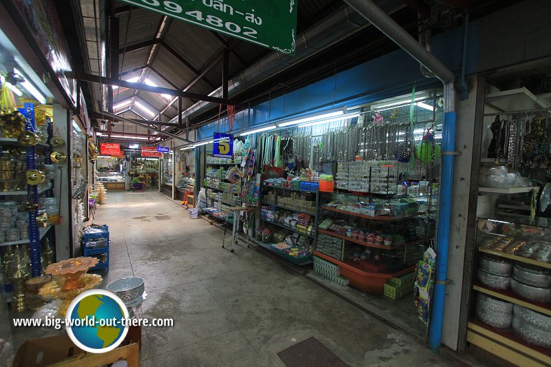
 Nakhon Si Thammarat Handicraft Center (12 January, 2013)
Going to Nakhon Si Thammarat
Most visitors arrive by road from Hat Yai. It is about one to two hours from Hat Yai. Alternatively, you can also fly to Nakhon Si Thammarat from Bangkok on Thai AirAsia.Travel within Nakhon Si Thammarat
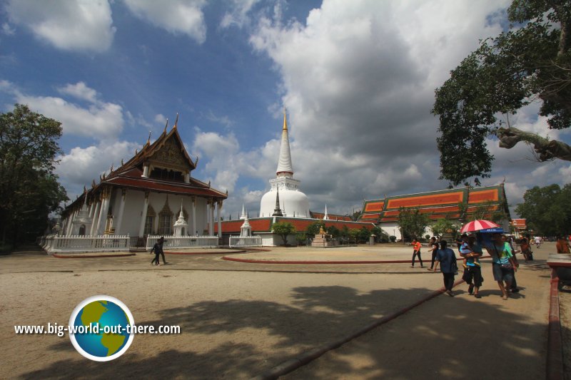
As with most small towns in Thailand, you are better off with your own transport. Otherwise, look for tuk tuk and hire them by the hour to take you to the places of interest. Wat Phra Mahathat Woramahawihan, the most important temple in Nakhon Si Thammarat (12 January, 2013)
Map of Nakhon Si Thammarat
Places of Interest in Nakhon Si Thammarat
The most important sight in Nakhon Si Thammarat is Wat Phra Mahathat Woramahawihan, its main Buddhist temple. It is on the tentative list for future inscription as a World Heritage Site.- Bovorn Bazaar: A courtyard with cafés and restaurants.
- City Pillar Shrine of Nakhon Si Thammarat (GPS: 8.43047, 99.9622)

Shrine housing the pillar driven into the ground during the founding of the city. - City Wall: Ancient wall encircling Nakhon Si Thammarat.
- Ho Phra Buddha Sihing: Temple housing a replica of the Phra Buddha Sing, one of the most revered Buddha images in Thailand.
- Ho Phra I-suan: Shrine dedicated to the Hindu deity Shiva, represented by by a shivalinga, the phallic.
- Ho Phra Narai: Shrine where five lingas dating to AD 1,000 were discovered.
- Lak Muang: The city pillar of Nakhon Si Thammarat.
- Nakhon Si Thammarat National Museum: Museum with ancient artifacts found in southern Thailand, including a 9th century Vishnu statue in the south Indian style.
- Suchart House: Shadow puppet practitioner still engaged in this dying form of performing arts.
- Tha Chang Road: Road in Nakhon Si Thammarat famous for its gold and silversmiths. Traditionally only the best artisans were allowed to locate there.
- Wat Phra Mahathat Woramahawihan (GPS: 8.41102, 99.96611)

One of the most sacred Buddhist temples in Thailand, believed to be 1,500 years old. Today it is on the tentative list for inscription as a World Heritage Site. - Wat Sao Thong Tong: Temple with an intricate Thai wooden house from the late 19th century in its compound.
Places of Interest near Nakhon Si Thammarat town
- Khao Luang National Park
National park around Khao Luang, the tallest mountain in southern Thailand
Places to eat at Nakhon Si Thammarat
- Khanom Jin Muang Nakhon (GPS: 8.41557, 99.96712)

Restaurant serving authentic Thai laksa.
 Latest updates on Penang Travel Tips
 Map of Roads in Penang
Looking for information on Penang? Use this Map of Roads in Penang to zoom in on information about Penang, brought to you road by road.
Copyright © 2003-2025 Timothy Tye. All Rights Reserved.


 Go Back