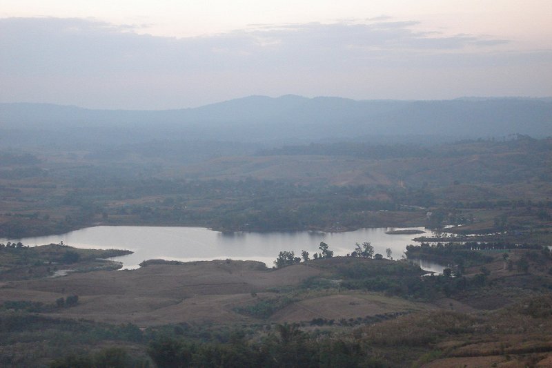
 View of a lake in Khao Kho National Park, Phetchabun Province
 https://commons.wikimedia.org/wiki/File:View_Khao_Kho_3.jpg
 Love Krittaya
Phetchabun Province จังหวัดเพชรบูรณ์
 is one of the northern provinces of Thailand. This landlocked province is bordered by Loei Province to the north, Khon Kaen Province and Chaiyaphum Province to the east, Lopburi Province to the south, and Nakhon Sawan Province, Phichit Province and Phitsanulok Province to the west.
Phetchabun Province covers 12,668.4 sq km, making it the 9th largest province in the kingdom. Its population of 991,000 (2011 estimate), however makes it only the 19th most populous. The provincial capital is Mueang Phetchabun, often translated as Phetchabun Town or simply Phetchabun.
The Pa Sak River is the main river flowing through Phetchabun Province. The terrain of the province is a flat valley bordered by the Phetchabun mountain range to the east and west. Much of its nature remains unspoilt, so there are still a number of national parks in the province.
Phetchabun Province comprises eleven districts (called amphoe), which are subdivided into 117 subdistricts (tambon) and 1261 villages (muban). Apart from the urban district of Mueang Phetchabun, the ten other districts are Chon Daen, Lom Sak, Lom Kao, Wichian Buri, Si Thep, Nong Phai, Bueng Sam Phan, Nam Nao, Wang Phong and Khao Kho.
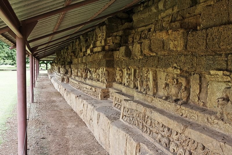
 Ruins of Khao Klang Nai temple in the Si Thep Historical Park, Phetchabun Province
 https://commons.wikimedia.org/wiki/File:Khao_Khlang_Nai-008.jpg
 Ddalbiez
[an error occurred while processing this directive]
History of Phetchabun Province
The history of Phetchabun Province goes back as far the time the of the Sukhothai Kingdom. King Narai the Great of the Ayutthaya Kingdom also controlled the area. The name Phetchabun is derived from Phuenchapura, which means "city of bountiful crops".In 1903, a prefecture (monthon) system of administration was put in place, where the elsewhile provinces of Lom Sak and Phetchabun were governed under the Monthon Phitsanulok. This lasted until 1907, when Lom Sak was taken out. Then in 1915 the monthon system was dissolved. Following that, the present provincial system was implemented, and Lom Sak was made part of Phetchabun Province in 1932.
How to go to Phetchabun Province
As there are no trains from Bangkok, your means of reaching Phetchabun is by bus, or alternatively self-drive. The distance to Phetchabun Town is 370 km on Route 21 (also called Kochasenee Road). Buddhist monks in a forest in Phetchabun Province, Thailand
 https://commons.wikimedia.org/wiki/File:Buddhist_monks_in_Phetchabun.jpg
 Tevaprapas Makklay
Places of Interest in Phetchabun Province
- Khao Kho National Park
A scenic place often call the Little Switzerland of Thailand. - Nam Nao National Park
A forested area that has remained largely undisturbed. - Phu Hin Rong Kla National Park
Park located at the border with Phitsanulok Province, Phu Hin Rong Kla has a number of scenic spots as well as historic sites. - Si Thep Historical Park
Site of an ancient town that flourished from the 11th to the 18th century. Due to its location, Si Thep was once the meeting point of trades between the Dvarravati Kingdom of the central plains and the Khmer Kingdom of the northeast. - Than Thip Waterfall
Waterfall located in a forest park near the village of Baan Than Tip, in Lom Sak District.
Location of Phetchabun Province on the map
 Latest updates on Penang Travel Tips
 Map of Roads in Penang
Looking for information on Penang? Use this Map of Roads in Penang to zoom in on information about Penang, brought to you road by road.
Copyright © 2003-2025 Timothy Tye. All Rights Reserved.


 Go Back