 Si Satchanalai Historical Park (23 December, 2002)
Si Satchanalai Historical Park (GPS: 17.431772, 99.786276; Thai: อุทยานประวัติศาสตร์ศรีสัชนาลัย
 ) is a historical park that preserves the ruins of the ancient sites of Si Satchanalai and Chalieng, in Sukhothai Province, Thailand. The park is located beside the Yom River, about 55 kilomters from Sukhothai Historical Park. It covers 45.14 square kilomters and comprises four areas: the Inner City of Si Satchanalai, the western part of Si Satchanalai, the northern part, where the ancient ceramic kilns are located, and the Chalieng district.
The name Si Satchanalai means City of Good People. Before the founding of the Sukhothai Kingdom, the area was called Chalieng, but today that name Chalieng refers to only to the area in the bow of the Yom River. After Sukhothai was founded, Si Satchanalai became a city state, with its own city pillar shrine. It is a sister site to Sukhothai, and in the 13th and 14th centuries, was government by the Crown Prince.
Due to the close relationship between Sukhothai and Si Satchanalai, I discover that the temple ruins at Si Satchanalai are pretty much similar to that of Sukhothai in terms of architectural style. As the the layout, Si Satchanalai is roughly rectangular. There is possibly a moat around it, with the northeastern side being the Yom River. Today, the moat is dry and overgrown with vegetation.
A modern road encircles the Inner City of Si Satchanalai. Much of the medieval wall that surrounds Si Satchanalai is still there, and is punctuated with gates, such as Tao Moh Gate (GPS: 17.43793, 99.78659)
 in the north side. While the main section is relatively flat, the terrain of the surroundings is undulating, and so that medieval wall also follows the contours of the terrain. None of the gates can compare to those at Angkor Thom.
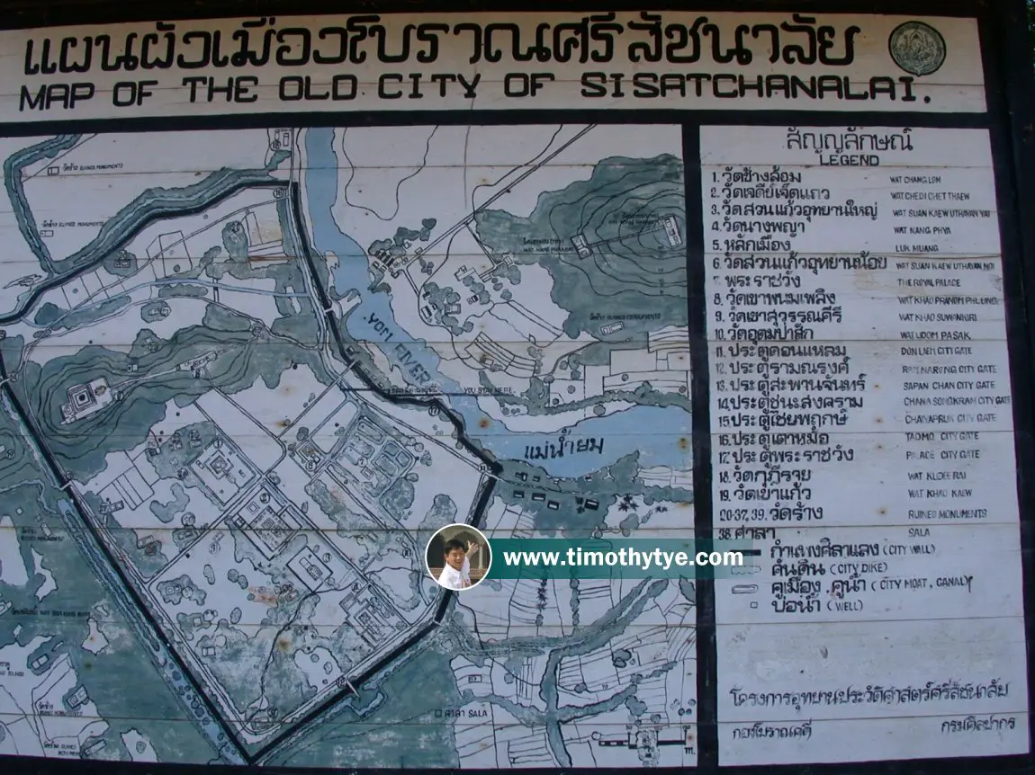
Map of Si Satchanalai Historical Park
Sights in Si Satchanalai
- Chao Mae La-Ong Sam Lee Shrine (GPS: 17.43447, 99.78309)

- Lak Muang (GPS: 17.43028, 99.7891)

- Tao Moh Gate (GPS: 17.43793, 99.78659)

- Wat Chang Lom (GPS: 17.43205, 99.78516)

- Wat Chao Chan (GPS: 17.42876, 99.80454)

- Wat Chedi Kao Yod (GPS: 17.43085, 99.78632)

- Wat Chedi Chet Thaew (GPS: 17.43085, 99.78632)

- Wat Chom Chuen (GPS: 17.4283, 99.80597)

- Wat Khao Phanom Phloeng (GPS: 17.43421, 99.7846)

- Wat Khao Suwankhiri (GPS: 17.43347, 99.78196)

- Wat Khok Singkharam (GPS: 17.43075, 99.79728)

- Wat Kudi Rai (GPS: 17.43937, 99.78652)

- Wat Nang Phaya (GPS: 17.42918, 99.78816)

- Wat Noi (GPS: 17.43054, 99.79917)

- Wat Noi Cham Pi (GPS: 17.43069, 99.79766)

- Wat Phaya Dam (GPS: 17.42346, 99.78385)

- Wat Phra Si Ariya Metta Yaram, present-day temple (GPS: 17.44095, 99.78628)

- Wat Phra Si Ratana Mahathat (GPS: 17.44095, 99.78628)

- Wat Rahu (GPS: 17.42819, 99.78168)

- Wat Sa Khai Nam (GPS: 17.42893, 99.78029)

- Wat Sa Pathum (GPS: 17.42323, 99.78184)

- Wat Suan Keao Utthayan Noi (GPS: 17.43231, 99.78717)

- Wat Suan Keao Utthayan Yai (GPS: 17.42998, 99.78725)

- Wat Thung Setthi (GPS: 17.4255, 99.78896)

- Wat Yai Ta (GPS: 17.42893, 99.78029)

Where to stay when in Si Satchanalai
Use our search engine to look for and compare room rates in the vicinity of Si Satchanalai, as provided by various online booking sites.Travel to Si Satchanalai
Si Satchanalai is about 20 km from Sukhothai. There is a bus that goes there from Sukhothai, which you can reach by train from Bangkok or Chiang Mai.Travel within Si Satchanalai
It is possible to visit the ruins on foot. You can also hire a tuk tuk to be on standby to help you cover distances between ruins. On site map of Si Satchanalai (23 December, 2003)
Google Street View of sights in Si Satchanalai
Tao Moh Gate (GPS: 17.43793, 99.78659 ) (Jan 2014)
[an error occurred while processing this directive]
 Latest updates on Penang Travel Tips
 Map of Roads in Penang
Looking for information on Penang? Use this Map of Roads in Penang to zoom in on information about Penang, brought to you road by road.
Copyright © 2003-2025 Timothy Tye. All Rights Reserved.


 Go Back