 Hoi An, Vietnam
Source: https://commons.wikimedia.org/wiki/File:B%E1%BA%BFn_H%E1%BB%99i_An.jpg
Author: hienmtd

Author: hienmtd

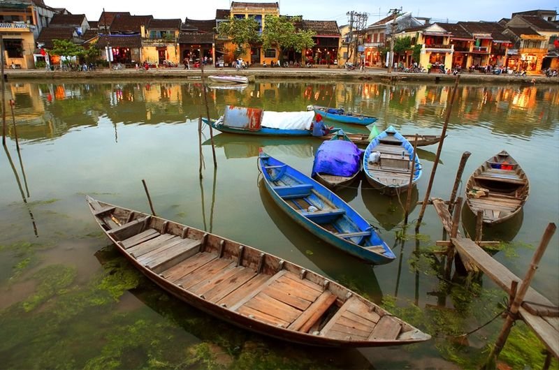
Hoi An (Vietnamese: Hội An
 ) is a historic town by the northern banks of the Thu Bon River. Geographically, it is located about midway between between northern and southern Vietnam. The city was an important trading port for Vietnam from the 16th to the 18th century. During its golden years, Hoi An attracted merchants and traders from China, Japan and even Europe. Today it is a city of about 120,000 people.
The history of Hoi An goes back to the 1st century, when it was known as Lam Ap Pho. Even during that time, it already had the largest harbour in Southeast Asia. At that time, it was inhabited mostly by the Cham (people of Champa). The old town was at the estuary of the Thu Bon River.
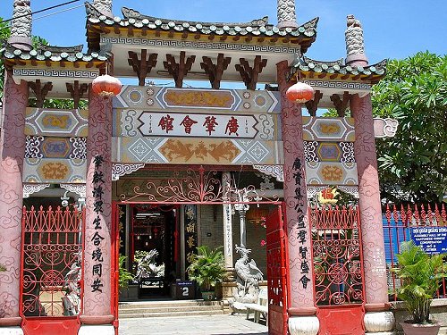
 Quang Dong Assembly Hall, Hoi An
Source: https://commons.wikimedia.org/wiki/File:Hoi_An_2008.jpg
Author: ssedro

Author: ssedro

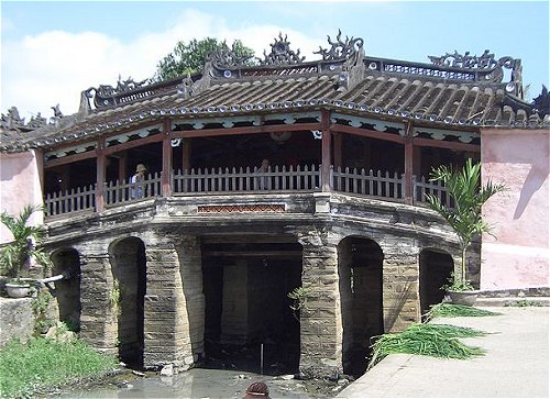
Hoi An was inscribed as a World Heritage Site since 1999. It has many interesting sights including Chinese pagodas, community halls, family ancestral shrines and craft shops. The Japanese Covered Bridge dating to the 16th century is another heritage site in the city. Backpackers and tourists will find numerous Internet cafés, bars and restaurants along its famed (and quite picturesque) riverfront.
Visiting Hoi An
To reach Hoi An, you can fly to Da Nang, and from there take a taxi to Hoi An. The airport taxi to Hoi Ann will cost you about US$15.00. The return journey will only cost you half that amount - make sure you negotiate the fare rather than rely on the unreliable Vietnam taxi meter!You can also take the train to Da Nang from Hanoi, Ho Chi Minh city, Hue or Nha Trang, and then a taxi from there to Hoi An.
Getting around in Hoi An
The center of Hoi An is quite small. You can explore it easily on foot. Keep an eye on the motorcycles that weave in and out of traffic. You can also rent a motorcycle to take you around for US$3 per day. Be sure you get a helmet as your head is unlikely to be as tough as the locals'. Japanese Covered Bridge, Hoi An
Source: https://commons.wikimedia.org/wiki/File:Hoi_An_Japanische_Br%C3%BCcke.jpg
Author: Alice Stoecklin

Author: Alice Stoecklin

Places of Interest in Hoi An
- Cantonese Assembly Hall
Also called Quang Dong Assembly Hall, after Guangdong, this historical building dates to 1786. - Central Market
Lively market occupying two narrow streets in Hoi An. - Cua Dai Beach
White sand beach popular among locals in Hoi An. - Hainan Assembly Hall
19th century assembly hall of the Hainanese immigrants who came to settle in Hoi An. - Hoi An Artcraft Manufacturing Workshop
Workshop specializing in the production of Hoi An's specialty craft, lanterns. - House of Phung Hung
Historical building from 1780 that has housed the same family for eight generations. - House of Quan Thang
One storey shophouse that is an excellent example of Hoi An's traditional dwelling. - House of Tan Ky
This 18th century Sino-Vietnamese shophouse is the most famous traditional house in Hoi An. - Japanese Covered Bridge
The most prominent landmark of Hoi An constructed in 1593 by the then prosperous Japanese traders living in the city. - Museum of Sa Huynh Culture
Museum showcasing a prehistoric culture that appeared in Sa Huynh between 1000 BC and AD 200. - Museum of Trading Ceramics
Museum in a traditional timber shophouse documenting Hoi An's ceramic trade. - Phuc Kien Assembly Hall
A flamboyant building established by Chinese merchants who fled Fujian province in the 17th century. - Quan Cong Pagoda
Pagoda founded in 1653 and dedicated to a 3rd century Chinese general. - Tran Family Chapel
Ancestral shrine built two centuries ago to venerate ancestors of the Tran clan.
 Latest updates on Penang Travel Tips
 Map of Roads in Penang
Looking for information on Penang? Use this Map of Roads in Penang to zoom in on information about Penang, brought to you road by road.
Copyright © 2003-2025 Timothy Tye. All Rights Reserved.

 Go Back